 |
|
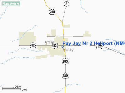
Location & QuickFacts
| FAA Information Effective: | 2008-09-25 |
| Airport Identifier: | NM46 |
| Airport Status: | Operational |
| Longitude/Latitude: | 104-24-01.8660W/32-50-25.4040N
-104.400518/32.840390 (Estimated) |
| Elevation: | 3385 ft / 1031.75 m (Estimated) |
| Land: | 0 acres |
| From nearest city: | 0 nautical miles NE of Artesia, NM |
| Location: | Eddy County, NM |
| Magnetic Variation: | 10E (1985) |
Owner & Manager
| Ownership: | Privately owned |
| Owner: | Martin Yates, Iii
MYCO INDUSTRIES, INC. & YATES DRILLING COMPANY. |
| Address: | 331 W Main Suite A
Artesia, NM 88210 |
| Phone number: | 505-748-1471 |
| Manager: | Randy G. Patterson |
| Address: | 331 W Main Suite A
Artesia, NM 88210 |
| Phone number: | 505-748-1471 |
Airport Operations and Facilities
| Airport Use: | Private |
| Segmented Circle: | No |
| Control Tower: | No |
| Sectional chart: | Albuquerque |
| Region: | ASW - Southwest |
| Boundary ARTCC: | ZAB - Albuquerque |
| Tie-in FSS: | ABQ - Albuquerque |
| FSS Toll Free: | 1-800-WX-BRIEF |
Runway Information
Helipad H1
| Dimension: | 45 x 80 ft / 13.7 x 24.4 m |
| Surface: | TURF, |
| |
Runway H1 |
Runway |
| Traffic Pattern: | Left | Left |
|
Radio Navigation Aids
| ID |
Type |
Name |
Ch |
Freq |
Var |
Dist |
| ATS | NDB | Artesia | | 414.00 | 09E | 3.2 nm |
| RO | NDB | Topan | | 305.00 | 10E | 31.6 nm |
| PIO | VOR/DME | Pinon | 041X | 110.40 | 12E | 49.4 nm |
| CME | VORTAC | Chisum | 108X | 116.10 | 12E | 31.9 nm |
| CNM | VORTAC | Carlsbad | 110X | 116.30 | 12E | 36.2 nm |
Images and information placed above are from
http://www.airport-data.com/airport/NM46/
We thank them for the data!
| General Info
|
| Country |
United States
|
| State |
NEW MEXICO
|
| FAA ID |
NM46
|
| Latitude |
32-50-25.404N
|
| Longitude |
104-24-01.866W
|
| Elevation |
3385 feet
|
| Near City |
ARTESIA
|
We don't guarantee the information is fresh and accurate. The data may
be wrong or outdated.
For more up-to-date information please refer to other sources.
|
|


