 |
|
Location & QuickFacts
| FAA Information Effective: | 2008-09-25 |
| Airport Identifier: | NM76 |
| Airport Status: | Operational |
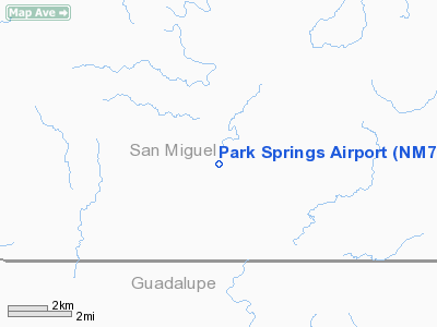
| Longitude/Latitude: | 104-55-08.0000W/35-15-39.0000N
-104.918889/35.260833 (Estimated) |
| Elevation: | 5115 ft / 1559.05 m (Estimated) |
| Land: | 0 acres |
| From nearest city: | 11 nautical miles NE of Anton Chico, NM |
| Location: | San Miguel County, NM |
| Magnetic Variation: | 11E (1985) |
Owner & Manager
| Ownership: | Privately owned |
| Owner: | John M Brittingham |
| Address: | P.o. Box 199
Anton Chico, NM 87711 |
| Phone number: | 505-427-4540 |
| Manager: | John M Brittingham |
| Address: | Po Box 199
Anton Chico, NM 87711 |
| Phone number: | 505-427-4540 |
Airport Operations and Facilities
| Airport Use: | Private |
| Wind indicator: | No |
| Segmented Circle: | No |
| Control Tower: | No |
| Landing fee charge: | No |
| Sectional chart: | Albuquerque |
| Region: | ASW - Southwest |
| Boundary ARTCC: | ZAB - Albuquerque |
| Tie-in FSS: | ABQ - Albuquerque |
| FSS on Airport: | No |
| FSS Toll Free: | 1-800-WX-BRIEF |
Airport Services
| Airframe Repair: | NONE |
| Power Plant Repair: | NONE |
Runway Information
Runway 09/27
| Dimension: | 4000 x 50 ft / 1219.2 x 15.2 m |
| Surface: | TURF, |
| |
Runway 09 |
Runway 27 |
| Traffic Pattern: | Left | Left |
|
Radio Navigation Aids
| ID |
Type |
Name |
Ch |
Freq |
Var |
Dist |
| ACH | VORTAC | Anton Chico | 125X | 117.80 | 12E | 10.8 nm |
| FTI | VORTAC | Fort Union | 120X | 117.30 | 13E | 26.1 nm |
Images and information placed above are from
http://www.airport-data.com/airport/NM76/
We thank them for the data!
| General Info
|
| Country |
United States
|
| State |
NEW MEXICO
|
| FAA ID |
NM76
|
| Latitude |
35-15-39.000N
|
| Longitude |
104-55-08.000W
|
| Elevation |
5115 feet
|
| Near City |
ANTON CHICO
|
We don't guarantee the information is fresh and accurate. The data may
be wrong or outdated.
For more up-to-date information please refer to other sources.
|
|


