 |
|
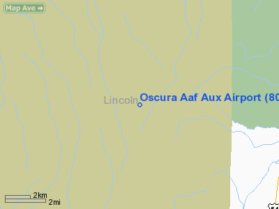
Location & QuickFacts
| FAA Information Effective: | 2008-09-25 |
| Airport Identifier: | 80E |
| Airport Status: | Closed Permanently |
| Longitude/Latitude: | 106-11-02.0010W/33-29-40.2690N
-106.183889/33.494519 (Estimated) |
| Elevation: | 4500 ft / 1371.60 m (Estimated) |
| Land: | 0 acres |
| From nearest city: | 5 nautical miles W of Oscura, NM |
| Location: | Lincoln County, NM |
| Magnetic Variation: | 11E (1985) |
Owner & Manager
| Ownership: | Army owned |
| Owner: | U S Army Atca-aso |
| Address: | Cameron Station
Alexandria, VA 22314 |
| Address: |
|
Airport Operations and Facilities
| Airport Use: | Private |
| Segmented Circle: | No |
| Control Tower: | No |
| Landing fee charge: | No |
| Sectional chart: | Phoenix |
| Region: | ASW - Southwest |
| Boundary ARTCC: | ZAB - Albuquerque |
| Tie-in FSS: | ABQ - Albuquerque |
| FSS on Airport: | No |
| FSS Toll Free: | 1-800-WX-BRIEF |
| NOTAMs Facility: | ABQ |
Runway Information
Runway 01/19
| Dimension: | 4000 x 100 ft / 1219.2 x 30.5 m |
| Surface: | ASPH, |
| |
Runway 01 |
Runway 19 |
| Traffic Pattern: | Left | Left |
|
Radio Navigation Aids
| ID |
Type |
Name |
Ch |
Freq |
Var |
Dist |
| CEP | NDB | Capitan | | 278.00 | 10E | 39.1 nm |
| ALM | NDB | Alamogordo | | 341.00 | 11E | 40.0 nm |
| HMN | TACAN | Holloman | 092X | | 10E | 38.2 nm |
| BWS | VOR/DME | Boles | 033X | 109.60 | 11E | 41.4 nm |
Remarks
- (E137-1) ARPT INACTIVE, TO BE REMOVED FROM VFR CHARTS.
- (ARPT STATUS) ARPT CLSD PERMLY.
Images and information placed above are from
http://www.airport-data.com/airport/80E/
We thank them for the data!
| General Info
|
| Country |
United States
|
| State |
NEW MEXICO
|
| FAA ID |
80E
|
| Latitude |
33-29-40.269N
|
| Longitude |
106-11-02.001W
|
| Elevation |
4500 feet
|
| Near City |
OSCURA
|
We don't guarantee the information is fresh and accurate. The data may
be wrong or outdated.
For more up-to-date information please refer to other sources.
|
|


