 |
|
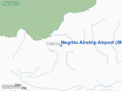
Location & QuickFacts
| FAA Information Effective: | 2008-09-25 |
| Airport Identifier: | 0NM7 |
| Airport Status: | Operational |
| Longitude/Latitude: | 108-32-34.2120W/33-31-15.2200N
-108.542837/33.520894 (Estimated) |
| Elevation: | 8143 ft / 2481.99 m (Estimated) |
| Land: | 0 acres |
| From nearest city: | 18 nautical miles SE of Reserve, NM |
| Location: | Catron County, NM |
| Magnetic Variation: | 12E (1985) |
Owner & Manager
| Ownership: | Publicly owned |
| Owner: | U S Forest Service |
| Address: | 2610 N Silver St
Silver City, NM 88061 |
| Phone number: | 505-388-1986 |
| Manager: | Charles C Harsh
AIR SERVICE MGR. |
| Address: | 2610 N Silver St
Silver City, NM 88061 |
| Phone number: | 505-388-1986 |
Airport Operations and Facilities
| Airport Use: | Private |
| Wind indicator: | Yes |
| Segmented Circle: | No |
| Control Tower: | No |
| Landing fee charge: | No |
| Sectional chart: | Albuquerque |
| Region: | ASW - Southwest |
| Boundary ARTCC: | ZAB - Albuquerque |
| Tie-in FSS: | ABQ - Albuquerque |
| FSS on Airport: | No |
| FSS Toll Free: | 1-800-WX-BRIEF |
Airport Services
| Airframe Repair: | NONE |
| Power Plant Repair: | NONE |
Runway Information
Runway 03/21
| Dimension: | 4000 x 60 ft / 1219.2 x 18.3 m |
| Surface: | TURF-GRVL, Fair Condition |
| |
Runway 03 |
Runway 21 |
| Traffic Pattern: | Left | Left |
| Obstruction: | 35 ft trees, 50.0 ft from runway, 40 ft left of centerline, 1:1 slope to clear | 40 ft trees, 400.0 ft from runway, 10:1 slope to clear |
|
Runway 17/35
| Dimension: | 7500 x 60 ft / 2286.0 x 18.3 m |
| Surface: | TURF-GRVL, Fair Condition |
| |
Runway 17 |
Runway 35 |
| Traffic Pattern: | Left | Left |
| Obstruction: | 15 ft trees, 80 ft right of centerline | 4 ft fence, 0.0 ft from runway |
|
Radio Navigation Aids
| ID |
Type |
Name |
Ch |
Freq |
Var |
Dist |
Remarks
-
- WATCH FOR LOW FLYING ACFT & HELICOPTERS IN SUMMER MONTHS. CAUTION (USFS).
- CAUTION: CATTLE ON & INVOF ARPT.
Images and information placed above are from
http://www.airport-data.com/airport/0NM7/
We thank them for the data!
| General Info
|
| Country |
United States
|
| State |
NEW MEXICO
|
| FAA ID |
0NM7
|
| Latitude |
33-31-15.220N
|
| Longitude |
108-32-34.212W
|
| Elevation |
8143 feet
|
| Near City |
RESERVE
|
We don't guarantee the information is fresh and accurate. The data may
be wrong or outdated.
For more up-to-date information please refer to other sources.
|
|


