 |
|
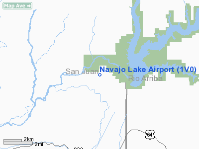
Location & QuickFacts
| FAA Information Effective: | 2008-09-25 |
| Airport Identifier: | 1V0 |
| Airport Status: | Operational |
| Longitude/Latitude: | 107-39-05.2000W/36-48-30.0180N
-107.651444/36.808338 (Estimated) |
| Elevation: | 6475 ft / 1973.58 m (Surveyed) |
| Land: | 560 acres |
| From nearest city: | 3 nautical miles NE of Navajo Dam, NM |
| Location: | San Juan County, NM |
| Magnetic Variation: | 12E (1985) |
Owner & Manager
| Ownership: | Publicly owned |
| Owner: | Nm Dot - Aviation Division |
| Address: | Po Box 1149
Santa Fe, NM 87504-1149 |
| Phone number: | 505-476-0930 |
| Manager: | Tom Baca |
| Address: | Po Box 1149
Santa Fe, NM 87504-1149 |
| Phone number: | 505-244-1790 |
Airport Operations and Facilities
| Airport Use: | Open to public |
| Wind indicator: | Yes |
| Segmented Circle: | Yes |
| Control Tower: | No |
| Lighting Schedule: | DUSK-DAWN |
| Beacon Color: | Clear-Green (lighted land airport) |
| Landing fee charge: | No |
| Sectional chart: | Denver |
| Region: | ASW - Southwest |
| Boundary ARTCC: | ZDV - Denver |
| Tie-in FSS: | ABQ - Albuquerque |
| FSS on Airport: | No |
| FSS Toll Free: | 1-800-WX-BRIEF |
| NOTAMs Facility: | ABQ (NOTAM-d service avaliable) |
| Federal Agreements: | NGSY |
Airport Communications
Airport Services
| Airframe Repair: | NONE |
| Power Plant Repair: | NONE |
| Bottled Oxygen: | NONE |
| Bulk Oxygen: | NONE |
Runway Information
Runway 06/24
| Dimension: | 4995 x 60 ft / 1522.5 x 18.3 m |
| Surface: | ASPH, |
| Weight Limit: | Single wheel: 12000 lbs. |
| |
Runway 06 |
Runway 24 |
| Traffic Pattern: | Left | Left |
| Markings: | Basic, Good Condition | Basic, Good Condition |
| VASI: | system of panels on left side that may or may not be lighted
RETRO-REFLECTIVE PANEL GLIDE SLOPE INDICATOR. | system of panels on left side that may or may not be lighted
RETRO-REFLECTIVE PANEL GLIDE SLOPE INDICATOR. |
| Approach lights: | NSTD
NSTD ODALS - 3 NSTD LGTS ON EXTENDED RY CNTRLN ON LESS THAN STANDARD SPACING. | NSTD
NSTD ODALS - 1 FLASHING LGT ON RY CNTRLN & 2 AT RY THLD. |
|
Radio Navigation Aids
| ID |
Type |
Name |
Ch |
Freq |
Var |
Dist |
| DRO | VOR/DME | Durango | 019X | 108.20 | 14E | 21.3 nm |
| RSK | VORTAC | Rattlesnake | 100X | 115.30 | 14E | 21.8 nm |
Remarks
- NO SNOW REMOVAL; PPR WHEN SNOW OR ICE ON RY CALL 505-476-0941.
- ARPT CLSD DURING WINTER MONTHS.
- GATE ALWAYS LOCKED; COMBINATION SET TO FIELD ELEVATION.
- RYS 06 & 24 ODALS OTS INDEFLY.
- LIVESTOCK ON ARPT.
- ARPT CLSD AT NIGHT.
Images and information placed above are from
http://www.airport-data.com/airport/1V0/
We thank them for the data!
| General Info
|
| Country |
United States
|
| State |
NEW MEXICO
|
| FAA ID |
1V0
|
| Latitude |
36-48-30.018N
|
| Longitude |
107-39-05.200W
|
| Elevation |
6475 feet
|
| Near City |
NAVAJO DAM
|
We don't guarantee the information is fresh and accurate. The data may
be wrong or outdated.
For more up-to-date information please refer to other sources.
|
|


