 |
|
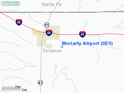
Location & QuickFacts
| FAA Information Effective: | 2008-09-25 |
| Airport Identifier: | 0E0 |
| Airport Status: | Operational |
| Longitude/Latitude: | 106-00-34.0780W/34-59-08.1830N
-106.009466/34.985606 (Estimated) |
| Elevation: | 6199 ft / 1889.46 m (Estimated) |
| Land: | 429 acres |
| From nearest city: | 2 nautical miles SE of Moriarty, NM |
| Location: | Torrance County, NM |
| Magnetic Variation: | 11E (1995) |
Owner & Manager
| Ownership: | Publicly owned |
| Owner: | City Of Moriarty |
| Address: | Po Box 130
Moriarty, NM 87035 |
| Phone number: | 505-832-4406 |
| Manager: | Mike Tapia |
| Address: | Po Box 130
Moriarty, NM 87035 |
| Phone number: | 505-832-4406 |
Airport Operations and Facilities
| Airport Use: | Open to public |
| Wind indicator: | Yes |
| Segmented Circle: | Yes |
| Control Tower: | No |
| Lighting Schedule: | DUSK-DAWN |
| Beacon Color: | Clear-Green (lighted land airport) |
| Landing fee charge: | No |
| Sectional chart: | Albuquerque |
| Region: | ASW - Southwest |
| Traffic Pattern Alt: | 1000 ft |
| Boundary ARTCC: | ZAB - Albuquerque |
| Tie-in FSS: | ABQ - Albuquerque |
| FSS on Airport: | No |
| FSS Toll Free: | 1-800-WX-BRIEF |
| NOTAMs Facility: | ABQ (NOTAM-d service avaliable) |
| Federal Agreements: | NGY |
Airport Communications
Airport Services
| Fuel available: | 100LLA
FOR JET A AFT HRS & HOLS CALL 505-832-2222; 100LL AVBL 24 HRS SELF-SERVICE WITH MAJOR CREDIT CARD. |
| Airframe Repair: | MAJOR |
| Power Plant Repair: | MAJOR |
| Bottled Oxygen: | NONE |
| Bulk Oxygen: | NONE |
Runway Information
Runway 08/26
| Dimension: | 7700 x 75 ft / 2347.0 x 22.9 m |
| Surface: | ASPH, Good Condition |
| Edge Lights: | Medium |
| |
Runway 08 |
Runway 26 |
| Traffic Pattern: | Left | Left |
| Markings: | Non-precision instrument, Good Condition | Non-precision instrument, Good Condition |
| Runway End Identifier: | Yes | Yes |
|
Radio Navigation Aids
| ID |
Type |
Name |
Ch |
Freq |
Var |
Dist |
| ILT | NDB | Isleta | | 247.00 | 11E | 30.1 nm |
| OTO | VOR | Otto | | 114.00 | 13E | 6.3 nm |
| SAF | VORTAC | Santa Fe | 043X | 110.60 | 13E | 33.5 nm |
| ABQ | VORTAC | Albuquerque | 079X | 113.20 | 13E | 39.9 nm |
| CNX | VORTAC | Corona | 102X | 115.50 | 13E | 40.6 nm |
| ACH | VORTAC | Anton Chico | 125X | 117.80 | 12E | 48.3 nm |
| ABQ | VOT | Albuquerque Intl | | 111.00 | | 29.6 nm |
Remarks
- EXTENSIVE GLIDER ACTIVITY.
- FOR EMERG REPAIRS CALL 505-269-8234.
Images and information placed above are from
http://www.airport-data.com/airport/0E0/
We thank them for the data!
| General Info
|
| Country |
United States
|
| State |
NEW MEXICO
|
| FAA ID |
0E0
|
| Latitude |
34-59-08.183N
|
| Longitude |
106-00-34.078W
|
| Elevation |
6199 feet
|
| Near City |
MORIARTY
|
We don't guarantee the information is fresh and accurate. The data may
be wrong or outdated.
For more up-to-date information please refer to other sources.
|
|


