 |
|
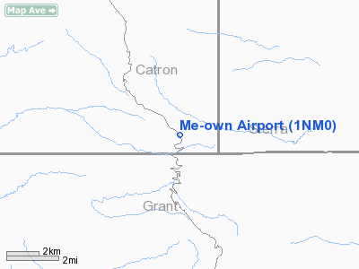
Location & QuickFacts
| FAA Information Effective: | 2008-09-25 |
| Airport Identifier: | 1NM0 |
| Airport Status: | Operational |
| Longitude/Latitude: | 108-01-32.1550W/33-12-43.2550N
-108.025599/33.212015 (Estimated) |
| Elevation: | 7554 ft / 2302.46 m (Surveyed) |
| Land: | 0 acres |
| From nearest city: | 30 nautical miles NE of Silver City, NM |
| Location: | Catron County, NM |
| Magnetic Variation: | 11E (1985) |
Owner & Manager
| Ownership: | Publicly owned |
| Owner: | Us Forest Service |
| Address: | 517 Gold Ave Sw
Albuquerque, NM 87102 |
| Phone number: | 505-766-2444 |
| Manager: | Steve Servis |
| Address: | Us For Svc 2610 N Silver St
Silver City, NM 88061 |
| Phone number: | 505-388-8201 |
Airport Operations and Facilities
| Airport Use: | Private |
| Wind indicator: | Yes |
| Segmented Circle: | Yes |
| Control Tower: | No |
| Landing fee charge: | No |
| Sectional chart: | Albuquerque |
| Region: | ASW - Southwest |
| Boundary ARTCC: | ZAB - Albuquerque |
| Tie-in FSS: | ABQ - Albuquerque |
| FSS on Airport: | No |
| FSS Toll Free: | 1-800-WX-BRIEF |
Airport Services
| Airframe Repair: | NONE |
| Power Plant Repair: | NONE |
Runway Information
Runway 14/32
| Dimension: | 3700 x 50 ft / 1127.8 x 15.2 m |
| Surface: | TURF, Fair Condition |
| |
Runway 14 |
Runway 32 |
| Traffic Pattern: | Left | Left |
| Obstruction: | 12 ft tree, 100.0 ft from runway, 100 ft right of centerline, 8:1 slope to clear | 15 ft tree, 25.0 ft from runway, 30 ft right of centerline, 1:1 slope to clear |
|
Radio Navigation Aids
| ID |
Type |
Name |
Ch |
Freq |
Var |
Dist |
| SVC | VORTAC | Silver City | 045X | 110.80 | 13E | 35.2 nm |
| TCS | VORTAC | Truth Or Consequences | 074X | 112.70 | 13E | 37.7 nm |
Remarks
-
- NO SNOW REMOVAL OR CONDITION REPORTS; CHECK ARPT CONDITIONS WITH FOREST SERVICE /SILVER CITY/ BEFORE USE.
- ESTBLSHD PRIOR TO 1959.
Images and information placed above are from
http://www.airport-data.com/airport/1NM0/
We thank them for the data!
| General Info
|
| Country |
United States
|
| State |
NEW MEXICO
|
| FAA ID |
1NM0
|
| Latitude |
33-12-43.255N
|
| Longitude |
108-01-32.155W
|
| Elevation |
7554 feet
|
| Near City |
SILVER CITY
|
We don't guarantee the information is fresh and accurate. The data may
be wrong or outdated.
For more up-to-date information please refer to other sources.
|
|


