 |
|
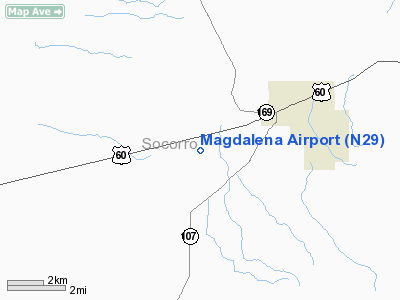
Location & QuickFacts
| FAA Information Effective: | 2008-09-25 |
| Airport Identifier: | N29 |
| Airport Status: | Operational |
| Longitude/Latitude: | 107-17-52.1310W/34-05-40.2280N
-107.297814/34.094508 (Estimated) |
| Elevation: | 6727 ft / 2050.39 m (Surveyed) |
| Land: | 80 acres |
| From nearest city: | 3 nautical miles W of Magdalena, NM |
| Location: | Socorro County, NM |
| Magnetic Variation: | 11E (1985) |
Owner & Manager
| Ownership: | Publicly owned |
| Owner: | Village Of Magdalena |
| Address: | Po Box 145
Magdalena, NM 87825 |
| Phone number: | 575-854-2261 |
| Manager: | Ambers Guin |
| Address: | Box 417
Magdalena, NM 87825 |
| Phone number: | 575-854-2462 |
Airport Operations and Facilities
| Airport Use: | Open to public |
| Wind indicator: | Yes |
| Segmented Circle: | Yes |
| Control Tower: | No |
| Sectional chart: | Albuquerque |
| Region: | ASW - Southwest |
| Boundary ARTCC: | ZAB - Albuquerque |
| Tie-in FSS: | ABQ - Albuquerque |
| FSS Toll Free: | 1-800-WX-BRIEF |
| NOTAMs Facility: | ABQ (NOTAM-d service avaliable) |
| Federal Agreements: | NGY |
Airport Communications
Airport Services
Runway Information
Runway 02/20
| Dimension: | 5650 x 50 ft / 1722.1 x 15.2 m |
| Surface: | DIRT-GRVL, Fair Condition
SFC TREATED WITH FLYASH; FIRM BUT DUSTY WITH SOME LARGE ROCKS. |
| |
Runway 02 |
Runway 20 |
| Traffic Pattern: | Left | Left |
| Runway End Identifier: | No
RYS 02 & 20 NSTD REIL EACH END; 2 STROBES AT RY ENDS FLASH ALTERNATELY WITH SINGLE STROBES 200 FT FM RY END ON CNTRLN, ACTIVATE USING 122.9. | |
| Obstruction: | 15 ft fence, 300.0 ft from runway, 20:1 slope to clear | , 50:1 slope to clear |
|
Radio Navigation Aids
| ID |
Type |
Name |
Ch |
Freq |
Var |
Dist |
| FIA | NDB | Florida | | 329.00 | 12E | 19.8 nm |
| ONM | VORTAC | Socorro | 115X | 116.80 | 13E | 27.9 nm |
| TCS | VORTAC | Truth Or Consequences | 074X | 112.70 | 13E | 48.8 nm |
Remarks
- SMALL ARMS FIRE W ARPT SFC 2000 FT AGL 1ST & 3RD SAT 1300-1600 INDEFLY.
- PVT DIRT AIRSTRIP 600 FT WEST OF ARPT.
Images and information placed above are from
http://www.airport-data.com/airport/N29/
We thank them for the data!
| General Info
|
| Country |
United States
|
| State |
NEW MEXICO
|
| FAA ID |
N29
|
| Latitude |
34-05-40.228N
|
| Longitude |
107-17-52.131W
|
| Elevation |
6727 feet
|
| Near City |
MAGDALENA
|
We don't guarantee the information is fresh and accurate. The data may
be wrong or outdated.
For more up-to-date information please refer to other sources.
|
|


