|
|
| Los Alamos Airport |
| IATA: LAM – ICAO: KLAM |
| Summary |
| Airport type |
Public |
| Operator |
County of Los Alamos |
| Location |
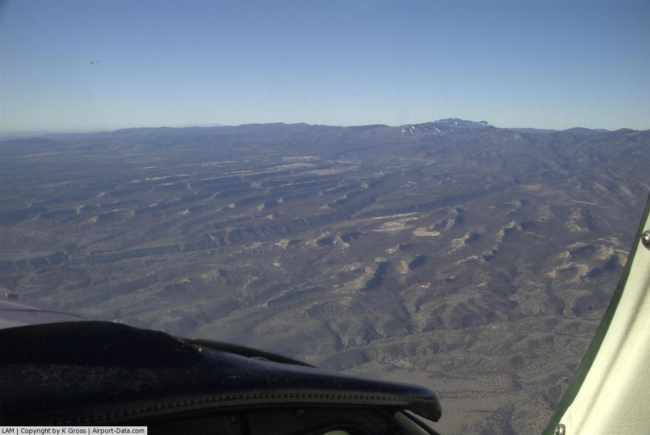
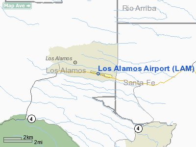
Los Alamos, New Mexico |
| Elevation AMSL |
7,171 ft / 2,185.7 m |
| Coordinates |
35°52′47.28″N 106°16′09.89″W / 35.8798°N 106.2694139°W / 35.8798; -106.2694139Coordinates: 35°52′47.28″N 106°16′09.89″W / 35.8798°N 106.2694139°W / 35.8798; -106.2694139 |
| Runways |
| Direction |
Length |
Surface |
| ft |
m |
| 9/27 |
5,550 |
1,692 |
Asphalt |
Los Alamos Airport (IATA: LAM, ICAO: KLAM), also known as Los Alamos County Airport, is a public airport located in Los Alamos, New Mexico, USA.
Facilities
Los Alamos Airport covers 87 acres and has one runway:
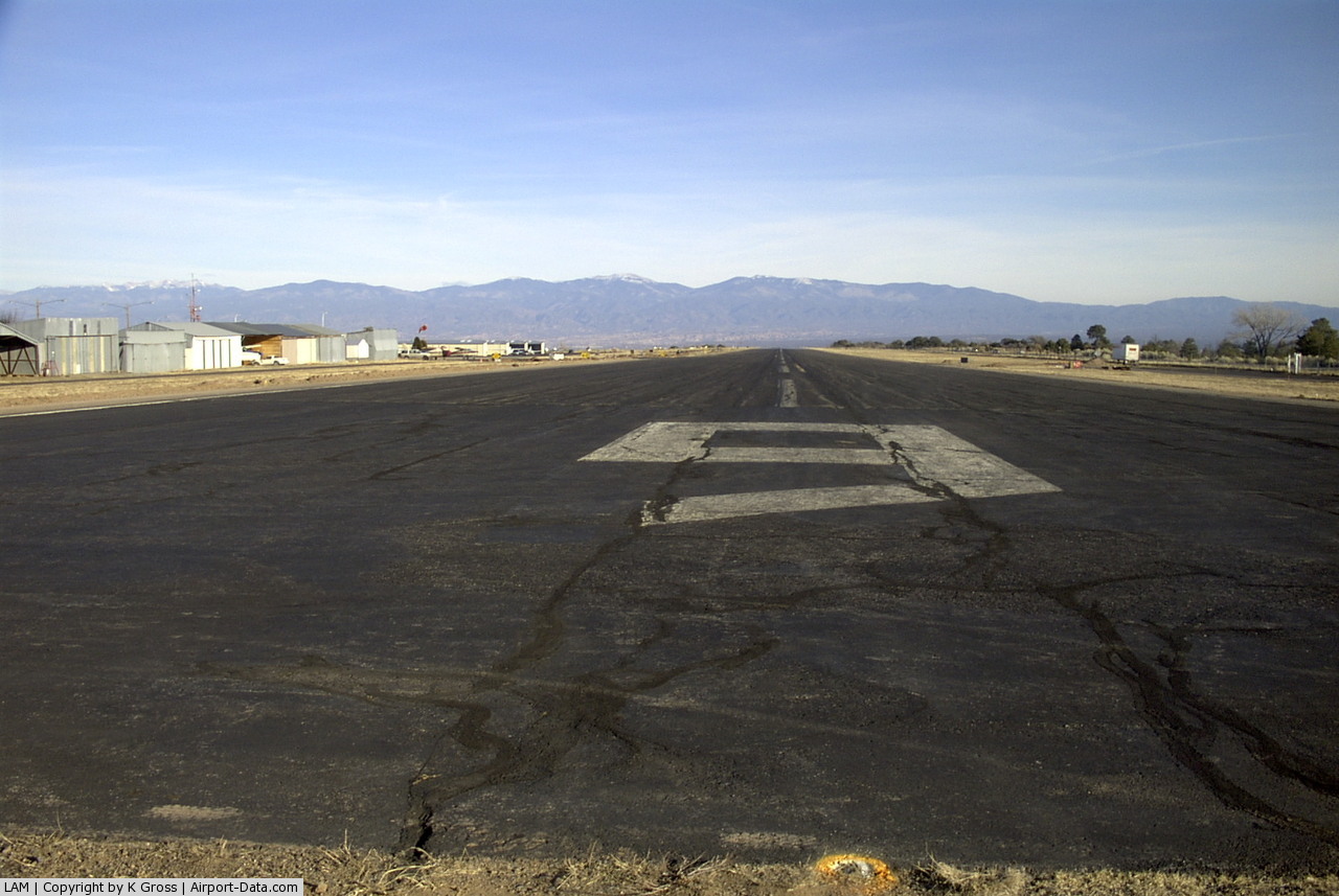
- Runway 9/27: 5,550 x 113 ft (1,692 x 34 m), Surface: Asphalt
The above content comes from Wikipedia and is published under free licenses – click here to read more.
 |
(Click on the photo to enlarge) |
 |
(Click on the photo to enlarge) |
 |
(Click on the photo to enlarge) |
Location & QuickFacts
| FAA Information Effective: | 2008-09-25 |
| Airport Identifier: | LAM |
| Airport Status: | Operational |
| Longitude/Latitude: | 106-16-09.8950W/35-52-47.2870N
-106.269415/35.879802 (Estimated) |
| Elevation: | 7171 ft / 2185.72 m (Surveyed) |
| Land: | 89 acres |
| From nearest city: | 1 nautical miles E of Los Alamos, NM |
| Location: | Los Alamos County, NM |
| Magnetic Variation: | 10E (2005) |
Owner & Manager
| Ownership: | Publicly owned |
| Owner: | County Of Los Alamos
LEASED. PROPERTY OWNED BY DEPT OF ENERGY; 528 35TH STREET, LOS ALAMOS NM 87555. 505-667-5105. |
| Address: | Po Box 30
Los Alamos, NM 87544 |
| Phone number: | 505-662-8080 |
| Manager: | David Ploeger |
| Address: | Po Box 30
Los Alamos, NM 87544 |
| Phone number: | 505-662-8420 |
Airport Operations and Facilities
| Airport Use: | Open to public |
| Wind indicator: | Yes |
| Segmented Circle: | Yes |
| Control Tower: | No |
| Lighting Schedule: | DUSK-DAWN
ACTVT MIRL RY 09/27 & REIL RY 27 - CTAF. |
| Beacon Color: | Clear-Green (lighted land airport) |
| Landing fee charge: | No |
| Sectional chart: | Denver |
| Region: | ASW - Southwest |
| Boundary ARTCC: | ZAB - Albuquerque |
| Tie-in FSS: | ABQ - Albuquerque |
| FSS on Airport: | No |
| FSS Toll Free: | 1-800-WX-BRIEF |
| NOTAMs Facility: | LAM (NOTAM-d service avaliable) |
| Federal Agreements: | N |
Airport Communications
| CTAF: | 123.000 |
| Unicom: | 123.000 |
Airport Services
| Fuel available: | 100LL |
| Airframe Repair: | MAJOR |
| Power Plant Repair: | MAJOR |
Runway Information
Runway 09/27
| Dimension: | 5550 x 113 ft / 1691.6 x 34.4 m |
| Surface: | ASPH, Good Condition |
| Surface Treatment: | Porous Friction Course |
| Weight Limit: | Single wheel: 43000 lbs. |
| Edge Lights: | Medium |
| |
Runway 09 |
Runway 27 |
| Longitude: | 106-16-42.8140W | 106-15-36.9680W |
| Latitude: | 35-52-53.1970N | 35-52-41.4200N |
| Elevation: | 7171.00 ft | 7088.00 ft |
| Alignment: | 102 | 127 |
| Traffic Pattern: | Left | Right |
| Markings: | Basic, Good Condition | Non-precision instrument, Good Condition |
| Crossing Height: | 0.00 ft | 50.00 ft |
| VASI: | | 2-box on left side |
| Visual Glide Angle: | 0.00° | 2.75° |
| Runway End Identifier: | | Yes |
| Obstruction: | 60 ft tree, 324.0 ft from runway, 2:1 slope to clear
+7 FT FENCE 135 FT FM RY END; +8 FT BLAST FENCE 85 FT FM RY END. | , 50:1 slope to clear |
|
Radio Navigation Aids
| ID |
Type |
Name |
Ch |
Freq |
Var |
Dist |
| SKX | NDB | Ski | | 414.00 | 11E | 45.1 nm |
| SAF | VORTAC | Santa Fe | 043X | 110.60 | 13E | 22.7 nm |
| TAS | VORTAC | Taos | 123X | 117.60 | 13E | 47.2 nm |
Remarks
- RY 27 GRADIENT 1.5% UP TO WEST.
- VFR LNDG TRAFFIC REMAIN 5 MILES EAST OF THE ARPT UNTIL TURNING FINAL FOR RY 27 TO AVOID RESTRICTED AREA SOUTH OF THE ARPT.
- RADIO COMMUNICATION REQUIRED BEFORE ENTERING TFC PATTERN.
- STRONG GUSTY CROSSWINDS.
- BLAST BARRIER AER 09.
- NO TOUCH & GO LANDINGS.
- RY 27 MAKE RIGHT TURN ON GO-AROUND OR MISSED APCH; RESTRICTED AREA ADJ TO SOUTH SIDE OF ARPT.
- PRVDD APCH SLOPES TO RY ENDS AT LEAST 20:1 & EXCEPTIONS TO THE ONE WAY OPNS ARE PRVDD IN THE CASE OF ADVERSE TAIL WINDS WHICH WOULD EXCEED A GIVEN ACFT'S TAIL WIND LIMITATIONS.
Images and information placed above are from
http://www.airport-data.com/airport/LAM/
We thank them for the data!
| General Info
|
| Country |
United States
|
| State |
NEW MEXICO
|
| FAA ID |
LAM
|
| Latitude |
35-52-47.287N
|
| Longitude |
106-16-09.895W
|
| Elevation |
7171 feet
|
| Near City |
LOS ALAMOS
|
We don't guarantee the information is fresh and accurate. The data may
be wrong or outdated.
For more up-to-date information please refer to other sources.
|
|