 |
|
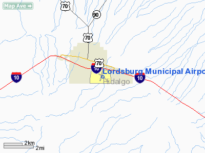
Location & QuickFacts
| FAA Information Effective: | 2008-09-25 |
| Airport Identifier: | LSB |
| Airport Status: | Operational |
| Longitude/Latitude: | 108-41-30.2600W/32-20-00.4700N
-108.691739/32.333464 (Estimated) |
| Elevation: | 4289 ft / 1307.29 m (Surveyed) |
| Land: | 752 acres |
| From nearest city: | 1 nautical miles SE of Lordsburg, NM |
| Location: | Hidalgo County, NM |
| Magnetic Variation: | 11E (1990) |
Owner & Manager
| Ownership: | Publicly owned |
| Owner: | City Of Lordsburg |
| Address: | 206 S. Main St
Lordsburg, NM 88045 |
| Phone number: | 575-542-3421 |
| Manager: | Mayor Smith |
| Address: | 206 S. Main St
Lordsburg, NM 88045 |
| Phone number: | 575-542-3421 |
Airport Operations and Facilities
| Airport Use: | Open to public |
| Wind indicator: | Yes |
| Segmented Circle: | Yes |
| Control Tower: | No |
| Lighting Schedule: | DUSK-DAWN
ACTVT MIRL RY 12/30 - CTAF. |
| Beacon Color: | Clear-Green (lighted land airport) |
| Landing fee charge: | No |
| Sectional chart: | Albuquerque |
| Region: | ASW - Southwest |
| Boundary ARTCC: | ZAB - Albuquerque |
| Tie-in FSS: | ABQ - Albuquerque |
| FSS on Airport: | No |
| FSS Toll Free: | 1-800-WX-BRIEF |
| NOTAMs Facility: | ABQ (NOTAM-d service avaliable) |
| Federal Agreements: | NR |
Airport Communications
| CTAF: | 122.800 |
| Unicom: | 122.800 |
Airport Services
| Fuel available: | 100LLA |
| Airframe Repair: | MINOR |
| Power Plant Repair: | MINOR |
| Bottled Oxygen: | NONE |
| Bulk Oxygen: | NONE |
Runway Information
Runway 01/19
| Dimension: | 3250 x 50 ft / 990.6 x 15.2 m |
| Surface: | DIRT, Good Condition
RY 01/19 SOFT WHEN WET AND NEEDS PERIODIC ROLLING AND GRADING. |
| |
Runway 01 |
Runway 19 |
| Traffic Pattern: | Left | Left |
| Obstruction: | 6 ft hill, 175.0 ft from runway, 29:1 slope to clear | 35 ft pline, 350.0 ft from runway, 120 ft right of centerline, 10:1 slope to clear |
|
Runway 12/30
| Dimension: | 5011 x 75 ft / 1527.4 x 22.9 m |
| Surface: | ASPH, Good Condition
RY 01/19 SOFT WHEN WET AND NEEDS PERIODIC ROLLING AND GRADING. |
| Edge Lights: | Medium |
| |
Runway 12 |
Runway 30 |
| Longitude: | 108-41-49.7850W | 108-41-05.2320W |
| Latitude: | 32-20-14.0290N | 32-19-41.9920N |
| Elevation: | 4278.00 ft | 4277.00 ft |
| Alignment: | 127 | 127 |
| Traffic Pattern: | Left | Left |
| Markings: | Basic, Good Condition | Basic, Poor Condition
RY CNTRLN AND NUMBER FADED. |
| Obstruction: | 15 ft road, 540.0 ft from runway, 175 ft left of centerline, 22:1 slope to clear | 3 ft brush, 200.0 ft from runway
+2 FT BRUSH IN PRIMARY SURFACE, BOTH SIDES OF RY AND IN RY SAFETY AREA. |
|
Radio Navigation Aids
| ID |
Type |
Name |
Ch |
Freq |
Var |
Dist |
| SSO | VORTAC | San Simon | 101X | 115.40 | 13E | 29.3 nm |
| SVC | VORTAC | Silver City | 045X | 110.80 | 13E | 32.5 nm |
Images and information placed above are from
http://www.airport-data.com/airport/LSB/
We thank them for the data!
| General Info
|
| Country |
United States
|
| State |
NEW MEXICO
|
| FAA ID |
LSB
|
| Latitude |
32-19-58.011N
|
| Longitude |
108-41-27.507W
|
| Elevation |
4278 feet
|
| Near City |
LORDSBURG
|
We don't guarantee the information is fresh and accurate. The data may
be wrong or outdated.
For more up-to-date information please refer to other sources.
|
|


