 |
|
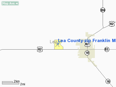
Lea County-zip Franklin Memorial Airport |
| Lea County-Zip Franklin Memorial Airport |
| IATA: none – ICAO: none – FAA LID: E06 |
| Summary |
| Airport type |
Public |
| Operator |
Lea County |
| Location |
Lovington, New Mexico |
| Elevation AMSL |
3,979 ft / 1,212.8 m |
| Coordinates |
32°57′14″N 103°24′32″W / 32.95389°N 103.40889°W / 32.95389; -103.40889Coordinates: 32°57′14″N 103°24′32″W / 32.95389°N 103.40889°W / 32.95389; -103.40889 |
| Runways |
| Direction |
Length |
Surface |
| ft |
m |
| 3/21 |
6,000 |
1,829 |
Asphalt |
| 12/30 |
4,409 |
1,344 |
Asphalt |
Lea County-Zip Franklin Memorial Airport (FAA LID: E06), also known as Lovington Airport, is a public airport located three miles (5 km) west of the central business district (CBD) of Lovington, a city in Lea County, New Mexico, USA. The airport covers 400 acres (162 ha) and has two runways. The airport is named for aviator Oliver Gene "Zip" Franklin.
The above content comes from Wikipedia and is published under free licenses – click here to read more.
Location & QuickFacts
| FAA Information Effective: | 2008-09-25 |
| Airport Identifier: | E06 |
| Airport Status: | Operational |
| Longitude/Latitude: | 103-24-31.6000W/32-57-14.2000N
-103.408778/32.953944 (Estimated) |
| Elevation: | 3979 ft / 1212.80 m (Surveyed) |
| Land: | 400 acres |
| From nearest city: | 3 nautical miles W of Lovington, NM |
| Location: | Lea County, NM |
| Magnetic Variation: | 10E (1985) |
Owner & Manager
| Ownership: | Publicly owned |
| Owner: | Lea County |
| Address: | Po Box 1106
Hobbs, NM 88241-1106 |
| Phone number: | 575-391-2934 |
| Manager: | Bill Gatchell |
| Address: | Po Box 1106
Hobbs, NM 88241-1106 |
| Phone number: | 575-391-2934 |
Airport Operations and Facilities
| Airport Use: | Open to public |
| Wind indicator: | Yes |
| Segmented Circle: | Yes |
| Control Tower: | No |
| Lighting Schedule: | DUSK-DAWN
MIRL RY 03/21 AND RY 12/30 PRESET LOW INTST; TO INCR INTST ACTVT - CTAF. |
| Beacon Color: | Clear-Green (lighted land airport) |
| Landing fee charge: | No |
| Sectional chart: | Albuquerque |
| Region: | ASW - Southwest |
| Boundary ARTCC: | ZFW - Fort Worth |
| Tie-in FSS: | ABQ - Albuquerque |
| FSS on Airport: | No |
| FSS Toll Free: | 1-800-WX-BRIEF |
| NOTAMs Facility: | ABQ (NOTAM-d service avaliable) |
| Federal Agreements: | NGY |
Airport Communications
| CTAF: | 122.800 |
| Unicom: | 122.800 |
Airport Services
| Bottled Oxygen: | NONE |
| Bulk Oxygen: | NONE |
Runway Information
Runway 03/21
| Dimension: | 6000 x 75 ft / 1828.8 x 22.9 m |
| Surface: | ASPH, Good Condition |
| Weight Limit: | Single wheel: 12000 lbs. |
| Edge Lights: | Medium |
| |
Runway 03 |
Runway 21 |
| Longitude: | 103-24-51.7560W | 103-24-01.9950W |
| Latitude: | 32-56-55.3850N | 32-57-37.3740N |
| Elevation: | 3976.00 ft | 3967.00 ft |
| Alignment: | 45 | 127 |
| Traffic Pattern: | Left | Left |
| Markings: | Non-precision instrument, Good Condition | Non-precision instrument, Good Condition |
| Crossing Height: | 42.00 ft | 42.00 ft |
| VASI: | pulsating/steady burning on left side | pulsating/steady burning on left side |
| Visual Glide Angle: | 3.00° | 3.00° |
| Obstruction: | 40 ft pline, 936.0 ft from runway, 273 ft right of centerline, 18:1 slope to clear | 21 ft tree, 624.0 ft from runway, 75 ft left of centerline, 20:1 slope to clear |
|
Runway 12/30
| Dimension: | 4409 x 60 ft / 1343.9 x 18.3 m |
| Surface: | ASPH, |
| Weight Limit: | Single wheel: 12000 lbs. |
| Edge Lights: | Medium |
| |
Runway 12 |
Runway 30 |
| Longitude: | 103-24-55.2290W | 103-24-20.6410W |
| Latitude: | 32-57-27.4680N | 32-56-55.0360N |
| Elevation: | 3979.00 ft | 3970.00 ft |
| Alignment: | 127 | 127 |
| Traffic Pattern: | Left | Left |
| Markings: | Basic, Good Condition | Basic, Good Condition |
| Obstruction: | 4 ft fence, 258.0 ft from runway, 14:1 slope to clear | 35 ft pline, 1250.0 ft from runway, 150 ft left of centerline, 30:1 slope to clear |
|
Radio Navigation Aids
| ID |
Type |
Name |
Ch |
Freq |
Var |
Dist |
| GNC | NDB | Gaines County | | 344.00 | 09E | 42.1 nm |
| HOB | VORTAC | Hobbs | 047X | 111.00 | 11E | 20.2 nm |
Remarks
- EXTENSIVE OIL WELL DRILLING ACTIVITY ON & INVOF ARPT.
Images and information placed above are from
http://www.airport-data.com/airport/E06/
We thank them for the data!
| General Info
|
| Country |
United States
|
| State |
NEW MEXICO
|
| FAA ID |
E06
|
| Latitude |
32-57-14.200N
|
| Longitude |
103-24-31.600W
|
| Elevation |
3979 feet
|
| Near City |
LOVINGTON
|
We don't guarantee the information is fresh and accurate. The data may
be wrong or outdated.
For more up-to-date information please refer to other sources.
|
|


