 |
|
Coordinates: 35°39′15″N 105°08′33″W / 35.65417°N 105.1425°W / 35.65417; -105.1425
| Las Vegas Municipal Airport |
| IATA: LVS – ICAO: KLVS – FAA LID: LVS |
| Summary |
| Airport type |
Public |
| Owner |
City of Las Vegas |
| Serves |
Las Vegas, New Mexico |
| Elevation AMSL |
6,877 ft / 2,096 m |
| Runways |
| Direction |
Length |
Surface |
| ft |
m |
| 2/20 |
5,004 |
1,525 |
Asphalt |
| 14/32 |
8,198 |
2,499 |
Asphalt |
| Statistics (2006) |
| Aircraft operations |
11,350 |
| Based aircraft |
14 |
| Source: Federal Aviation Administration |
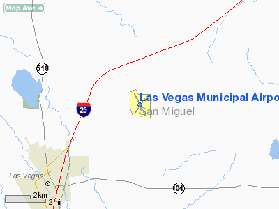
Las Vegas Municipal Airport (IATA: LVS, ICAO: KLVS, FAA LID: LVS) is a city-owned public-use airport located five miles (8 km) northeast of the central business district of Las Vegas, a city in San Miguel County, New Mexico, United States.
Facilities and aircraft
Las Vegas Municipal Airport covers an area of 1,300 acres (526 ha) which contains two asphalt paved runways: 2/20 measuring 5,004 x 75 ft (1,525 x 23 m) and 14/32 measuring 8,198 x 75 ft (2,499 x 23 m).
For the 12-month period ending April 11, 2006, the airport had 11,350 aircraft operations, an average of 31 per day: 97% general aviation and 3% military. At that time there were 14 aircraft based at this airport: 86% single-engine, 7% multi-engine and 7% jet.
The above content comes from Wikipedia and is published under free licenses – click here to read more.
Location & QuickFacts
| FAA Information Effective: | 2008-09-25 |
| Airport Identifier: | LVS |
| Airport Status: | Operational |
| Longitude/Latitude: | 105-08-32.6000W/35-39-15.2000N
-105.142389/35.654222 (Estimated) |
| Elevation: | 6877 ft / 2096.11 m (Surveyed) |
| Land: | 1300 acres |
| From nearest city: | 5 nautical miles NE of Las Vegas, NM |
| Location: | San Miguel County, NM |
| Magnetic Variation: | 13E (1965) |
Owner & Manager
| Ownership: | Publicly owned |
| Owner: | City Of Las Vegas |
| Address: | Box 160
Las Vegas, NM 87701 |
| Phone number: | 505-454-1401 |
| Manager: | John Aragon |
| Address: | 910 Airport Road
Las Vegas, NM 87701 |
| Phone number: | 505-454-0881 |
Airport Operations and Facilities
| Airport Use: | Open to public |
| Wind indicator: | Yes |
| Segmented Circle: | No |
| Control Tower: | No |
| Lighting Schedule: | DUSK-DAWN
ACTVT MIRL RY 14/32 - CTAF. |
| Beacon Color: | Clear-Green (lighted land airport) |
| Sectional chart: | Albuquerque |
| Region: | ASW - Southwest |
| Boundary ARTCC: | ZAB - Albuquerque |
| Tie-in FSS: | ABQ - Albuquerque |
| FSS on Airport: | No |
| FSS Toll Free: | 1-800-WX-BRIEF |
| NOTAMs Facility: | LVS (NOTAM-d service avaliable) |
| Federal Agreements: | NGY3 |
Airport Communications
| CTAF: | 122.800 |
| Unicom: | 122.800 |
Airport Services
| Fuel available: | 100LLA1 |
| Bottled Oxygen: | NONE |
| Bulk Oxygen: | NONE |
Runway Information
Runway 02/20
| Dimension: | 5004 x 75 ft / 1525.2 x 22.9 m |
| Surface: | ASPH, Good Condition |
| Weight Limit: | Single wheel: 15000 lbs. |
| |
Runway 02 |
Runway 20 |
| Longitude: | 105-08-50.7250W | 105-08-16.0420W |
| Latitude: | 35-38-53.7520N | 35-39-34.3220N |
| Elevation: | 6866.00 ft | 6861.00 ft |
| Alignment: | 35 | 127 |
| Traffic Pattern: | Left | Left |
| Markings: | Non-precision instrument, Good Condition | Non-precision instrument, Good Condition |
| Crossing Height: | 40.00 ft | 55.00 ft |
| VASI: | nonstandard system
RETRO-REFLECTIVE PASSIVE APCH SLOPE INDICATOR. | nonstandard system
RETRO-REFLECTIVE PASSIVE APCH SLOPE INDICATOR. |
| Visual Glide Angle: | 3.00° | 3.50° |
| Approach lights: | NSTD
NSTD ODALS - 3 NSTD LGTS ON EXTDD RY CNTRLN ON LESS THAN STD SPACING. | NSTD
NSTD ODALS - 3 NSTD LGTS ON EXTDD RY CNTRLN ON LESS THAN STD SPACING. |
|
Runway 14/32
| Dimension: | 8198 x 75 ft / 2498.8 x 22.9 m |
| Surface: | ASPH, Good Condition |
| Weight Limit: | Single wheel: 20000 lbs. |
| Edge Lights: | Medium
RY 02/20 EDGE LGTG RETRO-REFLECTIVE. |
| |
Runway 14 |
Runway 32 |
| Longitude: | 105-08-55.7680W | 105-08-08.5940W |
| Latitude: | 35-39-51.5000N | 35-38-40.1810N |
| Elevation: | 6840.00 ft | 6877.00 ft |
| Alignment: | 127 | 127 |
| Traffic Pattern: | Left | Left |
| Markings: | Non-precision instrument, Good Condition | Non-precision instrument, Good Condition |
|
Radio Navigation Aids
| ID |
Type |
Name |
Ch |
Freq |
Var |
Dist |
| FTI | VORTAC | Fort Union | 120X | 117.30 | 13E | 0.4 nm |
| ACH | VORTAC | Anton Chico | 125X | 117.80 | 12E | 33.0 nm |
| SAF | VORTAC | Santa Fe | 043X | 110.60 | 13E | 45.6 nm |
Remarks
- BE ALERT FOR HEAVY CONCENTRATIONS OF BIRDS ON & INVOF ARPT.
Images and information placed above are from
http://www.airport-data.com/airport/LVS/
We thank them for the data!
| General Info
|
| Country |
United States
|
| State |
NEW MEXICO
|
| FAA ID |
LVS
|
| Latitude |
35-39-15.200N
|
| Longitude |
105-08-32.600W
|
| Elevation |
6877 feet
|
| Near City |
LAS VEGAS
|
We don't guarantee the information is fresh and accurate. The data may
be wrong or outdated.
For more up-to-date information please refer to other sources.
|
|


