 |
|
| Las Cruces International Airport |
| IATA: LRU – ICAO: KLRU |
| Summary |
| Airport type |
Public |
| Owner |
City of Las Cruces |
| Operator |
City of Las Cruces |
| Serves |
Las Cruces, NM |
| Location |
Las Cruces, NM |
| Elevation AMSL |
4,456 ft / 1,358.2 m |
| Coordinates |
32°17′21.9″N 106°55′19.1″W / 32.289417°N 106.921972°W / 32.289417; -106.921972Coordinates: 32°17′21.9″N 106°55′19.1″W / 32.289417°N 106.921972°W / 32.289417; -106.921972 |
| Runways |
| Direction |
Length |
Surface |
| ft |
m |
| 4/22 |
7,499 |
2,286 |
Asphalt |
| 12/30 * |
7,499 |
2,286 |
Asphalt |
| 8/26 |
6,069 |
1,850 |
Asphalt |
| * Closed for reconstruction as of 20 July 2009. |
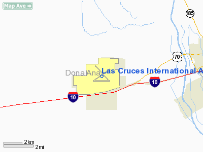
Las Cruces International Airport (IATA: LRU, ICAO: KLRU) is an international airport located 8 miles west of the city center of Las Cruces, New Mexico, on a Mesa overlooking the Mesilla Valley. The airport was the major hub for Zia Airlines in the 1970's and early 1980's.[1] There have been no scheduled passenger flights to this airport since Westward Airways ceased operations on July 25, 2005. The airport is the home base for 135 aircraft, and sees an average of 209 flight operations daily. The airport is used by general aviation, the United States government, New Mexico State University, private charters and the local CAP squadron. Should an airline desire to restore scheduled air service, the field retains a passenger terminal. Most Las Crucens wanting to travel by air either drive or take shuttle buses to El Paso International Airport or Albuquerque International Sunport.
The airport features two fixed base operators, Southwest Aviation and Adventure Aviation, to provide flight instruction services, aircraft fuel, and facilities to handle corporate aircraft and private charters. In addition, Adventure Aviation features a restaurant open to the general public, Crosswinds Grill.
The above content comes from Wikipedia and is published under free licenses – click here to read more.
Location & QuickFacts
| FAA Information Effective: | 2008-09-25 |
| Airport Identifier: | LRU |
| Airport Status: | Operational |
| Longitude/Latitude: | 106-55-19.1000W/32-17-21.9000N
-106.921972/32.289417 (Estimated) |
| Elevation: | 4456 ft / 1358.19 m (Surveyed) |
| Land: | 2193 acres |
| From nearest city: | 8 nautical miles W of Las Cruces, NM |
| Location: | Dona Ana County, NM |
| Magnetic Variation: | 11E (1990) |
Owner & Manager
| Ownership: | Publicly owned |
| Owner: | City Of Las Cruces |
| Address: | Po Box 20000
Las Cruces, NM 88004 |
| Phone number: | 575-541-2076 |
| Manager: | Lisa Murphy |
| Address: | Box 20000
Las Cruces, NM 88004 |
| Phone number: | 575-541-2471 |
Airport Operations and Facilities
| Airport Use: | Open to public |
| Wind indicator: | Yes |
| Segmented Circle: | Yes |
| Control Tower: | No |
| Lighting Schedule: | DUSK-DAWN
ACTVT MIRL RYS 04/22 & 12/30 AND MALSR RY 30 - CTAF. MIRL RY 08/26 PRESET LOW INTST; TO INCR INTST ACTVT - CTAF. |
| Beacon Color: | Clear-Green (lighted land airport) |
| Landing fee charge: | No |
| Sectional chart: | Albuquerque |
| Region: | ASW - Southwest |
| Traffic Pattern Alt: | 1000 ft |
| Boundary ARTCC: | ZAB - Albuquerque |
| Tie-in FSS: | ABQ - Albuquerque |
| FSS on Airport: | No |
| FSS Toll Free: | 1-800-WX-BRIEF |
| NOTAMs Facility: | LRU (NOTAM-d service avaliable) |
| Certification type/date: | IV A U 01/198
PPR 48 HRS FOR ACR ACFT WITH MORE THAN 30 PSGR SEATS CALL AMGR 575-541-2471 OR 575-541-2473. |
| Federal Agreements: | NGPSY3 |
Airport Communications
| CTAF: | 122.700 |
| Unicom: | 122.700 |
Airport Services
| Fuel available: | 100LLA1+ |
| Airframe Repair: | MAJOR |
| Power Plant Repair: | MAJOR |
| Bottled Oxygen: | HIGH |
| Bulk Oxygen: | HIGH |
Runway Information
Runway 04/22
| Dimension: | 7499 x 100 ft / 2285.7 x 30.5 m |
| Surface: | ASPH, Fair Condition |
| Weight Limit: | Single wheel: 30000 lbs.
Dual wheel: 30000 lbs.
Dual tandem wheel: 30000 lbs.
Dual dual tandem wheel: 30000 lbs. |
| Edge Lights: | Medium |
| |
Runway 04 |
Runway 22 |
| Longitude: | 106-55-55.5550W | 106-54-44.3210W |
| Latitude: | 32-17-04.4800N | 32-17-47.4070N |
| Elevation: | 4436.00 ft | 4452.00 ft |
| Alignment: | 55 | 127 |
| Traffic Pattern: | Left | Left |
| Markings: | Basic, Fair Condition | Basic, Fair Condition |
| Crossing Height: | 0.00 ft | 48.00 ft |
| VASI: | | 4-box on left side |
| Visual Glide Angle: | 0.00° | 3.00° |
| Decleard distances: | Take off run available 7499.00 ft
Take off distance available 7499.00 ft
Actual stop distance available 7499.00 ft
Landing distance available 7499.00 ft
| Take off run available 7499.00 ft
Take off distance available 7499.00 ft
Actual stop distance available 7499.00 ft
Landing distance available 7499.00 ft
|
|
Runway 08/26
| Dimension: | 6069 x 100 ft / 1849.8 x 30.5 m |
| Surface: | ASPH, Good Condition |
| Weight Limit: | Single wheel: 70000 lbs.
Dual wheel: 120000 lbs. |
| Edge Lights: | Medium |
| |
Runway 08 |
Runway 26 |
| Longitude: | 106-55-56.0500W | 106-54-45.3720W |
| Latitude: | 32-17-05.8290N | 32-17-05.8510N |
| Elevation: | 4437.00 ft | 4436.00 ft |
| Alignment: | 90 | 127 |
| Traffic Pattern: | Left | Left |
| Markings: | Basic, Fair Condition | Basic, Fair Condition |
| Crossing Height: | 55.00 ft | 41.00 ft |
| VASI: | 2-box on left side | 2-box on left side |
| Visual Glide Angle: | 3.00° | 3.00° |
| Decleard distances: | Take off run available 6069.00 ft
Take off distance available 6069.00 ft
Actual stop distance available 6069.00 ft
Landing distance available 6069.00 ft
| Take off run available 6069.00 ft
Take off distance available 6069.00 ft
Actual stop distance available 6069.00 ft
Landing distance available 6069.00 ft
|
|
Runway 12/30
| Dimension: | 7499 x 100 ft / 2285.7 x 30.5 m |
| Surface: | ASPH, Fair Condition |
| Weight Limit: | Single wheel: 70000 lbs.
Dual wheel: 120000 lbs. |
| Edge Lights: | Medium |
| |
Runway 12 |
Runway 30 |
| Longitude: | 106-55-47.7330W | 106-54-45.9830W |
| Latitude: | 32-17-57.0360N | 32-17-04.5650N |
| Elevation: | 4456.00 ft | 4436.00 ft |
| Alignment: | 127 | 127 |
| ILS Type: | | ILS/DME
|
| Traffic Pattern: | Left | Left |
| Markings: | Non-precision instrument, Fair Condition | Precision instrument, Good Condition |
| Approach lights: | | MALSR |
| Decleard distances: | Take off run available 7499.00 ft
Take off distance available 7499.00 ft
Actual stop distance available 7499.00 ft
Landing distance available 7499.00 ft
| Take off run available 7499.00 ft
Take off distance available 7499.00 ft
Actual stop distance available 7499.00 ft
Landing distance available 7499.00 ft
|
|
Radio Navigation Aids
| ID |
Type |
Name |
Ch |
Freq |
Var |
Dist |
| EL | NDB | Valtr | | 242.00 | 11E | 40.2 nm |
| CUS | VOR/DME | Columbus | 049X | 111.20 | 12E | 43.6 nm |
| CJS | VOR/DME | Ciudad Juarez | 114X | 116.70 | 11E | 46.7 nm |
| DMN | VORTAC | Deming | 023X | 108.60 | 12E | 34.7 nm |
| EWM | VORTAC | Newman | 071X | 112.40 | 12E | 38.8 nm |
| ELP | VORTAC | El Paso | 099X | 115.20 | 12E | 43.3 nm |
| ELP | VOT | El Paso Intl | | 111.00 | | 39.8 nm |
Remarks
- RY 30 DESIGNATED CALM WIND RY.
- BIRDS ON & INVOF ARPT SEP-MAR.
- RY 04/22 NOT AVBL FOR ACR OPNS WITH MORE THAN 30 PSGR SEATS.
- UNMANNED AERIAL VEHICLE TRAINING OPERATIONS ON THE AIRPORT.
- RY 04/22 CLSD TO ACFT OVER 30,000 LBS.
Images and information placed above are from
http://www.airport-data.com/airport/LRU/
We thank them for the data!
| General Info
|
| Country |
United States
|
| State |
NEW MEXICO
|
| FAA ID |
LRU
|
| Latitude |
32-17-21.900N
|
| Longitude |
106-55-19.100W
|
| Elevation |
4456 feet
|
| Near City |
LAS CRUCES
|
We don't guarantee the information is fresh and accurate. The data may
be wrong or outdated.
For more up-to-date information please refer to other sources.
|
|


