 |
|
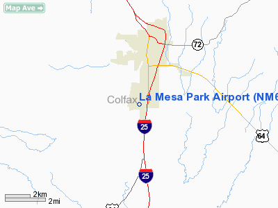
Location & QuickFacts
| FAA Information Effective: | 2008-09-25 |
| Airport Identifier: | NM67 |
| Airport Status: | Operational |
| Longitude/Latitude: | 104-26-51.9520W/36-51-25.0920N
-104.447764/36.856970 (Estimated) |
| Elevation: | 6578 ft / 2004.97 m (Estimated) |
| Land: | 35 acres |
| From nearest city: | 2 nautical miles SW of Raton, NM |
| Location: | Colfax County, NM |
| Magnetic Variation: | 11E (1985) |
Owner & Manager
| Ownership: | Privately owned |
| Owner: | International State Bank |
| Address: | 200 S 2nd
Raton, NM 87740 |
| Phone number: | 505-445-2321 |
| Manager: | Joel Sanderson |
| Address: | Box 519
Raton, NM 87740 |
| Phone number: | 505-445-3486 |
Airport Operations and Facilities
| Airport Use: | Private |
| Wind indicator: | Yes |
| Segmented Circle: | No |
| Control Tower: | No |
| Lighting Schedule: | DUSK-DAWN |
| Landing fee charge: | No |
| Sectional chart: | Denver |
| Region: | ASW - Southwest |
| Boundary ARTCC: | ZAB - Albuquerque |
| Tie-in FSS: | ABQ - Albuquerque |
| FSS on Airport: | No |
| FSS Toll Free: | 1-800-WX-BRIEF |
Airport Services
| Airframe Repair: | NONE |
| Power Plant Repair: | NONE |
Runway Information
Runway 16/34
| Dimension: | 5445 x 40 ft / 1659.6 x 12.2 m |
| Surface: | ASPH, Poor Condition
HEAVY WEED ENCROACHMENT N & S ENDS; POTHOLES TOWARD S END. |
| Weight Limit: | Single wheel: 10000 lbs. |
| Edge Lights: | Low
NUMEROUS RWY LGT FIXTURES MISSING; ONLY SOUTH 4970' OF RWY LGTD. |
| |
Runway 16 |
Runway 34 |
| Traffic Pattern: | Left | Left |
| Markings: | Nonstandard, Poor Condition
16/34 CNTRLN MARKINGS ONLY NO NUMBERS; RY MARKINGS FADED. | Nonstandard, Poor Condition |
| Obstruction: | 11 ft road, 200.0 ft from runway
+30' POLE AND +25' HGR 100' FROM THR 75' LEFT; +11' ROAD 0-200' FROM THR. | , 50:1 slope to clear
+4' FENCE 115' FROM THR; +4' FENCE 155' FM THR. |
|
Radio Navigation Aids
| ID |
Type |
Name |
Ch |
Freq |
Var |
Dist |
| MXR | NDB | Maxwell | | 284.00 | 10E | 10.4 nm |
| TAD | NDB | Trinidad | | 329.00 | 10E | 27.5 nm |
| CIM | VORTAC | Cimarron | 111X | 116.40 | 13E | 30.0 nm |
| TBE | VORTAC | Tobe | 049X | 111.20 | 12E | 47.3 nm |
Remarks
- RWY 34 HAZARDOUS FOR TKOF: TKOF TO SOUTH ONLY DUE HIGH TERRAIN TO NORTH.
- RY 16/34 CLSD TO ACFT 7000 LBS & OVER.
Images and information placed above are from
http://www.airport-data.com/airport/NM67/
We thank them for the data!
| General Info
|
| Country |
United States
|
| State |
NEW MEXICO
|
| FAA ID |
NM67
|
| Latitude |
36-51-25.092N
|
| Longitude |
104-26-51.952W
|
| Elevation |
6578 feet
|
| Near City |
RATON
|
We don't guarantee the information is fresh and accurate. The data may
be wrong or outdated.
For more up-to-date information please refer to other sources.
|
|


