 |
|
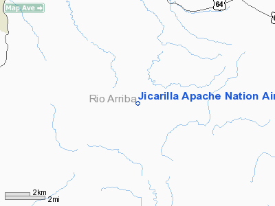
Jicarilla Apache Nation Airport |
Location & QuickFacts
| FAA Information Effective: | 2008-09-25 |
| Airport Identifier: | 24N |
| Airport Status: | Closed Indefinitely |
| Longitude/Latitude: | 106-53-03.0890W/36-49-42.7260N
-106.884191/36.828535 (Estimated) |
| Elevation: | 7618 ft / 2321.97 m (Estimated) |
| Land: | 360 acres |
| From nearest city: | 10 nautical miles S of Dulce, NM |
| Location: | Rio Arriba County, NM |
| Magnetic Variation: | 11E (1995) |
Owner & Manager
| Ownership: | Publicly owned |
| Owner: | Jicarilla Apache Tribe |
| Address: | Po Box 507
Dulce, NM 87528 |
| Phone number: | 575-759-3242 |
| Manager: | Lambert Callado |
| Address: | Po Box 507
Dulce, NM 87528 |
| Phone number: | 575-759-4309 |
Airport Operations and Facilities
| Airport Use: | Open to public |
| Wind indicator: | Yes |
| Segmented Circle: | Yes |
| Control Tower: | No |
| Lighting Schedule: | DUSK-DAWN
ACTVT MIRL RY 17/35; REIL & PAPI RYS 17 & 35 - CTAF. |
| Beacon Color: | Clear-Green (lighted land airport) |
| Sectional chart: | Denver |
| Region: | ASW - Southwest |
| Boundary ARTCC: | ZDV - Denver |
| Tie-in FSS: | ABQ - Albuquerque |
| FSS on Airport: | No |
| FSS Toll Free: | 1-800-WX-BRIEF |
| NOTAMs Facility: | ABQ (NOTAM-d service avaliable) |
| Federal Agreements: | NGY |
Airport Communications
Runway Information
Runway 17/35
| Dimension: | 7500 x 75 ft / 2286.0 x 22.9 m |
| Surface: | ASPH, Good Condition
RY HAS NUMEROUS 5 INCH CRACKS. |
| Weight Limit: | Single wheel: 12500 lbs. |
| Edge Lights: | Medium |
| |
Runway 17 |
Runway 35 |
| Longitude: | 106-53-01.4970W | 106-53-04.6810W |
| Latitude: | 36-50-19.7820N | 36-49-05.6690N |
| Elevation: | 7536.00 ft | 7618.00 ft |
| Alignment: | 127 | 2 |
| Traffic Pattern: | Left | Left |
| Markings: | Non-precision instrument, Good Condition | Non-precision instrument, Good Condition |
| Crossing Height: | 30.00 ft | 30.00 ft |
| VASI: | 2-light PAPI on left side | 2-light PAPI on left side |
| Visual Glide Angle: | 3.00° | 3.00° |
| Runway End Identifier: | Yes | Yes |
| Obstruction: | 18 ft tree, 635.0 ft from runway, 150 ft right of centerline, 24:1 slope to clear | 25 ft tree, 756.0 ft from runway, 175 ft right of centerline, 22:1 slope to clear |
|
Radio Navigation Aids
| ID |
Type |
Name |
Ch |
Freq |
Var |
Dist |
| DRO | VOR/DME | Durango | 019X | 108.20 | 14E | 45.9 nm |
| TAS | VORTAC | Taos | 123X | 117.60 | 13E | 48.9 nm |
Remarks
- RISING TERRAIN IN ALL DIRECTIONS.
- MAIN GATE LOCKED AT ALL TIMES; CTC AMGR TO ENTER/EXIT 575-759-4311. GATE COMBINATION 1995.
- WIND SOCK LGTS OTS INDEFLY.
- WILDLIFE IN VICINITY OF AIRPORT.
- (ARPT STATUS) ARPT CLSD INDEFLY.
Images and information placed above are from
http://www.airport-data.com/airport/24N/
We thank them for the data!
| General Info
|
| Country |
United States
|
| State |
NEW MEXICO
|
| FAA ID |
24N
|
| Latitude |
36-49-42.726N
|
| Longitude |
106-53-03.089W
|
| Elevation |
7618 feet
|
| Near City |
DULCE
|
We don't guarantee the information is fresh and accurate. The data may
be wrong or outdated.
For more up-to-date information please refer to other sources.
|
|


