 |
|
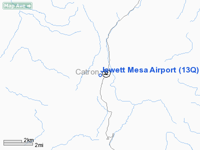
Location & QuickFacts
| FAA Information Effective: | 2008-09-25 |
| Airport Identifier: | 13Q |
| Airport Status: | Operational |
| Longitude/Latitude: | 108-40-41.2380W/34-00-12.1870N
-108.678122/34.003385 (Estimated) |
| Elevation: | 7681 ft / 2341.17 m (Surveyed) |
| Land: | 10 acres |
| From nearest city: | 10 nautical miles N of Apache Creek, NM |
| Location: | Catron County, NM |
| Magnetic Variation: | 12E (1985) |
Owner & Manager
| Ownership: | Publicly owned |
| Owner: | U S Forest Service |
| Address: | Po Box 931
Hurley, NM 88043 |
| Phone number: | 505-538-2702 |
| Manager: | Rance Irwin |
| Address: | Po Box 931
Hurley, NM 88043 |
| Phone number: | 505-538-2702 |
Airport Operations and Facilities
| Airport Use: | Open to public
ARPT OPEN MAY-SEP; OTHER TIMES CLSD. |
| Segmented Circle: | No |
| Control Tower: | No |
| Landing fee charge: | No |
| Sectional chart: | Albuquerque |
| Region: | ASW - Southwest |
| Boundary ARTCC: | ZAB - Albuquerque |
| Tie-in FSS: | ABQ - Albuquerque |
| FSS on Airport: | No |
| FSS Toll Free: | 1-800-WX-BRIEF |
| NOTAMs Facility: | ABQ (NOTAM-d service avaliable) |
Airport Communications
Runway Information
Runway 06/24
| Dimension: | 5200 x 45 ft / 1585.0 x 13.7 m |
| Surface: | DIRT, Poor Condition
HAS LARGE ROCKS ON RY; SFC DEEPLY RUTTED. |
| |
Runway 06 |
Runway 24 |
| Traffic Pattern: | Left | Left |
| Obstruction: | 75 ft pline, 1183.0 ft from runway, 104 ft right of centerline, 15:1 slope to clear | 12 ft road, 110.0 ft from runway, 125 ft left of centerline, 8:1 slope to clear |
|
Radio Navigation Aids
| ID |
Type |
Name |
Ch |
Freq |
Var |
Dist |
| SJN | VORTAC | St Johns | 070X | 112.30 | 12E | 34.3 nm |
Remarks
- WILDLIFE & LIVESTOCK ON RY.
- RY 06/24 RECOMMEND VISUAL INSPECTION BEFORE USING; INFREQUENT MAINTENANCE & POOR COND.
Images and information placed above are from
http://www.airport-data.com/airport/13Q/
We thank them for the data!
|
|


