 |
|
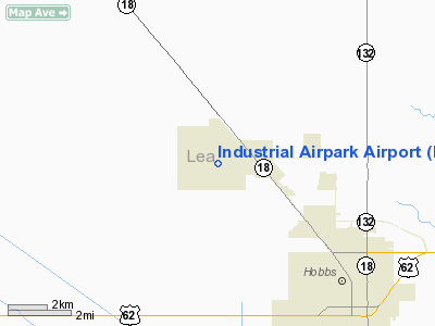
Industrial Airpark Airport |
Location & QuickFacts
| FAA Information Effective: | 2008-09-25 |
| Airport Identifier: | NM83 |
| Airport Status: | Operational |
| Longitude/Latitude: | 103-12-31.7570W/32-46-00.4120N
-103.208821/32.766781 (Estimated) |
| Elevation: | 3707 ft / 1129.89 m (Estimated) |
| Land: | 3066 acres |
| From nearest city: | 6 nautical miles NW of Hobbs, NM |
| Location: | Lea County, NM |
| Magnetic Variation: | 10E (1985) |
Owner & Manager
| Ownership: | Publicly owned |
| Owner: | City Of Hobbs |
| Address: | 300 N. Turner
Hobbs, NM 88240 |
| Phone number: | 505-397-9205 |
| Manager: | Debbie Lee |
| Address: | 300 N. Turner
Hobbs, NM 88240 |
| Phone number: | 505-397-9205 |
Airport Operations and Facilities
| Airport Use: | Private |
| Segmented Circle: | No |
| Control Tower: | No |
| Landing fee charge: | No |
| Sectional chart: | Albuquerque |
| Region: | ASW - Southwest |
| Boundary ARTCC: | ZFW - Fort Worth |
| Tie-in FSS: | ABQ - Albuquerque |
| FSS on Airport: | No |
| FSS Toll Free: | 1-800-WX-BRIEF |
Airport Services
| Airframe Repair: | NONE |
| Power Plant Repair: | NONE |
| Bottled Oxygen: | NONE |
| Bulk Oxygen: | NONE |
Runway Information
Runway 03/21
| Dimension: | 7000 x 150 ft / 2133.6 x 45.7 m |
| Surface: | ASPH, Fair Condition |
| Weight Limit: | Single wheel: 30000 lbs.
Dual wheel: 50000 lbs. |
| |
Runway 03 |
Runway 21 |
| Traffic Pattern: | Left | Left |
| Runway End Identifier: | No | No |
| Centerline Lights: | No | No |
| Touchdown Lights: | No | No |
|
Runway 12/30
| Dimension: | 8810 x 150 ft / 2685.3 x 45.7 m |
| Surface: | ASPH, Fair Condition |
| Weight Limit: | Single wheel: 30000 lbs.
Dual wheel: 50000 lbs. |
| |
Runway 12 |
Runway 30 |
| Traffic Pattern: | Left | Left |
| Runway End Identifier: | No | No |
| Centerline Lights: | No | No |
| Touchdown Lights: | No | No |
|
Radio Navigation Aids
| ID |
Type |
Name |
Ch |
Freq |
Var |
Dist |
| GNC | NDB | Gaines County | | 344.00 | 09E | 29.0 nm |
| ANR | NDB | Andrews | | 245.00 | 09E | 42.3 nm |
| HOB | VORTAC | Hobbs | 047X | 111.00 | 11E | 8.3 nm |
Remarks
- VEGETATION ON RWYS AND TWYS.
- GLIDER OPNS USING WINCH TOW ON RYS UP TO 200' AGL.
Images and information placed above are from
http://www.airport-data.com/airport/NM83/
We thank them for the data!
| General Info
|
| Country |
United States
|
| State |
NEW MEXICO
|
| FAA ID |
NM83
|
| Latitude |
32-46-00.412N
|
| Longitude |
103-12-31.757W
|
| Elevation |
3707 feet
|
| Near City |
HOBBS
|
We don't guarantee the information is fresh and accurate. The data may
be wrong or outdated.
For more up-to-date information please refer to other sources.
|
|


