 |
|
Location & QuickFacts
| FAA Information Effective: | 2008-09-25 |
| Airport Identifier: | NM23 |
| Airport Status: | Closed Permanently |
| Longitude/Latitude: | 105-45-51.9540W/33-09-45.3070N
-105.764432/33.162585 (Estimated) |
| Elevation: | 6660 ft / 2029.97 m (Estimated) |
| Land: | 0 acres |
| From nearest city: | 0 nautical miles N of Mescalero, NM |
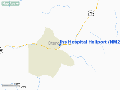
| Location: | Otero County, NM |
| Magnetic Variation: | 11E (1985) |
Owner & Manager
| Ownership: | Publicly owned |
| Owner: | Indian Health Service |
| Address: | 301 Sage Avenue
Mescalero, NM 88340 |
| Phone number: | 505-671-4441 |
| Manager: | Myra Dupree
SERVICE UNIT DIRECTOR. |
| Address: | 301 Sage Avenue
Mescalero, NM 88340 |
| Phone number: | 505-671-4441 |
Airport Operations and Facilities
| Airport Use: | Private
MEDICAL. |
| Segmented Circle: | No |
| Control Tower: | No |
| Lighting Schedule: | PHONE REQ
FOR ROTG BCN CALL 505-671-4441. |
| Beacon Color: | Clear (unlighted land airport) |
| Landing fee charge: | No |
| Sectional chart: | Albuquerque |
| Region: | ASW - Southwest |
| Boundary ARTCC: | ZAB - Albuquerque |
| Tie-in FSS: | ABQ - Albuquerque |
| FSS on Airport: | No |
| FSS Toll Free: | 1-800-WX-BRIEF |
Runway Information
Helipad H1
| Dimension: | 75 x 75 ft / 22.9 x 22.9 m |
| Surface: | TURF, |
| |
Runway H1 |
Runway |
| Traffic Pattern: | Left | Left |
|
Radio Navigation Aids
| ID |
Type |
Name |
Ch |
Freq |
Var |
Dist |
| ALM | NDB | Alamogordo | | 341.00 | 11E | 21.7 nm |
| CEP | NDB | Capitan | | 278.00 | 10E | 26.7 nm |
| HMN | TACAN | Holloman | 092X | | 10E | 25.1 nm |
| BWS | VOR/DME | Boles | 033X | 109.60 | 11E | 24.0 nm |
| PIO | VOR/DME | Pinon | 041X | 110.40 | 12E | 44.6 nm |
Remarks
- FOR PARKING LOT LGTS CALL 505-671-4441 30 MIN PRIOR TO LNDG.
- (ARPT STATUS) ARPT CLSD PERMLY.
- HELIPORT IS UNSUITABLE & UNSAFE FOR HELICOPTER OPNS.
Images and information placed above are from
http://www.airport-data.com/airport/NM23/
We thank them for the data!
| General Info
|
| Country |
United States
|
| State |
NEW MEXICO
|
| FAA ID |
NM23
|
| Latitude |
33-09-45.307N
|
| Longitude |
105-45-51.954W
|
| Elevation |
6660 feet
|
| Near City |
MESCALERO
|
We don't guarantee the information is fresh and accurate. The data may
be wrong or outdated.
For more up-to-date information please refer to other sources.
|
|


