 |
|
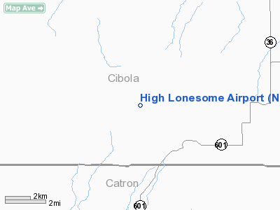
Location & QuickFacts
| FAA Information Effective: | 2008-09-25 |
| Airport Identifier: | NM91 |
| Airport Status: | Operational |
| Longitude/Latitude: | 108-47-24.7000W/34-37-20.4000N
-108.790194/34.622333 (Estimated) |
| Elevation: | 7430 ft / 2264.66 m (Estimated) |
| Land: | 840 acres |
| From nearest city: | 6 nautical miles W of Fence Lake, NM |
| Location: | Cibola County, NM |
| Magnetic Variation: | () |
Owner & Manager
| Ownership: | Privately owned |
| Owner: | John Benjamin |
| Address: | 5 Via La Puente
Galisteo, NM 87540 |
| Phone number: | 505-466-2111 |
| Manager: | John Benjamin |
| Address: | 5 Via La Puente
Galisteo, NM 87540 |
| Phone number: | 505-466-2111 |
Airport Operations and Facilities
| Airport Use: | Private |
| Wind indicator: | Yes |
| Control Tower: | No |
| Sectional chart: | Albuquerque |
| Region: | ASW - Southwest |
| Boundary ARTCC: | ZAB - Albuquerque |
| Tie-in FSS: | ABQ - Albuquerque |
| FSS Toll Free: | 1-800-WX-BRIEF |
Runway Information
Runway 09/27
| Dimension: | 4000 x 35 ft / 1219.2 x 10.7 m |
| Surface: | GRVL, |
| |
Runway 09 |
Runway 27 |
| Traffic Pattern: | Left | Left |
| Obstruction: | | 155 ft tower, 5280.0 ft from runway |
|
Radio Navigation Aids
| ID |
Type |
Name |
Ch |
Freq |
Var |
Dist |
| SJN | VORTAC | St Johns | 070X | 112.30 | 12E | 21.2 nm |
| ZUN | VORTAC | Zuni | 081X | 113.40 | 14E | 27.4 nm |
Images and information placed above are from
http://www.airport-data.com/airport/NM91/
We thank them for the data!
|
|


