 |
|
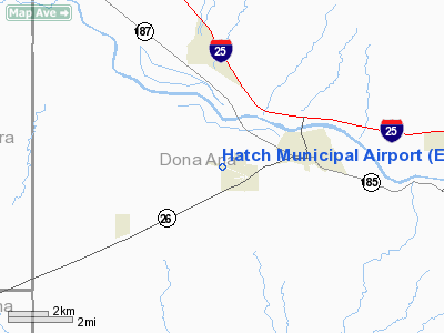
Location & QuickFacts
| FAA Information Effective: | 2008-09-25 |
| Airport Identifier: | E05 |
| Airport Status: | Operational |
| Longitude/Latitude: | 107-11-52.5620W/32-39-39.8190N
-107.197934/32.661061 (Estimated) |
| Elevation: | 4080 ft / 1243.58 m (Estimated) |
| Land: | 166 acres |
| From nearest city: | 3 nautical miles SW of Hatch, NM |
| Location: | Dona Ana County, NM |
| Magnetic Variation: | 11E (1985) |
Owner & Manager
| Ownership: | Publicly owned |
| Owner: | Village Of Hatch |
| Address: | Box 220
Hatch, NM 87937 |
| Phone number: | 575-267-5216 |
| Manager: | Andy Nunez
VILLAGE TRUSTEE. |
| Address: | Box 220
Hatch, NM 87937 |
| Phone number: | 575-267-3451 |
Airport Operations and Facilities
| Airport Use: | Open to public |
| Wind indicator: | Yes |
| Segmented Circle: | No |
| Control Tower: | No |
| Lighting Schedule: | DUSK-DAWN
ACTVT ODALS RYS 11 & 29 - CTAF. |
| Beacon Color: | Clear-Green (lighted land airport) |
| Landing fee charge: | No |
| Sectional chart: | Albuquerque |
| Region: | ASW - Southwest |
| Boundary ARTCC: | ZAB - Albuquerque |
| Tie-in FSS: | ABQ - Albuquerque |
| FSS on Airport: | No |
| FSS Toll Free: | 1-800-WX-BRIEF |
| NOTAMs Facility: | ABQ (NOTAM-d service avaliable) |
| Federal Agreements: | NS |
Airport Communications
Airport Services
| Airframe Repair: | NONE |
| Power Plant Repair: | NONE |
| Bottled Oxygen: | NONE |
| Bulk Oxygen: | NONE |
Runway Information
Runway 11/29
| Dimension: | 4110 x 60 ft / 1252.7 x 18.3 m |
| Surface: | ASPH, Good Condition |
| Weight Limit: | Single wheel: 9000 lbs. |
| |
Runway 11 |
Runway 29 |
| Longitude: | 107-12-05.6990W | 107-11-21.2200W |
| Latitude: | 32-39-44.7300N | 32-39-29.3200N |
| Elevation: | 4080.00 ft | 4078.00 ft |
| Traffic Pattern: | Left | Left |
| Markings: | Basic, Good Condition | Basic, Good Condition |
| VASI: | system of panels on left side that may or may not be lighted
APAP LGTD. | system of panels on left side that may or may not be lighted
APAP LGTD. |
| Approach lights: | NSTD
NSTD ODALS. | NSTD
NSTD ODALS. |
| Obstruction: | , 50:1 slope to clear | 56 ft pole, 1930.0 ft from runway, 30:1 slope to clear |
|
Radio Navigation Aids
| ID |
Type |
Name |
Ch |
Freq |
Var |
Dist |
| DMN | VORTAC | Deming | 023X | 108.60 | 12E | 31.1 nm |
| TCS | VORTAC | Truth Or Consequences | 074X | 112.70 | 13E | 37.6 nm |
| SVC | VORTAC | Silver City | 045X | 110.80 | 13E | 48.8 nm |
Images and information placed above are from
http://www.airport-data.com/airport/E05/
We thank them for the data!
| General Info
|
| Country |
United States
|
| State |
NEW MEXICO
|
| FAA ID |
E05
|
| Latitude |
32-39-39.819N
|
| Longitude |
107-11-52.562W
|
| Elevation |
4080 feet
|
| Near City |
HATCH
|
We don't guarantee the information is fresh and accurate. The data may
be wrong or outdated.
For more up-to-date information please refer to other sources.
|
|


