 |
|
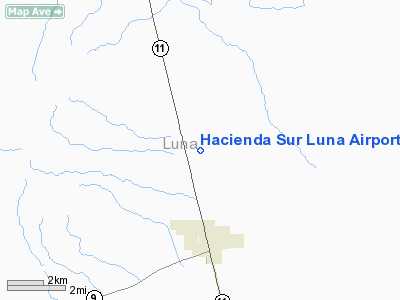
Hacienda Sur Luna Airport |
Location & QuickFacts
| FAA Information Effective: | 2008-09-25 |
| Airport Identifier: | NM78 |
| Airport Status: | Operational |
| Longitude/Latitude: | 107-38-44.0850W/31-52-40.3550N
-107.645579/31.877876 (Estimated) |
| Elevation: | 4150 ft / 1264.92 m (Estimated) |
| Land: | 307 acres |
| From nearest city: | 3 nautical miles N of Columbus, NM |
| Location: | Luna County, NM |
| Magnetic Variation: | 11E (1985) |
Owner & Manager
| Ownership: | Privately owned |
| Owner: | Estate Of M Ann Cobb-gambel |
| Address: | Po Box 196
Columbus, NM 88029 |
| Phone number: | 505-531-2771 |
| Manager: | Arlin H Gambel |
| Address: | Po Box 196
Columbus, NM 88029 |
| Phone number: | 505-531-2771 |
Airport Operations and Facilities
| Airport Use: | Private |
| Wind indicator: | Yes |
| Segmented Circle: | No |
| Control Tower: | No |
| Sectional chart: | El Paso |
| Region: | ASW - Southwest |
| Boundary ARTCC: | ZAB - Albuquerque |
| Tie-in FSS: | ABQ - Albuquerque |
| FSS on Airport: | No |
| FSS Toll Free: | 1-800-WX-BRIEF |
Airport Services
| Airframe Repair: | NONE |
| Power Plant Repair: | NONE |
Runway Information
Runway E/W
| Dimension: | 4800 x 30 ft / 1463.0 x 9.1 m |
| Surface: | ASPH, |
| |
Runway E |
Runway W |
| Traffic Pattern: | Left | Left |
|
Radio Navigation Aids
| ID |
Type |
Name |
Ch |
Freq |
Var |
Dist |
| CUS | VOR/DME | Columbus | 049X | 111.20 | 12E | 5.1 nm |
| DMN | VORTAC | Deming | 023X | 108.60 | 12E | 24.0 nm |
Images and information placed above are from
http://www.airport-data.com/airport/NM78/
We thank them for the data!
| General Info
|
| Country |
United States
|
| State |
NEW MEXICO
|
| FAA ID |
NM78
|
| Latitude |
31-52-40.355N
|
| Longitude |
107-38-44.085W
|
| Elevation |
4150 feet
|
| Near City |
COLUMBUS
|
We don't guarantee the information is fresh and accurate. The data may
be wrong or outdated.
For more up-to-date information please refer to other sources.
|
|


