 |
|
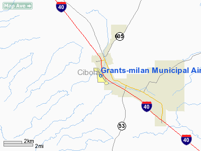
Grants-milan Muni Airport |
Location & QuickFacts
| FAA Information Effective: | 2008-09-25 |
| Airport Identifier: | GNT |
| Airport Status: | Operational |
| Longitude/Latitude: | 107-54-07.4000W/35-10-02.2000N
-107.902056/35.167278 (Estimated) |
| Elevation: | 6537 ft / 1992.48 m (Surveyed) |
| Land: | 365 acres |
| From nearest city: | 3 nautical miles NW of Grants, NM |
| Location: | Cibola County, NM |
| Magnetic Variation: | 11E (2005) |
Owner & Manager
| Ownership: | Publicly owned |
| Owner: | Town Of Grants |
| Address: | Po Box 879
Grants, NM 87020 |
| Phone number: | 505-287-7927 |
| Manager: | Wes Hobbs
G-M AVIATION, FBO/LESSEE. |
| Address: | Box 2579
Milan, NM 87021 |
| Phone number: | 505-287-4700 |
Airport Operations and Facilities
| Airport Use: | Open to public |
| Wind indicator: | Yes |
| Segmented Circle: | Yes |
| Control Tower: | No |
| Lighting Schedule: | DUSK-DAWN
ACTVT MIRL RY 13/31 - CTAF. |
| Beacon Color: | Clear-Green (lighted land airport) |
| Landing fee charge: | No |
| Sectional chart: | Albuquerque |
| Region: | ASW - Southwest |
| Boundary ARTCC: | ZAB - Albuquerque |
| Tie-in FSS: | ABQ - Albuquerque |
| FSS on Airport: | No |
| FSS Toll Free: | 1-800-WX-BRIEF |
| NOTAMs Facility: | GNT (NOTAM-d service avaliable) |
| Federal Agreements: | NGPY |
Airport Communications
| CTAF: | 122.800 |
| Unicom: | 122.800 |
Airport Services
| Fuel available: | 100LLA1+ |
| Airframe Repair: | MINOR |
| Power Plant Repair: | MINOR |
| Bottled Oxygen: | NONE |
| Bulk Oxygen: | NONE |
Runway Information
Runway 08/26
| Dimension: | 2350 x 40 ft / 716.3 x 12.2 m |
| Surface: | DIRT, Fair Condition |
| |
Runway 08 |
Runway 26 |
| Longitude: | 107-54-07.3446W | 107-53-39.0634W |
| Latitude: | 35-09-40.3421N | 35-09-39.6159N |
| Elevation: | 6524.00 ft | 6510.00 ft |
| Alignment: | 92 | 127 |
| Traffic Pattern: | Left | Left |
| Obstruction: | 25 ft hill, 710.0 ft from runway, 28:1 slope to clear | 4 ft fence, 20.0 ft from runway, 5:1 slope to clear
4 FT HIGH FENCE 20 FT FROM RY END. |
|
Runway 13/31
| Dimension: | 7172 x 75 ft / 2186.0 x 22.9 m |
| Surface: | ASPH, Good Condition |
| Weight Limit: | Single wheel: 12000 lbs. |
| Edge Lights: | Medium |
| |
Runway 13 |
Runway 31 |
| Longitude: | 107-54-36.8529W | 107-53-47.2610W |
| Latitude: | 35-10-38.5199N | 35-09-40.4614N |
| Elevation: | 6537.00 ft | 6518.00 ft |
| Alignment: | 127 | 127 |
| Traffic Pattern: | Left | Left |
| Markings: | Non-precision instrument, Good Condition | Basic, Good Condition |
| Crossing Height: | 40.00 ft | 40.00 ft |
| VASI: | 2-light PAPI on left side | 2-light PAPI on left side |
| Visual Glide Angle: | 3.00° | 3.00° |
| Runway End Identifier: | | No |
| Obstruction: | 15 ft gnd, 500.0 ft from runway, 33:1 slope to clear | , 50:1 slope to clear |
|
Radio Navigation Aids
| ID |
Type |
Name |
Ch |
Freq |
Var |
Dist |
Remarks
- +2 FT WINDROW EACH SIDE RY 08/26; 4 FT FENCE SOUTH EDGE PENETRATES PRIM SFC; DITCH AT EAST END.
Images and information placed above are from
http://www.airport-data.com/airport/GNT/
We thank them for the data!
| General Info
|
| Country |
United States
|
| State |
NEW MEXICO
|
| FAA ID |
GNT
|
| Latitude |
35-09-55.133N
|
| Longitude |
107-54-02.211W
|
| Elevation |
6521 feet
|
| Near City |
GRANTS
|
We don't guarantee the information is fresh and accurate. The data may
be wrong or outdated.
For more up-to-date information please refer to other sources.
|
|


