 |
|
| Grant County Airport |
| IATA: SVC – ICAO: KSVC |
| Summary |
| Airport type |
Public |
| Operator |
Grant County |
| Location |
Silver City, New Mexico |
| Elevation AMSL |
5,446 ft / 1,660 m |
| Coordinates |
32°38′12″N 108°09′23″W / 32.63667°N 108.15639°W / 32.63667; -108.15639Coordinates: 32°38′12″N 108°09′23″W / 32.63667°N 108.15639°W / 32.63667; -108.15639 |
| Runways |
| Direction |
Length |
Surface |
| ft |
m |
| 8/26 |
6,802 |
2,073 |
Asphalt |
| 17/35 |
5,473 |
1,668 |
Soil |
| 12/30 |
4,675 |
1,425 |
Dirt |
| 3/21 |
4,637 |
1,413 |
Dirt |
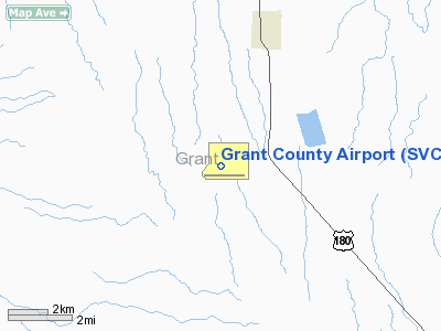
Grant County Airport (IATA: SVC, ICAO: KSVC, FAA LID: SVC) is a public airport located 10 miles (16 km) southeast of the central business district (CBD) of Silver City, in Grant County, New Mexico, USA. The airport covers 740 acres (299 ha) and has four runways. It is mostly used for general aviation, but is also served by one commercial airline. Service is subsidized by the Essential Air Service program.
This airport should not be confused with Grant County International Airport located in Moses Lake, Washington.
Airlines and destinations
| Airlines |
Destinations |
| Great Lakes Airlines |
Albuquerque |
The above content comes from Wikipedia and is published under free licenses – click here to read more.
Location & QuickFacts
| FAA Information Effective: | 2008-09-25 |
| Airport Identifier: | SVC |
| Airport Status: | Operational |
| Longitude/Latitude: | 108-09-22.9870W/32-38-11.5690N
-108.156385/32.636547 (Estimated) |
| Elevation: | 5446 ft / 1659.94 m (Surveyed) |
| Land: | 740 acres |
| From nearest city: | 10 nautical miles SE of Silver City, NM |
| Location: | Grant County, NM |
| Magnetic Variation: | 12E (1980) |
Owner & Manager
| Ownership: | Publicly owned |
| Owner: | Grant County |
| Address: | P.o. Box 898
Silver City, NM 88062 |
| Phone number: | 575-574-0000 |
| Manager: | Larry Anderson |
| Address: | Po Box 6 188 Airport Road
Hurley, NM 88043 |
| Phone number: | 575-388-4554 |
Airport Operations and Facilities
| Airport Use: | Open to public |
| Wind indicator: | Yes |
| Segmented Circle: | Yes |
| Control Tower: | No |
| Lighting Schedule: | DUSK-DAWN
ACTVT MIRL RY 08/26 & MALS RY 26 - CTAF. |
| Beacon Color: | Clear-Green (lighted land airport) |
| Landing fee charge: | No |
| Sectional chart: | Albuquerque |
| Region: | ASW - Southwest |
| Boundary ARTCC: | ZAB - Albuquerque |
| Tie-in FSS: | ABQ - Albuquerque |
| FSS on Airport: | No |
| FSS Toll Free: | 1-800-WX-BRIEF |
| NOTAMs Facility: | SVC (NOTAM-d service avaliable) |
| Certification type/date: | III A S 11/20 |
| Federal Agreements: | NGY |
Airport Communications
| CTAF: | 122.800 |
| Unicom: | 122.800 |
Airport Services
| Fuel available: | 100LLA1
FOR FUEL AFT HRS CALL 888-723-5946. SELF-SERVICE 100LL ALSO AVAILABLE AT FBO 24 HOURS. |
| Bottled Oxygen: | NONE |
| Bulk Oxygen: | NONE |
Runway Information
Runway 03/21
| Dimension: | 4537 x 80 ft / 1382.9 x 24.4 m |
| Surface: | DIRT, Fair Condition |
| |
Runway 03 |
Runway 21 |
| Longitude: | 108-09-48.2990W | 108-09-10.6080W |
| Latitude: | 32-37-58.5720N | 32-38-30.1550N |
| Elevation: | 5383.00 ft | 5411.00 ft |
| Alignment: | 45 | 127 |
| Traffic Pattern: | Left | Left |
| Obstruction: | 35 ft pole, 800.0 ft from runway, 250 ft right of centerline, 22:1 slope to clear | 4 ft fence, 0.0 ft from runway |
|
Runway 08/26
| Dimension: | 6802 x 100 ft / 2073.2 x 30.5 m |
| Surface: | ASPH, Good Condition |
| Weight Limit: | Single wheel: 75000 lbs.
Dual wheel: 100000 lbs. |
| Edge Lights: | Medium |
| |
Runway 08 |
Runway 26 |
| Longitude: | 108-09-54.9540W | 108-08-35.4370W |
| Latitude: | 32-37-56.7290N | 32-37-56.4760N |
| Elevation: | 5386.00 ft | 5376.00 ft |
| Alignment: | 90 | 127 |
| ILS Type: | | LOC/DME
|
| Traffic Pattern: | Left | Left |
| Markings: | Non-precision instrument, Good Condition | Non-precision instrument, Good Condition |
| Approach lights: | | MALS |
| Runway End Identifier: | Yes | |
|
Runway 12/30
| Dimension: | 4675 x 75 ft / 1424.9 x 22.9 m |
| Surface: | DIRT, Fair Condition |
| |
Runway 12 |
Runway 30 |
| Longitude: | 108-09-38.4430W | 108-08-59.7640W |
| Latitude: | 32-38-31.0020N | 32-37-58.3230N |
| Elevation: | 5425.00 ft | 5375.00 ft |
| Alignment: | 127 | 127 |
| Traffic Pattern: | Left | Left |
| Obstruction: | 5 ft fence, 100.0 ft from runway, 20:1 slope to clear | 30 ft tower, 800.0 ft from runway, 100 ft right of centerline, 26:1 slope to clear |
|
Runway 17/35
| Dimension: | 5473 x 75 ft / 1668.2 x 22.9 m |
| Surface: | DIRT, Fair Condition |
| |
Runway 17 |
Runway 35 |
| Longitude: | 108-09-30.3800W | 108-09-30.8800W |
| Latitude: | 32-38-52.2760N | 32-37-58.1390N |
| Elevation: | 5446.00 ft | 5386.00 ft |
| Alignment: | 127 | 127 |
| Traffic Pattern: | Left | Left |
| Displaced threshold: | 109.00 ft
DSPLCD THLD MKD BY TIRES IN 'L' PATTERN. | 0.00 ft |
| Obstruction: | 6 ft fence
APCH RATIO 16:1 FM DSPLCD THR. | 35 ft pline, 1000.0 ft from runway, 28:1 slope to clear |
|
Radio Navigation Aids
| ID |
Type |
Name |
Ch |
Freq |
Var |
Dist |
| SVC | VORTAC | Silver City | 045X | 110.80 | 13E | 0.2 nm |
| DMN | VORTAC | Deming | 023X | 108.60 | 12E | 35.4 nm |
Remarks
- 5490 FT MSL CRANES LCTD EAST OF RY 26 THLD.
- RY 08 VASI OTS.
Images and information placed above are from
http://www.airport-data.com/airport/SVC/
We thank them for the data!
| General Info
|
| Country |
United States
|
| State |
NEW MEXICO
|
| FAA ID |
SVC
|
| Latitude |
32-38-11.569N
|
| Longitude |
108-09-22.987W
|
| Elevation |
5446 feet
|
| Near City |
SILVER CITY
|
We don't guarantee the information is fresh and accurate. The data may
be wrong or outdated.
For more up-to-date information please refer to other sources.
|
|


