 |
|
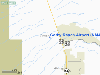
Location & QuickFacts
| FAA Information Effective: | 2008-09-25 |
| Airport Identifier: | NM40 |
| Airport Status: | Operational |
| Longitude/Latitude: | 105-59-56.9610W/32-57-48.3110N
-105.999156/32.963420 (Estimated) |
| Elevation: | 4400 ft / 1341.12 m (Estimated) |
| Land: | 0 acres |
| From nearest city: | 5 nautical miles NW of Alamogordo, NM |
| Location: | Otero County, NM |
| Magnetic Variation: | 11E (1985) |
Owner & Manager
| Ownership: | Privately owned |
| Owner: | Al Gorby |
| Address: | Po Drawer N.n.
Alamogordo, NM 88310 |
| Phone number: | 505-437-6657 |
| Manager: | Al Gorby |
| Address: | Po Drawer N.n.
Alamogordo, NM 88310 |
| Phone number: | 505-437-6657 |
Airport Operations and Facilities
| Airport Use: | Private |
| Wind indicator: | No |
| Segmented Circle: | No |
| Control Tower: | No |
| Landing fee charge: | No |
| Sectional chart: | Albuquerque |
| Region: | ASW - Southwest |
| Boundary ARTCC: | ZAB - Albuquerque |
| Tie-in FSS: | ABQ - Albuquerque |
| FSS on Airport: | No |
| FSS Toll Free: | 1-800-WX-BRIEF |
Runway Information
Runway 17/35
| Dimension: | 2500 x 50 ft / 762.0 x 15.2 m |
| Surface: | TURF, |
| |
Runway 17 |
Runway 35 |
| Traffic Pattern: | Left | Left |
| Obstruction: | 25 ft plines, 300.0 ft from runway | |
|
Radio Navigation Aids
| ID |
Type |
Name |
Ch |
Freq |
Var |
Dist |
| ALM | NDB | Alamogordo | | 341.00 | 11E | 6.9 nm |
| CEP | NDB | Capitan | | 278.00 | 10E | 43.5 nm |
| HMN | TACAN | Holloman | 092X | | 10E | 8.2 nm |
| BWS | VOR/DME | Boles | 033X | 109.60 | 11E | 8.6 nm |
| PIO | VOR/DME | Pinon | 041X | 110.40 | 12E | 43.7 nm |
Remarks
- PRVDD RWY THRS ARE LCTD TO PROVIDE A CLEAR 20:1 APCH SLOPE OVER ANY & ALL OBSTNS; PILOTS DEPARTING ARPT SHALL TURN LEFT OR RIGHT AFTER TKOF TO ENTER VFR CORRIDOR BOUNDED ON THE WEST BY RR & REMAIN BELOW 500' AGL. ARRIVING PILOTS SHOULD REMAIN BELOW 500' AGL WHEN DEPARTING THE VFR CORRIDOR.
Images and information placed above are from
http://www.airport-data.com/airport/NM40/
We thank them for the data!
| General Info
|
| Country |
United States
|
| State |
NEW MEXICO
|
| FAA ID |
NM40
|
| Latitude |
32-57-48.311N
|
| Longitude |
105-59-56.961W
|
| Elevation |
4400 feet
|
| Near City |
ALAMOGORDO
|
We don't guarantee the information is fresh and accurate. The data may
be wrong or outdated.
For more up-to-date information please refer to other sources.
|
|


