 |
|
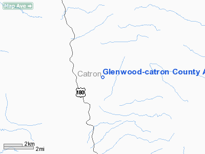
Glenwood-catron County Airport |
Location & QuickFacts
| FAA Information Effective: | 2008-09-25 |
| Airport Identifier: | E94 |
| Airport Status: | Operational |
| Longitude/Latitude: | 108-52-02.2290W/33-21-10.2230N
-108.867286/33.352840 (Estimated) |
| Elevation: | 5428 ft / 1654.45 m (Surveyed) |
| Land: | 10 acres |
| From nearest city: | 3 nautical miles NE of Glenwood, NM |
| Location: | Catron County, NM |
| Magnetic Variation: | 12E (1985) |
Owner & Manager
| Ownership: | Publicly owned |
| Owner: | U. S. Forest Service |
| Address: | 3005 Camino Del Bosque
Silver City, NM 88061 |
| Phone number: | 575-388-8201 |
| Manager: | Bill Aymar
COUNTY MANAGER. |
| Address: | Po Box 507
Reserve, NM 87830 |
| Phone number: | 575-533-6423 |
Airport Operations and Facilities
| Airport Use: | Open to public |
| Wind indicator: | Yes
WINDSOCK MISSING. |
| Segmented Circle: | No |
| Control Tower: | No |
| Landing fee charge: | No |
| Sectional chart: | Albuquerque |
| Region: | ASW - Southwest |
| Boundary ARTCC: | ZAB - Albuquerque |
| Tie-in FSS: | ABQ - Albuquerque |
| FSS on Airport: | No |
| FSS Toll Free: | 1-800-WX-BRIEF |
| NOTAMs Facility: | ABQ (NOTAM-d service avaliable) |
| Federal Agreements: | N |
Airport Communications
Runway Information
Runway 01/19
| Dimension: | 3700 x 84 ft / 1127.8 x 25.6 m |
| Surface: | DIRT, Fair Condition
SOFT WHEN WET. LARGE ROCKS ON SOUTH 300 FT EDGES OF RY. |
| |
Runway 01 |
Runway 19 |
| Traffic Pattern: | Left | Left |
| Obstruction: | 10 ft tree, 30.0 ft from runway, 55 ft right of centerline, 3:1 slope to clear | 5 ft fence, 0.0 ft from runway |
|
Radio Navigation Aids
| ID |
Type |
Name |
Ch |
Freq |
Var |
Dist |
Remarks
- LIVESTOCK & DEER ON ARPT.
- MOUNTAINS SURROUND AIRPORT.
- ACCESS ROAD NOT USEABLE AFTER RAIN.
Images and information placed above are from
http://www.airport-data.com/airport/E94/
We thank them for the data!
| General Info
|
| Country |
United States
|
| State |
NEW MEXICO
|
| FAA ID |
E94
|
| Latitude |
33-21-10.223N
|
| Longitude |
108-52-02.229W
|
| Elevation |
5428 feet
|
| Near City |
GLENWOOD
|
We don't guarantee the information is fresh and accurate. The data may
be wrong or outdated.
For more up-to-date information please refer to other sources.
|
|


