 |
|
Location & QuickFacts
| FAA Information Effective: | 2008-09-25 |
| Airport Identifier: | NM85 |
| Airport Status: | Operational |
| Longitude/Latitude: | 108-15-40.1700W/32-47-53.2600N
-108.261158/32.798128 (Estimated) |
| Elevation: | 6097 ft / 1858.37 m (Estimated) |
| Land: | 0 acres |
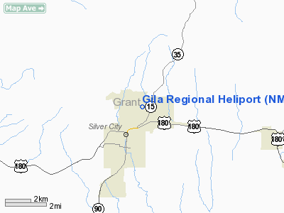
| From nearest city: | 3 nautical miles SW of Silver City, NM |
| Location: | Grant County, NM |
| Magnetic Variation: | 11E (2000) |
Owner & Manager
| Ownership: | Privately owned |
| Owner: | Gila Regional Medical Center |
| Address: | 1313 E. 32nd Street
Silver City, NM 88061 |
| Phone number: | 505-538-4184 |
| Manager: | Donald Mcnutt |
| Address: | 1313 E. 32nd Street
Silver City, NM 88061 |
| Phone number: | 505-538-4184 |
Airport Operations and Facilities
| Airport Use: | Private
MEDICAL. |
| Segmented Circle: | No |
| Control Tower: | No |
| Sectional chart: | Albuquerque |
| Region: | ASW - Southwest |
| Boundary ARTCC: | ZAB - Albuquerque |
| Tie-in FSS: | ABQ - Albuquerque |
| FSS Toll Free: | 1-800-WX-BRIEF |
Runway Information
Helipad H1
| Dimension: | 54 x 54 ft / 16.5 x 16.5 m |
| Surface: | ASPH, |
| |
Runway H1 |
Runway |
| Traffic Pattern: | Left | Left |
|
Radio Navigation Aids
| ID |
Type |
Name |
Ch |
Freq |
Var |
Dist |
| SVC | VORTAC | Silver City | 045X | 110.80 | 13E | 10.9 nm |
| DMN | VORTAC | Deming | 023X | 108.60 | 12E | 45.7 nm |
Remarks
- PRVDD PROPONENT MANAGER OF WHISKEY CREEK ARPT PROCEDURES OF GILA REGIONAL HELIPORT.
Images and information placed above are from
http://www.airport-data.com/airport/NM85/
We thank them for the data!
| General Info
|
| Country |
United States
|
| State |
NEW MEXICO
|
| FAA ID |
NM85
|
| Latitude |
32-47-53.260N
|
| Longitude |
108-15-40.170W
|
| Elevation |
6097 feet
|
| Near City |
SILVER CITY
|
We don't guarantee the information is fresh and accurate. The data may
be wrong or outdated.
For more up-to-date information please refer to other sources.
|
|


