 |
|
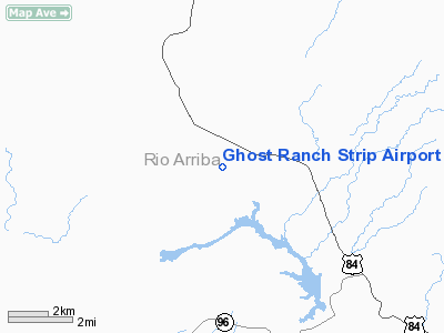
Ghost Ranch Strip Airport |
Location & QuickFacts
| FAA Information Effective: | 2008-09-25 |
| Airport Identifier: | 50NM |
| Airport Status: | Closed Indefinitely |
| Longitude/Latitude: | 106-29-17.1220W/36-18-10.0620N
-106.488089/36.302795 (Estimated) |
| Elevation: | 6440 ft / 1962.91 m (Estimated) |
| Land: | 0 acres |
| From nearest city: | 10 nautical miles NW of Abiquiu, NM |
| Location: | Rio Arriba County, NM |
| Magnetic Variation: | 12E (1985) |
Owner & Manager
| Ownership: | Privately owned |
| Owner: | Ghost Ranch |
| Address: | Po Box 1080
Abiquiu, NM 87510 |
| Phone number: | 505-842-8916 |
| Manager: | Fr Robt J Kirsch |
| Address: | P.o. Box 1080
Albvquerque, NM 87103 |
| Phone number: | 505-873-9068 |
Airport Operations and Facilities
| Airport Use: | Private |
| Wind indicator: | Yes |
| Segmented Circle: | No |
| Control Tower: | No |
| Landing fee charge: | No |
| Sectional chart: | Denver |
| Region: | ASW - Southwest |
| Boundary ARTCC: | ZAB - Albuquerque |
| Tie-in FSS: | ABQ - Albuquerque |
| FSS on Airport: | No |
| FSS Toll Free: | 1-800-WX-BRIEF |
Airport Services
| Airframe Repair: | NONE |
| Power Plant Repair: | NONE |
Runway Information
Runway 14/32
| Dimension: | 5200 x 75 ft / 1585.0 x 22.9 m |
| Surface: | ASPH, |
| |
Runway 14 |
Runway 32 |
| Traffic Pattern: | Left | Left |
|
Radio Navigation Aids
| ID |
Type |
Name |
Ch |
Freq |
Var |
Dist |
| SKX | NDB | Ski | | 414.00 | 11E | 40.4 nm |
| TAS | VORTAC | Taos | 123X | 117.60 | 13E | 33.6 nm |
Remarks
- (ARPT STATUS) ARPT CLSD INDEFLY.
Images and information placed above are from
http://www.airport-data.com/airport/50NM/
We thank them for the data!
| General Info
|
| Country |
United States
|
| State |
NEW MEXICO
|
| FAA ID |
50NM
|
| Latitude |
36-18-10.062N
|
| Longitude |
106-29-17.122W
|
| Elevation |
6440 feet
|
| Near City |
ABIQUIU
|
We don't guarantee the information is fresh and accurate. The data may
be wrong or outdated.
For more up-to-date information please refer to other sources.
|
|


