 |
|
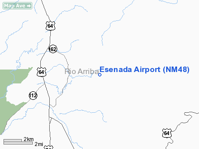
Location & QuickFacts
| FAA Information Effective: | 2008-09-25 |
| Airport Identifier: | NM48 |
| Airport Status: | Operational |
| Longitude/Latitude: | 106-29-42.1170W/36-43-50.0500N
-106.495033/36.730569 (Estimated) |
| Elevation: | 7640 ft / 2328.67 m (Estimated) |
| Land: | 54 acres |
| From nearest city: | 2 nautical miles E of Ensenada, NM |
| Location: | Rio Arriba County, NM |
| Magnetic Variation: | 12E (1985) |
Owner & Manager
| Ownership: | Privately owned |
| Owner: | Ron Gentry |
| Address: | 300 De Soto
Belen, NM 87002 |
| Phone number: | 505-864-4837 |
| Address: |
|
Airport Operations and Facilities
| Airport Use: | Private |
| Segmented Circle: | No |
| Control Tower: | No |
| Sectional chart: | Denver |
| Region: | ASW - Southwest |
| Boundary ARTCC: | ZDV - Denver |
| Tie-in FSS: | ABQ - Albuquerque |
| FSS on Airport: | No |
| FSS Toll Free: | 1-800-WX-BRIEF |
Runway Information
Runway 07/25
| Dimension: | 5000 x 200 ft / 1524.0 x 61.0 m |
| Surface: | TURF, |
| |
Runway 07 |
Runway 25 |
| Traffic Pattern: | Left | Left |
|
Radio Navigation Aids
| ID |
Type |
Name |
Ch |
Freq |
Var |
Dist |
| SKX | NDB | Ski | | 414.00 | 11E | 42.8 nm |
| TAS | VORTAC | Taos | 123X | 117.60 | 13E | 29.3 nm |
| ALS | VORTAC | Alamosa | 086X | 113.90 | 13E | 49.5 nm |
Remarks
- PRVDD USERS ARE MADE AWARE OF TERRIAN, ALT, RWY LENGTH & COND.
Images and information placed above are from
http://www.airport-data.com/airport/NM48/
We thank them for the data!
| General Info
|
| Country |
United States
|
| State |
NEW MEXICO
|
| FAA ID |
NM48
|
| Latitude |
36-43-50.050N
|
| Longitude |
106-29-42.117W
|
| Elevation |
7640 feet
|
| Near City |
ENSENADA
|
We don't guarantee the information is fresh and accurate. The data may
be wrong or outdated.
For more up-to-date information please refer to other sources.
|
|


