 |
|
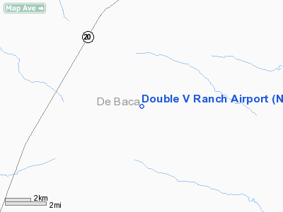
Location & QuickFacts
| FAA Information Effective: | 2008-09-25 |
| Airport Identifier: | NM38 |
| Airport Status: | Operational |
| Longitude/Latitude: | 104-25-37.9070W/34-07-02.2820N
-104.427196/34.117301 (Estimated) |
| Elevation: | 4114 ft / 1253.95 m (Estimated) |
| Land: | 0 acres |
| From nearest city: | 23 nautical miles SW of Fort Sumner, NM |
| Location: | De Baca County, NM |
| Magnetic Variation: | 10E (1985) |
Owner & Manager
| Ownership: | Privately owned |
| Owner: | Charles A. Dean |
| Address: | P.o. Box 10728
Midland, TX 79702 |
| Phone number: | 505-355-7360 |
| Manager: | Dick Dunlap |
| Address: | Dunlap Rte.
Ft. Sumner, NM 88119 |
| Phone number: | 505-355-7708 |
Airport Operations and Facilities
| Airport Use: | Private |
| Wind indicator: | Yes |
| Segmented Circle: | No |
| Control Tower: | No |
| Landing fee charge: | No |
| Sectional chart: | Albuquerque |
| Region: | ASW - Southwest |
| Boundary ARTCC: | ZAB - Albuquerque |
| Tie-in FSS: | ABQ - Albuquerque |
| FSS on Airport: | No |
| FSS Toll Free: | 1-800-WX-BRIEF |
Runway Information
Runway 14/32
| Dimension: | 4300 x 50 ft / 1310.6 x 15.2 m |
| Surface: | DIRT, |
| |
Runway 14 |
Runway 32 |
| Traffic Pattern: | Left | Left |
| Obstruction: | 50 ft trees, 500.0 ft from runway | |
|
Radio Navigation Aids
| ID |
Type |
Name |
Ch |
Freq |
Var |
Dist |
| RO | NDB | Topan | | 305.00 | 10E | 45.2 nm |
| CME | VORTAC | Chisum | 108X | 116.10 | 12E | 47.9 nm |
Images and information placed above are from
http://www.airport-data.com/airport/NM38/
We thank them for the data!
| General Info
|
| Country |
United States
|
| State |
NEW MEXICO
|
| FAA ID |
NM38
|
| Latitude |
34-07-02.282N
|
| Longitude |
104-25-37.907W
|
| Elevation |
4114 feet
|
| Near City |
FORT SUMNER
|
We don't guarantee the information is fresh and accurate. The data may
be wrong or outdated.
For more up-to-date information please refer to other sources.
|
|


