 |
|
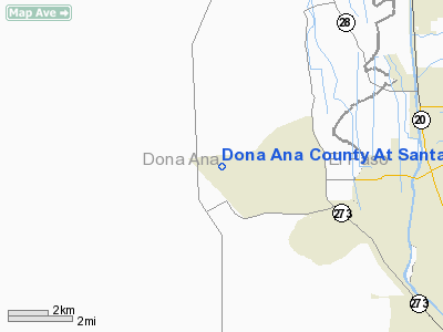
Dona Ana County At Santa Teresa Airport |
Location & QuickFacts
| FAA Information Effective: | 2008-09-25 |
| Airport Identifier: | 5T6 |
| Airport Status: | Operational |
| Longitude/Latitude: | 106-42-17.3270W/31-52-51.5480N
-106.704813/31.880986 (Estimated) |
| Elevation: | 4112 ft / 1253.34 m (Surveyed) |
| Land: | 1712 acres |
| From nearest city: | 4 nautical miles NW of Santa Teresa, NM |
| Location: | Dona Ana County, NM |
| Magnetic Variation: | 11E (1990) |
Owner & Manager
| Ownership: | Publicly owned |
| Owner: | Dona Ana County |
| Address: | 845 N. Motel
Las Cruces, NM 88007 |
| Phone number: | 575-647-7200 |
| Manager: | Vernon Wilson |
| Address: | 8000 Airport Rd.
Santa Teresa, NM 88008 |
| Phone number: | 575-589-1232
EMERGENCY PHONE: 575-644-2358. |
Airport Operations and Facilities
| Airport Use: | Open to public |
| Wind indicator: | Yes |
| Segmented Circle: | Yes |
| Control Tower: | No |
| Lighting Schedule: | DUSK-DAWN
MIRL RY 10/28 PRESET MED INTST ONLY DUSK-DAWN. |
| Beacon Color: | Clear-Green (lighted land airport) |
| Sectional chart: | El Paso |
| Region: | ASW - Southwest |
| Boundary ARTCC: | ZAB - Albuquerque |
| Tie-in FSS: | ABQ - Albuquerque |
| FSS Toll Free: | 1-800-WX-BRIEF |
| NOTAMs Facility: | ABQ (NOTAM-d service avaliable) |
| Federal Agreements: | NGSY |
Airport Communications
| CTAF: | 122.725 |
| Unicom: | 122.725
AUTOMATED UNICOM. |
Airport Services
| Fuel available: | 100LLA1+ |
| Airframe Repair: | MAJOR |
| Power Plant Repair: | MAJOR |
| Bottled Oxygen: | HIGH/LOW |
| Bulk Oxygen: | HIGH/LOW |
Runway Information
Runway 10/28
| Dimension: | 8500 x 100 ft / 2590.8 x 30.5 m |
| Surface: | ASPH, Good Condition |
| Weight Limit: | Single wheel: 20000 lbs. |
| Edge Lights: | Medium |
| |
Runway 10 |
Runway 28 |
| Longitude: | 106-43-03.0870W | 106-41-31.5710W |
| Latitude: | 31-53-07.1520N | 31-52-35.9400N |
| Elevation: | 4110.00 ft | 4108.00 ft |
| Alignment: | 112 | 127 |
| Traffic Pattern: | Left | Right |
| Markings: | Basic, Good Condition | Basic, Good Condition |
| Crossing Height: | 40.00 ft | 40.00 ft |
| VASI: | 2-light PAPI on left side | 2-light PAPI on left side |
| Visual Glide Angle: | 3.00° | 3.00° |
| Runway End Identifier: | Yes | Yes |
| Obstruction: | 37 ft rr, 1650.0 ft from runway, 720 ft right of centerline, 39:1 slope to clear | , 50:1 slope to clear |
|
Radio Navigation Aids
| ID |
Type |
Name |
Ch |
Freq |
Var |
Dist |
| EL | NDB | Valtr | | 242.00 | 11E | 19.8 nm |
| CJS | VOR/DME | Ciudad Juarez | 114X | 116.70 | 11E | 20.5 nm |
| CUS | VOR/DME | Columbus | 049X | 111.20 | 12E | 44.6 nm |
| ELP | VORTAC | El Paso | 099X | 115.20 | 12E | 21.9 nm |
| EWM | VORTAC | Newman | 071X | 112.40 | 12E | 22.5 nm |
| ELP | VOT | El Paso Intl | | 111.00 | | 16.8 nm |
Remarks
- FBO'S: AVIATION ADVANCED WEST 575-874-7775, 5T6 RESOURCES 575-589-4586 & GENE'S FLIGHT SCHOOL 575-874-9110.
- PRVDD COMPATIBLE TFC PTNS ARE ESTABLISHED WITH CIELO DORADO ARPT.
Images and information placed above are from
http://www.airport-data.com/airport/5T6/
We thank them for the data!
| General Info
|
| Country |
United States
|
| State |
NEW MEXICO
|
| FAA ID |
5T6
|
| Latitude |
31-52-51.548N
|
| Longitude |
106-42-17.327W
|
| Elevation |
4112 feet
|
| Near City |
SANTA TERESA
|
We don't guarantee the information is fresh and accurate. The data may
be wrong or outdated.
For more up-to-date information please refer to other sources.
|
|


