 |
|
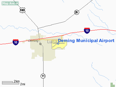
| Deming Municipal Airport |
| IATA: DMN – ICAO: KDMN – FAA LID: DMN |
| Summary |
| Airport type |
Public |
| Owner |
City of Deming |
| Serves |
Deming, New Mexico |
| Elevation AMSL |
4,314 ft / 1,315 m |
| Coordinates |
32°15′44″N 107°43′14″W / 32.26222°N 107.72056°W / 32.26222; -107.72056 |
| Runways |
| Direction |
Length |
Surface |
| ft |
m |
| 8/26 |
6,627 |
2,020 |
Asphalt |
| 4/22 |
5,675 |
1,730 |
Asphalt |
| Statistics (2008) |
| Aircraft operations |
28,655 |
| Based aircraft |
17 |
| Source: Federal Aviation Administration |
Deming Municipal Airport (IATA: DMN, ICAO: KDMN, FAA LID: DMN) is a city-owned public-use airport located two nautical miles (3.7 km) southeast of the central business district of Deming, a city in Luna County, New Mexico, United States. Facilities and aircraft
Deming Municipal Airport covers an area of 2,870 acres (1,161 ha) at an elevation of 4,314 feet (1,315 m) above mean sea level. It has two asphalt paved runways: 8/26 is 6,627 by 75 feet (2,020 x 23 m) and 4/22 is 5,675 by 60 feet (1,730 x 18 m).
For the 12-month period ending April 13, 2008, the airport had 28,655 aircraft operations, an average of 78 per day: 65% general aviation, 32% military and 3% air taxi. At that time there were 17 aircraft based at this airport: 94% single-engine and 6% multi-engine.
World War II
 | |
AAF Bombardier School patch, 1943 |
Activated 15 November 1942. Conducted bombardier training for USAAF Gulf Coast Training Center (later Central Flying Command). The first class of bombardiers graduated on 6 March. In the next three years an estimated 12,000 cadets passed through the Deming Qin school. The bombardier trainer used was the Beech AT-11 Kansan.
Assigned to Second Air Force 16th Bombardment Training Wing on 31 December 1944. Conducted B-29 Superfortress group bombardment training until the end of World War II, when the training program at Deming wound down, finally coming to an end and inactivated 18 December 1945. Airfield was closed on 31 January 1946. Eventually discharged to the War Assets Administration (WAA) and sold.
The above content comes from Wikipedia and is published under free licenses – click here to read more.
Location & QuickFacts
| FAA Information Effective: | 2008-09-25 |
| Airport Identifier: | DMN |
| Airport Status: | Operational |
| Longitude/Latitude: | 107-43-14.3000W/32-15-44.3000N
-107.720639/32.262306 (Estimated) |
| Elevation: | 4314 ft / 1314.91 m (Surveyed) |
| Land: | 2870 acres |
| From nearest city: | 2 nautical miles SE of Deming, NM |
| Location: | Luna County, NM |
| Magnetic Variation: | 10E (2005) |
Owner & Manager
| Ownership: | Publicly owned |
| Owner: | City Of Deming |
| Address: | Po Box 706
Deming, NM 88031 |
| Phone number: | 575-546-8848 |
| Manager: | Gene Paulk |
| Address: | Po Box 706
Deming, NM 88031 |
| Phone number: | 575-546-8848 |
Airport Operations and Facilities
| Airport Use: | Open to public |
| Wind indicator: | Yes |
| Segmented Circle: | No |
| Control Tower: | No |
| Lighting Schedule: | DUSK-DAWN
ACTVT MIRL RYS 04/22 & 08/26, PAPI RYS 08 & 26 - CTAF. |
| Beacon Color: | Clear-Green (lighted land airport) |
| Landing fee charge: | No |
| Sectional chart: | Albuquerque |
| Region: | ASW - Southwest |
| Boundary ARTCC: | ZAB - Albuquerque |
| Tie-in FSS: | ABQ - Albuquerque |
| FSS on Airport: | No |
| FSS Toll Free: | 1-800-WX-BRIEF |
| NOTAMs Facility: | DMN (NOTAM-d service avaliable) |
| Federal Agreements: | NGPY |
Airport Communications
| CTAF: | 122.800 |
| Unicom: | 122.800 |
Airport Services
| Fuel available: | 100LLA |
| Airframe Repair: | MAJOR |
| Power Plant Repair: | MAJOR |
| Bottled Oxygen: | NONE |
| Bulk Oxygen: | NONE |
Runway Information
Runway 04/22
| Dimension: | 5675 x 60 ft / 1729.7 x 18.3 m |
| Surface: | ASPH, Fair Condition
OUTSIDE LANES ROUGH. |
| Weight Limit: | Single wheel: 12000 lbs. |
| Edge Lights: | Medium |
| |
Runway 04 |
Runway 22 |
| Longitude: | 107-43-52.5042W | 107-43-00.7433W |
| Latitude: | 32-15-23.6575N | 32-15-58.5516N |
| Elevation: | 4311.00 ft | 4303.00 ft |
| Alignment: | 52 | 127 |
| Traffic Pattern: | Left | Left |
| Markings: | Non-precision instrument, Fair Condition | Basic, Fair Condition
MARKINGS FADED. |
| Obstruction: | 35 ft tree, 1210.0 ft from runway, 100 ft left of centerline, 28:1 slope to clear | 45 ft pole, 1645.0 ft from runway, 32:1 slope to clear |
|
Runway 08/26
| Dimension: | 6627 x 75 ft / 2019.9 x 22.9 m |
| Surface: | ASPH, Good Condition
OUTSIDE LANES ROUGH. |
| Weight Limit: | Single wheel: 20000 lbs. |
| Edge Lights: | Medium |
| |
Runway 08 |
Runway 26 |
| Longitude: | 107-43-42.3410W | 107-42-25.1772W |
| Latitude: | 32-15-46.8751N | 32-15-47.1845N |
| Elevation: | 4314.00 ft | 4292.00 ft |
| Alignment: | 90 | 127 |
| Traffic Pattern: | Left | Left |
| Markings: | Basic, Fair Condition
MARKINGS FADED. | Non-precision instrument, Fair Condition |
| Crossing Height: | 40.00 ft | 40.00 ft |
| VASI: | 2-light PAPI on left side | 4-light PAPI on left side |
| Visual Glide Angle: | 3.00° | 3.00° |
| Obstruction: | 30 ft trees, 1380.0 ft from runway, 39:1 slope to clear | , 50:1 slope to clear |
|
Radio Navigation Aids
| ID |
Type |
Name |
Ch |
Freq |
Var |
Dist |
| CUS | VOR/DME | Columbus | 049X | 111.20 | 12E | 27.7 nm |
| DMN | VORTAC | Deming | 023X | 108.60 | 12E | 5.9 nm |
| SVC | VORTAC | Silver City | 045X | 110.80 | 13E | 31.8 nm |
Remarks
- HELICOPTERS ARR FM EAST & DEP TO EAST REMAIN NORTH OF SEGMENTED CIRCLE.
- NO INTERSECTION TKOFS.
Images and information placed above are from
http://www.airport-data.com/airport/DMN/
We thank them for the data!
| General Info
|
| Country |
United States
|
| State |
NEW MEXICO
|
| FAA ID |
DMN
|
| Latitude |
32-15-44.313N
|
| Longitude |
107-43-14.303W
|
| Elevation |
4314 feet
|
| Near City |
DEMING
|
We don't guarantee the information is fresh and accurate. The data may
be wrong or outdated.
For more up-to-date information please refer to other sources.
|
|


