 |
|
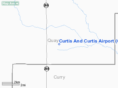
Curtis And Curtis Airport |
Location & QuickFacts
| FAA Information Effective: | 2008-09-25 |
| Airport Identifier: | 65NM |
| Airport Status: | Operational |
| Longitude/Latitude: | 103-36-34.8560W/34-43-36.2390N
-103.609682/34.726733 (Estimated) |
| Elevation: | 4691 ft / 1429.82 m (Surveyed) |
| Land: | 0 acres |
| From nearest city: | 4 nautical miles S of Forrest, NM |
| Location: | Quay County, NM |
| Magnetic Variation: | 10E (1985) |
Owner & Manager
| Ownership: | Privately owned |
| Owner: | J. V. Curtis |
| Address: | 2909 N Prince, Se
Clovis, NM 88101 |
| Phone number: | 505-458-6724 |
| Address: |
|
Airport Operations and Facilities
| Airport Use: | Private |
| Wind indicator: | No |
| Segmented Circle: | No |
| Control Tower: | No |
| Landing fee charge: | No |
| Sectional chart: | Albuquerque |
| Region: | ASW - Southwest |
| Boundary ARTCC: | ZAB - Albuquerque |
| Tie-in FSS: | ABQ - Albuquerque |
| FSS on Airport: | No |
| FSS Toll Free: | 1-800-WX-BRIEF |
Airport Services
| Airframe Repair: | NONE |
| Power Plant Repair: | NONE |
Runway Information
Runway 17/35
| Dimension: | 3600 x 40 ft / 1097.3 x 12.2 m |
| Surface: | DIRT, |
| |
Runway 17 |
Runway 35 |
| Traffic Pattern: | Left | Left |
|
Radio Navigation Aids
| ID |
Type |
Name |
Ch |
Freq |
Var |
Dist |
| PRZ | NDB | Portales | | 407.00 | 09E | 36.0 nm |
| CVS | TACAN | Cannon | 053X | | 10E | 25.2 nm |
| TCC | VORTAC | Tucumcari | 083X | 113.60 | 12E | 27.4 nm |
| TXO | VORTAC | Texico | 059X | 112.20 | 11E | 40.6 nm |
Images and information placed above are from
http://www.airport-data.com/airport/65NM/
We thank them for the data!
| General Info
|
| Country |
United States
|
| State |
NEW MEXICO
|
| FAA ID |
65NM
|
| Latitude |
34-43-36.239N
|
| Longitude |
103-36-34.856W
|
| Elevation |
4691 feet
|
| Near City |
FORREST
|
We don't guarantee the information is fresh and accurate. The data may
be wrong or outdated.
For more up-to-date information please refer to other sources.
|
|


