 |
|
| Clovis Municipal Airport |
| IATA: CVN – ICAO: KCVN |
| Summary |
| Airport type |
Public |
| Operator |
City of Clovis |
| Location |
Clovis, New Mexico |
| Elevation AMSL |
4,216 ft / 1,285 m |
| Coordinates |
34°25′30″N 103°04′45″W / 34.425°N 103.07917°W / 34.425; -103.07917Coordinates: 34°25′30″N 103°04′45″W / 34.425°N 103.07917°W / 34.425; -103.07917 |
| Runways |
| Direction |
Length |
Surface |
| ft |
m |
| 4/22 |
6,200 |
1,890 |
Asphalt |
| 12/30 |
5,697 |
1,736 |
Asphalt |
| 8/26 |
2,442 |
744 |
Grass |
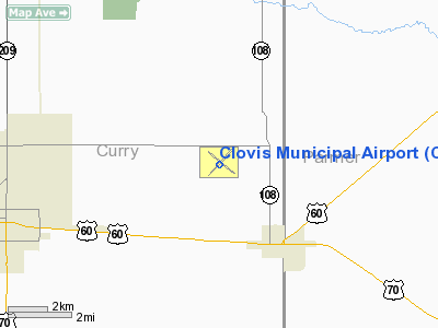
Clovis Municipal Airport (IATA: CVN, ICAO: KCVN) is a public airport located six miles (10 km) east of the central business district (CBD) of Clovis, a city in Curry County, New Mexico, USA. The airport covers 1,480 acres (599 ha) and has two asphalt and one turf runways. It is mostly used for general aviation, but is also served by one commercial airline. Service is subsidized by the Essential Air Service program.
Airlines and destinations
| Airlines |
Destinations |
| Great Lakes Airlines |
Albuquerque |
The above content comes from Wikipedia and is published under free licenses – click here to read more.
Location & QuickFacts
| FAA Information Effective: | 2008-09-25 |
| Airport Identifier: | CVN |
| Airport Status: | Operational |
| Longitude/Latitude: | 103-04-45.4000W/34-25-30.5000N
-103.079278/34.425139 (Estimated) |
| Elevation: | 4216 ft / 1285.04 m (Surveyed) |
| Land: | 1480 acres |
| From nearest city: | 6 nautical miles E of Clovis, NM |
| Location: | Curry County, NM |
| Magnetic Variation: | 09E (2000) |
Owner & Manager
| Ownership: | Publicly owned |
| Owner: | City Of Clovis |
| Address: | Po Box 760
Clovis, NM 88101 |
| Phone number: | 575-769-7828 |
| Manager: | Stephen Summers |
| Address: | Po Box 760
Clovis, NM 88101 |
| Phone number: | 575-769-7890 |
Airport Operations and Facilities
| Airport Use: | Open to public |
| Wind indicator: | Yes |
| Segmented Circle: | Yes |
| Control Tower: | No |
| Lighting Schedule: | DUSK-DAWN
ACTVT PAPI & MALSR RY 04 - CTAF. MIRL RY 04/22 PRESET LOW INTST DUSK-DAWN. MIRL RY 12/30 PRESET LOW INTST DUSK-2230 MON-THU & DUSK-0000 FRI-SUN. TO INCR INTST RY 04/22 & ACTVT MIRL RY 12/30 - CTAF. |
| Beacon Color: | Clear-Green (lighted land airport) |
| Landing fee charge: | No |
| Sectional chart: | Albuquerque |
| Region: | ASW - Southwest |
| Traffic Pattern Alt: | 800 ft |
| Boundary ARTCC: | ZAB - Albuquerque |
| Tie-in FSS: | ABQ - Albuquerque |
| FSS on Airport: | No |
| FSS Toll Free: | 1-800-WX-BRIEF |
| NOTAMs Facility: | CVN (NOTAM-d service avaliable) |
| Certification type/date: | III A S 11/20 |
| Federal Agreements: | NGY |
Airport Communications
| CTAF: | 122.800 |
| Unicom: | 122.800 |
Airport Services
| Fuel available: | 100LLA
100LL AVBL NW END TWY B DAILY, AFT HRS CALL 505-389-1224. FOR FUEL AFT HRS MAIN RAMP CALL 505-389-1272. JET A AVBL ON SUN ONLY BY APNTMT CALL 505-389-1272. |
| Airframe Repair: | MAJOR |
| Power Plant Repair: | MAJOR |
Runway Information
Runway 04/22
| Dimension: | 6200 x 150 ft / 1889.8 x 45.7 m |
| Surface: | ASPH, Poor Condition
FREQUENT THERMAL CRACKS, WIDE CRACKS UP TO 2 INCHES, DETERIORATION ALONG MORE THAN 25% OF CRACKS, EDGE CRACKS OVER 25% OF PAVEMENT EDGES, AND BLOCK CRACKING 5 FT APART. CENTER KEEL SECTION OF PAVEMENT IN BETTER CONDITION. |
| Surface Treatment: | Porous Friction Course
NO PFC ON 799' DSPLCD THR. |
| Weight Limit: | Single wheel: 45000 lbs.
Dual wheel: 57000 lbs. |
| Edge Lights: | Medium |
| |
Runway 04 |
Runway 22 |
| Longitude: | 103-05-09.9757W | 103-04-17.1041W |
| Latitude: | 34-25-13.9989N | 34-25-56.8986N |
| Elevation: | 4197.00 ft | 4216.00 ft |
| Alignment: | 46 | 127 |
| ILS Type: | ILS
| |
| Traffic Pattern: | Left | Left |
| Markings: | Precision instrument, Good Condition | Non-precision instrument, Good Condition |
| Crossing Height: | 41.00 ft | 48.00 ft |
| Displaced threshold: | 799.00 ft | 0.00 ft |
| VASI: | 4-light PAPI on left side
PAPI UNUSBL BYD 7 DEGS RIGHT OF CNTRLN. | 4-box on left side |
| Visual Glide Angle: | 3.00° | 3.00° |
| Approach lights: | MALSR | |
| Obstruction: | 12 ft road, 250.0 ft from runway, 510 ft right of centerline, 4:1 slope to clear
+15 FT ROAD DIST 960 FT 600 FT RIGHT; 50:1 ALL DATA BASED ON DSPLCD THLD. | 12 ft road, 200.0 ft from runway, 450 ft right of centerline |
|
Runway 08/26
| Dimension: | 2442 x 75 ft / 744.3 x 22.9 m |
| Surface: | TURF, Fair Condition
FREQUENT THERMAL CRACKS, WIDE CRACKS UP TO 2 INCHES, DETERIORATION ALONG MORE THAN 25% OF CRACKS, EDGE CRACKS OVER 25% OF PAVEMENT EDGES, AND BLOCK CRACKING 5 FT APART. CENTER KEEL SECTION OF PAVEMENT IN BETTER CONDITION. |
| |
Runway 08 |
Runway 26 |
| Elevation: | 4196.00 ft | 4185.00 ft |
| Alignment: | 90 | 127 |
| Traffic Pattern: | Left | Left |
| Obstruction: | 47 ft pline, 1783.0 ft from runway, 37:1 slope to clear | , 50:1 slope to clear |
|
Runway 12/30
| Dimension: | 5697 x 150 ft / 1736.4 x 45.7 m |
| Surface: | ASPH, Good Condition
FREQUENT THERMAL CRACKS, WIDE CRACKS UP TO 2 INCHES, DETERIORATION ALONG MORE THAN 25% OF CRACKS, EDGE CRACKS OVER 25% OF PAVEMENT EDGES, AND BLOCK CRACKING 5 FT APART. CENTER KEEL SECTION OF PAVEMENT IN BETTER CONDITION. |
| Weight Limit: | Single wheel: 42000 lbs.
Dual wheel: 50000 lbs. |
| Edge Lights: | Medium |
| |
Runway 12 |
Runway 30 |
| Longitude: | 103-05-07.7056W | 103-04-15.9802W |
| Latitude: | 34-25-53.7716N | 34-25-17.1976N |
| Elevation: | 4216.00 ft | 4187.00 ft |
| Alignment: | 127 | 127 |
| Traffic Pattern: | Left | Left |
| Markings: | Non-precision instrument, Fair Condition | Non-precision instrument, Fair Condition |
| Crossing Height: | 0.00 ft | 75.00 ft |
| VASI: | | pulsating/steady burning on left side |
| Visual Glide Angle: | 0.00° | 3.00° |
| Runway End Identifier: | Yes
REIL OTS INDEFLY. | Yes
REIL OTS INDEFLY. |
| Obstruction: | 16 ft road, 820.0 ft from runway, 320 ft left of centerline, 38:1 slope to clear | 10 ft road, 650.0 ft from runway, 280 ft right of centerline, 45:1 slope to clear |
|
Radio Navigation Aids
| ID |
Type |
Name |
Ch |
Freq |
Var |
Dist |
| PRZ | NDB | Portales | | 407.00 | 09E | 23.1 nm |
| HRX | NDB | Hereford | | 341.00 | 09E | 45.5 nm |
| LIU | NDB | Littlefield | | 212.00 | 10E | 45.9 nm |
| CVS | TACAN | Cannon | 053X | | 10E | 12.4 nm |
| TXO | VORTAC | Texico | 059X | 112.20 | 11E | 12.6 nm |
Remarks
- CAUTION: HEAVY JET TFC; CANNON AFB 13 NM SW.
- RY 22 PREFERRED RY FOR CALM WIND.
- EXTENSIVE AGRICULTURAL ACFT ACTIVITY ON & INVOF ARPT.
Images and information placed above are from
http://www.airport-data.com/airport/CVN/
We thank them for the data!
| General Info
|
| Country |
United States
|
| State |
NEW MEXICO
|
| FAA ID |
CVN
|
| Latitude |
34-25-30.500N
|
| Longitude |
103-04-45.400W
|
| Elevation |
4216 feet
|
| Near City |
CLOVIS
|
We don't guarantee the information is fresh and accurate. The data may
be wrong or outdated.
For more up-to-date information please refer to other sources.
|
|


