 |
|
Clayton Muni Arpk Airport |
| Clayton Municipal Airpark |
| IATA: CAO – ICAO: KCAO |
| Summary |
| Airport type |
Public |
| Operator |
Town of Clayton |
| Location |
Clayton, New Mexico |
| Elevation AMSL |
4,965 ft / 1513.3 m |
| Coordinates |
36°26′42.65″N 103°09′00.82″W / 36.4451806°N 103.1502278°W / 36.4451806; -103.1502278Coordinates: 36°26′42.65″N 103°09′00.82″W / 36.4451806°N 103.1502278°W / 36.4451806; -103.1502278 |
| Runways |
| Direction |
Length |
Surface |
| ft |
m |
| 2/20 |
4,810 |
1,466 |
Asphalt |
| 12/30 |
4,100 |
1,250 |
Asphalt |
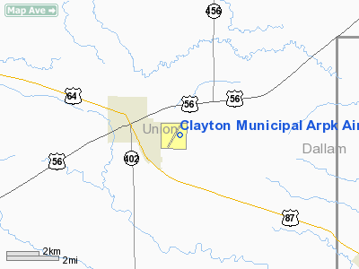
Clayton Municipal Airpark (IATA: CAO, ICAO: KCAO) is a general aviation airport located 2 miles (3 km) east of the town of Clayton in Union County, New Mexico, USA.
Facilities
Clayton Municipal Airpark covers 755 acres (3.06 km) and has two runways:
- Runway 2/20: 4,810 x 75 ft (1,466 x 23 m), Surface: Asphalt
- Runway 12/30: 4,100 x 60 ft (1,250 x 18 m), Surface: Asphalt
The above content comes from Wikipedia and is published under free licenses – click here to read more.
Location & QuickFacts
| FAA Information Effective: | 2008-09-25 |
| Airport Identifier: | CAO |
| Airport Status: | Operational |
| Longitude/Latitude: | 103-08-59.8900W/36-26-46.1480N
-103.149969/36.446152 (Estimated) |
| Elevation: | 4965 ft / 1513.33 m (Surveyed) |
| Land: | 755 acres |
| From nearest city: | 2 nautical miles E of Clayton, NM |
| Location: | Union County, NM |
| Magnetic Variation: | 09E (2005) |
Owner & Manager
| Ownership: | Publicly owned |
| Owner: | Town Of Clayton
MR. RUNNING IS CITY MANAGER. |
| Address: | 1 Chestnut St
Clayton, NM 88415 |
| Phone number: | 575-374-8331 |
| Manager: | Edward Sisneros |
| Address: | 1 Chestnut St
Clayton, NM 88415 |
| Phone number: | 575-374-9873 |
Airport Operations and Facilities
| Airport Use: | Open to public |
| Wind indicator: | Yes |
| Segmented Circle: | Yes |
| Control Tower: | No |
| Lighting Schedule: | DUSK-DAWN
ACTVT MIRL RY 02/20 & RY 12/30 - CTAF. |
| Beacon Color: | Clear-Green (lighted land airport) |
| Landing fee charge: | No |
| Sectional chart: | Wichita |
| Region: | ASW - Southwest |
| Boundary ARTCC: | ZAB - Albuquerque |
| Tie-in FSS: | ABQ - Albuquerque |
| FSS on Airport: | No |
| FSS Toll Free: | 1-800-WX-BRIEF |
| NOTAMs Facility: | CAO (NOTAM-d service avaliable) |
| Federal Agreements: | NGSY |
Airport Communications
| CTAF: | 122.800 |
| Unicom: | 122.800 |
Airport Services
| Fuel available: | 100LLA |
| Bottled Oxygen: | NONE |
| Bulk Oxygen: | NONE |
Runway Information
Runway 02/20
| Dimension: | 6300 x 75 ft / 1920.2 x 22.9 m |
| Surface: | ASPH, Good Condition |
| Weight Limit: | Single wheel: 16500 lbs. |
| Edge Lights: | Medium |
| |
Runway 02 |
Runway 20 |
| Longitude: | 103-09-28.5300W | 103-08-49.7000W |
| Latitude: | 36-26-19.5500N | 36-27-13.4000N |
| Elevation: | 4963.00 ft | 4964.00 ft |
| Alignment: | 30 | 127 |
| Traffic Pattern: | Left | Left |
| Markings: | Non-precision instrument, Good Condition | Non-precision instrument, Good Condition |
| Displaced threshold: | 380.00 ft | 0.00 ft |
|
Runway 12/30
| Dimension: | 4100 x 60 ft / 1249.7 x 18.3 m |
| Surface: | ASPH, Good Condition |
| Edge Lights: | Medium |
| |
Runway 12 |
Runway 30 |
| Longitude: | 103-09-04.8600W | 103-08-26.5500W |
| Latitude: | 36-26-58.7300N | 36-26-32.5600N |
| Elevation: | 4964.00 ft | 4944.00 ft |
| Alignment: | 127 | 127 |
| Traffic Pattern: | Left | Left |
| Markings: | Basic, Good Condition | Basic, Good Condition |
|
Radio Navigation Aids
| ID |
Type |
Name |
Ch |
Freq |
Var |
Dist |
| CAO | NDB | Clayton | | 332.00 | 09E | 0.1 nm |
| BCY | NDB | Thorp | | 212.00 | 10E | 35.0 nm |
| DHT | VORTAC | Dalhart | 057X | 112.00 | 12E | 36.3 nm |
Images and information placed above are from
http://www.airport-data.com/airport/CAO/
We thank them for the data!
| General Info
|
| Country |
United States
|
| State |
NEW MEXICO
|
| FAA ID |
CAO
|
| Latitude |
36-26-45.095N
|
| Longitude |
103-09-16.770W
|
| Elevation |
4963 feet
|
| Near City |
CLAYTON
|
We don't guarantee the information is fresh and accurate. The data may
be wrong or outdated.
For more up-to-date information please refer to other sources.
|
|


