 |
|
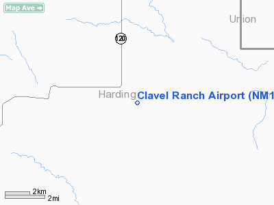
Location & QuickFacts
| FAA Information Effective: | 2008-09-25 |
| Airport Identifier: | NM15 |
| Airport Status: | Operational |
| Longitude/Latitude: | 103-53-14.8840W/36-02-46.1210N
-103.887468/36.046145 (Estimated) |
| Elevation: | 5534 ft / 1686.76 m (Estimated) |
| Land: | 0 acres |
| From nearest city: | 20 nautical miles NE of Roy, NM |
| Location: | Harding County, NM |
| Magnetic Variation: | 10E (1990) |
Owner & Manager
| Ownership: | Privately owned |
| Owner: | C.j. Clavel |
| Address: | Hc 73 Box 181
Roy, NM 87743 |
| Phone number: | 505-485-2543 |
| Manager: | C.j. Clavel |
| Address: | Hc 73 Box 181
Roy, NM 87743 |
| Phone number: | 505-485-2543 |
Airport Operations and Facilities
| Airport Use: | Private |
| Wind indicator: | Yes |
| Segmented Circle: | No |
| Control Tower: | No |
| Sectional chart: | Albuquerque |
| Region: | ASW - Southwest |
| Boundary ARTCC: | ZAB - Albuquerque |
| Tie-in FSS: | ABQ - Albuquerque |
| FSS on Airport: | No |
| FSS Toll Free: | 1-800-WX-BRIEF |
Runway Information
Runway 08/26
| Dimension: | 2640 x 300 ft / 804.7 x 91.4 m |
| Surface: | TURF, |
| |
Runway 08 |
Runway 26 |
| Traffic Pattern: | Left | Left |
|
Radio Navigation Aids
| ID |
Type |
Name |
Ch |
Freq |
Var |
Dist |
| CAO | NDB | Clayton | | 332.00 | 09E | 43.0 nm |
Images and information placed above are from
http://www.airport-data.com/airport/NM15/
We thank them for the data!
| General Info
|
| Country |
United States
|
| State |
NEW MEXICO
|
| FAA ID |
NM15
|
| Latitude |
36-02-46.121N
|
| Longitude |
103-53-14.884W
|
| Elevation |
5534 feet
|
| Near City |
ROY
|
We don't guarantee the information is fresh and accurate. The data may
be wrong or outdated.
For more up-to-date information please refer to other sources.
|
|


