 |
|
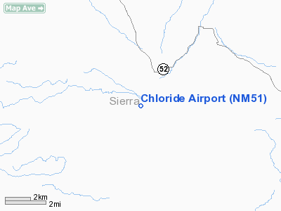
Location & QuickFacts
| FAA Information Effective: | 2008-09-25 |
| Airport Identifier: | NM51 |
| Airport Status: | Operational |
| Longitude/Latitude: | 107-39-42.8000W/33-19-42.3000N
-107.661889/33.328417 (Estimated) |
| Elevation: | 6202 ft / 1890.37 m (Estimated) |
| Land: | 140 acres |
| From nearest city: | 1 nautical miles SE of Chloride, NM |
| Location: | Sierra County, NM |
| Magnetic Variation: | 11E (2000) |
Owner & Manager
| Ownership: | Privately owned |
| Owner: | James Rood & La Ayres |
| Address: | Po Box 741
Kotzebue, AK 99752 |
| Phone number: | 907-442-3525 |
| Manager: | James Rood |
| Address: | Po Box 741
Kotzebue, AK 99752 |
| Phone number: | 907-442-3525 |
Airport Operations and Facilities
| Airport Use: | Private |
| Wind indicator: | Yes |
| Segmented Circle: | No |
| Control Tower: | No |
| Sectional chart: | Albuquerque |
| Region: | ASW - Southwest |
| Boundary ARTCC: | ZAB - Albuquerque |
| Tie-in FSS: | ABQ - Albuquerque |
| FSS Toll Free: | 1-800-WX-BRIEF |
Runway Information
Runway 12/30
| Dimension: | 3000 x 60 ft / 914.4 x 18.3 m |
| Surface: | TURF, |
| |
Runway 12 |
Runway 30 |
| Traffic Pattern: | Left | Left |
| Obstruction: | 15 ft trees, 300.0 ft from runway | |
|
Radio Navigation Aids
| ID |
Type |
Name |
Ch |
Freq |
Var |
Dist |
| TCS | VORTAC | Truth Or Consequences | 074X | 112.70 | 13E | 19.4 nm |
| SVC | VORTAC | Silver City | 045X | 110.80 | 13E | 48.6 nm |
Images and information placed above are from
http://www.airport-data.com/airport/NM51/
We thank them for the data!
| General Info
|
| Country |
United States
|
| State |
NEW MEXICO
|
| FAA ID |
NM51
|
| Latitude |
33-19-42.300N
|
| Longitude |
107-39-42.800W
|
| Elevation |
6202 feet
|
| Near City |
CHLORIDE
|
We don't guarantee the information is fresh and accurate. The data may
be wrong or outdated.
For more up-to-date information please refer to other sources.
|
|


