 |
|
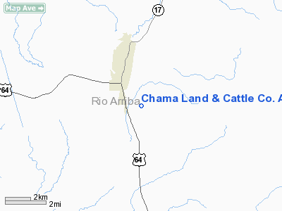
Chama Land & Cattle Co. Airport |
Location & QuickFacts
| FAA Information Effective: | 2008-09-25 |
| Airport Identifier: | NM16 |
| Airport Status: | Operational |
| Longitude/Latitude: | 106-34-02.1260W/36-52-00.0450N
-106.567257/36.866679 (Estimated) |
| Elevation: | 8025 ft / 2446.02 m (Surveyed) |
| Land: | 0 acres |
| From nearest city: | 2 nautical miles SE of Chama, NM |
| Location: | Rio Arriba County, NM |
| Magnetic Variation: | 12E (1985) |
Owner & Manager
| Ownership: | Privately owned |
| Owner: | The Jicarilla Apache Tribe
WAINWRIGHT VELARDE. |
| Address: | Po Box 127
Chama, NM 87520 |
| Phone number: | 505-759-3242 |
| Manager: | Frank Simms, Running Elk Corp |
| Address: | Po Box 127
Chama, NM 87520 |
| Phone number: | 505-756-2133 |
Airport Operations and Facilities
| Airport Use: | Private |
| Wind indicator: | Yes |
| Segmented Circle: | No |
| Control Tower: | No |
| Landing fee charge: | No |
| Sectional chart: | Denver |
| Region: | ASW - Southwest |
| Boundary ARTCC: | ZDV - Denver |
| Tie-in FSS: | ABQ - Albuquerque |
| FSS on Airport: | No |
| FSS Toll Free: | 1-800-WX-BRIEF |
Runway Information
Runway NE/SW
| Dimension: | 5800 x 100 ft / 1767.8 x 30.5 m |
| Surface: | TURF, |
| |
Runway NE |
Runway SW |
| Traffic Pattern: | Left | Left |
|
Radio Navigation Aids
| ID |
Type |
Name |
Ch |
Freq |
Var |
Dist |
| MVI | NDB | Monte Vista | | 311.00 | 11E | 47.0 nm |
| SKX | NDB | Ski | | 414.00 | 11E | 49.5 nm |
| TAS | VORTAC | Taos | 123X | 117.60 | 13E | 35.4 nm |
| ALS | VORTAC | Alamosa | 086X | 113.90 | 13E | 46.3 nm |
Images and information placed above are from
http://www.airport-data.com/airport/NM16/
We thank them for the data!
| General Info
|
| Country |
United States
|
| State |
NEW MEXICO
|
| FAA ID |
NM16
|
| Latitude |
36-52-00.045N
|
| Longitude |
106-34-02.126W
|
| Elevation |
8025 feet
|
| Near City |
CHAMA
|
We don't guarantee the information is fresh and accurate. The data may
be wrong or outdated.
For more up-to-date information please refer to other sources.
|
|


