 |
|
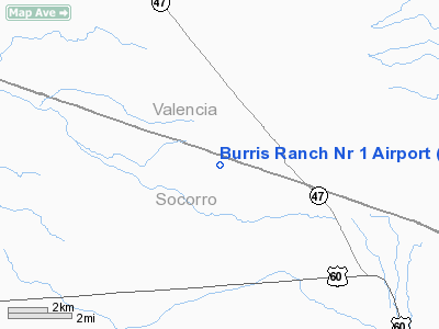
Burris Ranch Nr 1 Airport |
Location & QuickFacts
| FAA Information Effective: | 2008-09-25 |
| Airport Identifier: | 55NM |
| Airport Status: | Operational |
| Longitude/Latitude: | 106-36-47.0770W/34-29-00.2300N
-106.613077/34.483397 (Estimated) |
| Elevation: | 5218 ft / 1590.45 m (Estimated) |
| Land: | 0 acres |
| From nearest city: | 16 nautical miles SE of Belen, NM |
| Location: | Socorro County, NM |
| Magnetic Variation: | 11E (1985) |
Owner & Manager
| Ownership: | Privately owned |
| Owner: | G W Burris |
| Address: | Box 345
Belen, NM 87002 |
| Phone number: | 505-864-7371 |
| Manager: | G W Burris |
| Address: | Box 345
Belen, NM 87002 |
| Phone number: | 505-864-7371 |
Airport Operations and Facilities
| Airport Use: | Private |
| Wind indicator: | Yes |
| Segmented Circle: | No |
| Control Tower: | No |
| Landing fee charge: | No |
| Sectional chart: | Albuquerque |
| Region: | ASW - Southwest |
| Boundary ARTCC: | ZAB - Albuquerque |
| Tie-in FSS: | ABQ - Albuquerque |
| FSS on Airport: | No |
| FSS Toll Free: | 1-800-WX-BRIEF |
Airport Communications
Airport Services
| Airframe Repair: | NONE |
| Power Plant Repair: | NONE |
Runway Information
Runway 01/19
| Dimension: | 5000 x 50 ft / 1524.0 x 15.2 m |
| Surface: | DIRT,
NORTH 200 YDS OF N-S RWY ROUGH.
EAST 300 YDS OF E-W RWY ROUGH. |
| |
Runway 01 |
Runway 19 |
| Traffic Pattern: | Left | Left |
|
Runway 08/26
| Dimension: | 5000 x 40 ft / 1524.0 x 12.2 m |
| Surface: | DIRT,
NORTH 200 YDS OF N-S RWY ROUGH.
EAST 300 YDS OF E-W RWY ROUGH. |
| |
Runway 08 |
Runway 26 |
| Traffic Pattern: | Left | Left |
|
Radio Navigation Aids
| ID |
Type |
Name |
Ch |
Freq |
Var |
Dist |
| FIA | NDB | Florida | | 329.00 | 12E | 27.1 nm |
| ILT | NDB | Isleta | | 247.00 | 11E | 30.3 nm |
| OTO | VOR | Otto | | 114.00 | 13E | 48.7 nm |
| ONM | VORTAC | Socorro | 115X | 116.80 | 13E | 13.5 nm |
| ABQ | VORTAC | Albuquerque | 079X | 113.20 | 13E | 35.1 nm |
| CNX | VORTAC | Corona | 102X | 115.50 | 13E | 46.9 nm |
| ABQ | VOT | Albuquerque Intl | | 111.00 | | 33.6 nm |
Remarks
- CAUTION: AIRSTRIP USED BY 1550TH TNG WG FOR PARAMEDIC AND CARGO DROPS ON FREQUENT BASIS. CHECK NOTAMS.
Images and information placed above are from
http://www.airport-data.com/airport/55NM/
We thank them for the data!
| General Info
|
| Country |
United States
|
| State |
NEW MEXICO
|
| FAA ID |
55NM
|
| Latitude |
34-29-00.230N
|
| Longitude |
106-36-47.077W
|
| Elevation |
5218 feet
|
| Near City |
BELEN
|
We don't guarantee the information is fresh and accurate. The data may
be wrong or outdated.
For more up-to-date information please refer to other sources.
|
|


