 |
|
Location & QuickFacts
| FAA Information Effective: | 2008-09-25 |
| Airport Identifier: | NM14 |
| Airport Status: | Closed Permanently |
| Longitude/Latitude: | 107-17-42.0640W/32-18-40.3200N
-107.295018/32.311200 (Estimated) |
| Elevation: | 4400 ft / 1341.12 m (Estimated) |
| Land: | 0 acres |
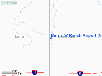
| From nearest city: | 27 nautical miles W of Las Cruces, NM |
| Location: | Dona Ana County, NM |
| Magnetic Variation: | 11E (1985) |
Owner & Manager
| Ownership: | Privately owned |
| Owner: | G Weldon Burris |
| Address: | Box 345
Belen, NM 87002 |
| Phone number: | 505-864-7371 |
| Address: |
|
Airport Operations and Facilities
| Airport Use: | Private |
| Wind indicator: | Yes |
| Segmented Circle: | No |
| Control Tower: | No |
| Landing fee charge: | No |
| Sectional chart: | Albuquerque |
| Region: | ASW - Southwest |
| Boundary ARTCC: | ZAB - Albuquerque |
| Tie-in FSS: | ABQ - Albuquerque |
| FSS on Airport: | No |
| FSS Toll Free: | 1-800-WX-BRIEF |
Runway Information
Runway 14/32
| Dimension: | 3100 x 40 ft / 944.9 x 12.2 m |
| Surface: | DIRT, |
| |
Runway 14 |
Runway 32 |
| Traffic Pattern: | Left | Left |
|
Radio Navigation Aids
| ID |
Type |
Name |
Ch |
Freq |
Var |
Dist |
| CUS | VOR/DME | Columbus | 049X | 111.20 | 12E | 32.8 nm |
| DMN | VORTAC | Deming | 023X | 108.60 | 12E | 15.9 nm |
| SVC | VORTAC | Silver City | 045X | 110.80 | 13E | 48.1 nm |
Remarks
- (ARPT STATUS) ARPT CLSD PERMLY.
Images and information placed above are from
http://www.airport-data.com/airport/NM14/
We thank them for the data!
| General Info
|
| Country |
United States
|
| State |
NEW MEXICO
|
| FAA ID |
NM14
|
| Latitude |
32-18-40.320N
|
| Longitude |
107-17-42.064W
|
| Elevation |
4400 feet
|
| Near City |
LAS CRUCES
|
We don't guarantee the information is fresh and accurate. The data may
be wrong or outdated.
For more up-to-date information please refer to other sources.
|
|


