 |
|
Location & QuickFacts
| FAA Information Effective: | 2008-09-25 |
| Airport Identifier: | NM44 |
| Airport Status: | Operational |
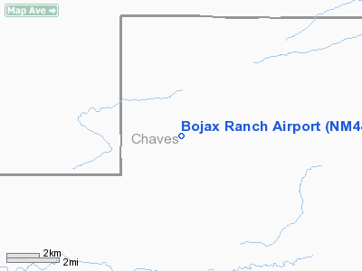
| Longitude/Latitude: | 104-06-55.8840W/34-01-02.2930N
-104.115523/34.017304 (Estimated) |
| Elevation: | 3920 ft / 1194.82 m (Estimated) |
| Land: | 0 acres |
| From nearest city: | 26 nautical miles SE of Kenna, NM |
| Location: | Chaves County, NM |
| Magnetic Variation: | 10E (1985) |
Owner & Manager
| Ownership: | Privately owned |
| Owner: | Bojax Ranch |
| Address: | Box 112
Elida, NM 88116 |
| Phone number: | 505-274-6464 |
| Manager: | Jeff Bilbery |
| Address: | Box 112
Elida, NM 88116 |
| Phone number: | 505-274-6464 |
Airport Operations and Facilities
| Airport Use: | Private |
| Wind indicator: | Yes |
| Segmented Circle: | No |
| Control Tower: | No |
| Sectional chart: | Albuquerque |
| Region: | ASW - Southwest |
| Boundary ARTCC: | ZAB - Albuquerque |
| Tie-in FSS: | ABQ - Albuquerque |
| FSS Toll Free: | 1-800-WX-BRIEF |
Runway Information
Runway 03/21
| Dimension: | 3750 x 60 ft / 1143.0 x 18.3 m |
| Surface: | DIRT, |
| |
Runway 03 |
Runway 21 |
| Traffic Pattern: | Left | Left |
|
Radio Navigation Aids
| ID |
Type |
Name |
Ch |
Freq |
Var |
Dist |
| PRZ | NDB | Portales | | 407.00 | 09E | 36.2 nm |
| RO | NDB | Topan | | 305.00 | 10E | 42.5 nm |
| CVS | TACAN | Cannon | 053X | | 10E | 45.1 nm |
| CME | VORTAC | Chisum | 108X | 116.10 | 12E | 48.1 nm |
Images and information placed above are from
http://www.airport-data.com/airport/NM44/
We thank them for the data!
| General Info
|
| Country |
United States
|
| State |
NEW MEXICO
|
| FAA ID |
NM44
|
| Latitude |
34-01-02.293N
|
| Longitude |
104-06-55.884W
|
| Elevation |
3920 feet
|
| Near City |
KENNA
|
We don't guarantee the information is fresh and accurate. The data may
be wrong or outdated.
For more up-to-date information please refer to other sources.
|
|


