 |
|
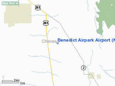
Location & QuickFacts
| FAA Information Effective: | 2008-09-25 |
| Airport Identifier: | NM20 |
| Airport Status: | Operational |
| Longitude/Latitude: | 104-26-32.8770W/33-15-07.3740N
-104.442466/33.252048 (Estimated) |
| Elevation: | 3556 ft / 1083.87 m (Estimated) |
| Land: | 0 acres |
| From nearest city: | 10 nautical miles SE of Roswell, NM |
| Location: | Chaves County, NM |
| Magnetic Variation: | 10E (1985) |
Owner & Manager
| Ownership: | Privately owned |
| Owner: | Thomas L. Benedict |
| Address: | 136 Orchard Park Rd.
Dexter, NM 88230 |
| Phone number: | 505-622-3458 |
| Manager: | Thomas L. Benedict |
| Address: | 136 Orchard Park Rd.
Dexter, NM 88230 |
| Phone number: | 505-622-3458 |
Airport Operations and Facilities
| Airport Use: | Private |
| Segmented Circle: | No |
| Control Tower: | No |
| Sectional chart: | Albuquerque |
| Region: | ASW - Southwest |
| Boundary ARTCC: | ZAB - Albuquerque |
| Tie-in FSS: | ABQ - Albuquerque |
| FSS on Airport: | No |
| FSS Toll Free: | 1-800-WX-BRIEF |
Runway Information
Runway 17/35
| Dimension: | 2500 x 75 ft / 762.0 x 22.9 m |
| Surface: | TURF, |
| |
Runway 17 |
Runway 35 |
| Traffic Pattern: | Left | Left |
|
Radio Navigation Aids
| ID |
Type |
Name |
Ch |
Freq |
Var |
Dist |
| RO | NDB | Topan | | 305.00 | 10E | 6.8 nm |
| ATS | NDB | Artesia | | 414.00 | 09E | 24.0 nm |
| CME | VORTAC | Chisum | 108X | 116.10 | 12E | 10.3 nm |
Images and information placed above are from
http://www.airport-data.com/airport/NM20/
We thank them for the data!
| General Info
|
| Country |
United States
|
| State |
NEW MEXICO
|
| FAA ID |
NM20
|
| Latitude |
33-15-07.374N
|
| Longitude |
104-26-32.877W
|
| Elevation |
3556 feet
|
| Near City |
ROSWELL
|
We don't guarantee the information is fresh and accurate. The data may
be wrong or outdated.
For more up-to-date information please refer to other sources.
|
|


