 |
|
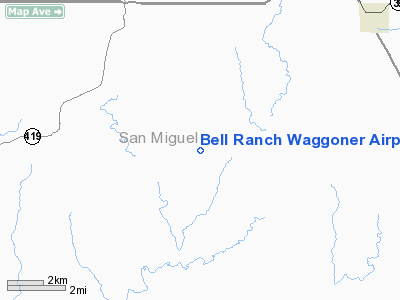
Bell Ranch Waggoner Airport |
Location & QuickFacts
| FAA Information Effective: | 2008-09-25 |
| Airport Identifier: | NM32 |
| Airport Status: | Operational |
| Longitude/Latitude: | 104-03-39.9060W/35-42-28.1470N
-104.061085/35.707819 (Estimated) |
| Elevation: | 4725 ft / 1440.18 m (Estimated) |
| Land: | 0 acres |
| From nearest city: | 0 nautical miles N of Bell Ranch, NM |
| Location: | San Miguel County, NM |
| Magnetic Variation: | 10E (1985) |
Owner & Manager
| Ownership: | Privately owned |
| Owner: | Lane Agrico |
| Address: | Bell Ranch
Solano, NM 87746 |
| Phone number: | 505-673-2929 |
| Manager: | Jeffrey P Lane |
| Address: | Bell Ranch
Solano, NM 87746 |
| Phone number: | 505-673-2929 |
Airport Operations and Facilities
| Airport Use: | Private |
| Wind indicator: | Yes |
| Segmented Circle: | Yes |
| Control Tower: | No |
| Lighting Schedule: | PHONE REQ
FOR LIRL RY 18/36 CALL 505-673-2929. |
| Landing fee charge: | No |
| Sectional chart: | Denver |
| Region: | ASW - Southwest |
| Boundary ARTCC: | ZAB - Albuquerque |
| Tie-in FSS: | ABQ - Albuquerque |
| FSS on Airport: | No |
| FSS Toll Free: | 1-800-WX-BRIEF |
Runway Information
Runway 18/36
| Dimension: | 8200 x 70 ft / 2499.4 x 21.3 m |
| Surface: | DIRT, |
| Edge Lights: | Low |
| |
Runway 18 |
Runway 36 |
| Traffic Pattern: | Left | Left |
| Obstruction: | 25 ft pline, 1200.0 ft from runway | , 0.0 ft from runway |
|
Radio Navigation Aids
| ID |
Type |
Name |
Ch |
Freq |
Var |
Dist |
| TCC | VORTAC | Tucumcari | 083X | 113.60 | 12E | 38.9 nm |
Images and information placed above are from
http://www.airport-data.com/airport/NM32/
We thank them for the data!
| General Info
|
| Country |
United States
|
| State |
NEW MEXICO
|
| FAA ID |
NM32
|
| Latitude |
35-42-28.147N
|
| Longitude |
104-03-39.906W
|
| Elevation |
4725 feet
|
| Near City |
BELL RANCH
|
We don't guarantee the information is fresh and accurate. The data may
be wrong or outdated.
For more up-to-date information please refer to other sources.
|
|


