 |
|
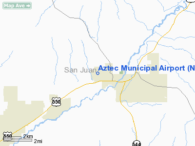
Location & QuickFacts
| FAA Information Effective: | 2008-09-25 |
| Airport Identifier: | N19 |
| Airport Status: | Operational |
| Longitude/Latitude: | 108-01-42.2490W/36-50-05.0120N
-108.028402/36.834726 (Estimated) |
| Elevation: | 5877 ft / 1791.31 m (Estimated) |
| Land: | 160 acres |
| From nearest city: | 2 nautical miles NW of Aztec, NM |
| Location: | San Juan County, NM |
| Magnetic Variation: | 12E (1985) |
Owner & Manager
| Ownership: | Publicly owned |
| Owner: | City Of Aztec |
| Address: | 201 West Chaco
Aztec, NM 87410 |
| Phone number: | 505-334-9456 |
| Manager: | Mike Arnold |
| Address: | 201 West Chaco
Aztec, NM 87410 |
| Phone number: | 505-334-1002
ARPT PHONE 505-334-1002. |
Airport Operations and Facilities
| Airport Use: | Open to public |
| Wind indicator: | Yes |
| Segmented Circle: | No |
| Control Tower: | No |
| Lighting Schedule: | DUSK-0000
ACTVT ODALS RY 08 - CTAF. |
| Beacon Color: | Clear-Green (lighted land airport) |
| Landing fee charge: | No |
| Sectional chart: | Denver |
| Region: | ASW - Southwest |
| Boundary ARTCC: | ZDV - Denver |
| Tie-in FSS: | ABQ - Albuquerque |
| FSS on Airport: | No |
| FSS Toll Free: | 1-800-WX-BRIEF |
| NOTAMs Facility: | ABQ (NOTAM-d service avaliable) |
| Federal Agreements: | N |
Airport Communications
Airport Services
| Fuel available: | 100LLMOGAS |
| Bottled Oxygen: | NONE |
| Bulk Oxygen: | NONE |
Runway Information
Runway 04/22
| Dimension: | 2850 x 40 ft / 868.7 x 12.2 m |
| Surface: | ASPH, Poor Condition
PAVEMENT HAS NUMEROUS LARGE CRACKS AND LOOSE ROCK. |
| Weight Limit: | Single wheel: 8000 lbs. |
| |
Runway 04 |
Runway 22 |
| Traffic Pattern: | Left | Left |
| Markings: | Basic, Poor Condition
RUNWAY MARKINGS FADED. | Basic, Poor Condition
RUNWAY MARKINGS FADED. |
|
Runway 08/26
| Dimension: | 4300 x 50 ft / 1310.6 x 15.2 m |
| Surface: | ASPH, Good Condition
PAVEMENT HAS NUMEROUS LARGE CRACKS AND LOOSE ROCK. |
| Weight Limit: | Single wheel: 10000 lbs. |
| |
Runway 08 |
Runway 26 |
| Traffic Pattern: | Left | Left |
| Markings: | Basic, Good Condition | Basic, Good Condition |
| Crossing Height: | 0.00 ft | 20.00 ft |
| Displaced threshold: | 210.00 ft | 210.00 ft |
| VASI: | system of panels on left side that may or may not be lighted | pulsating/steady burning on right side |
| Visual Glide Angle: | 0.00° | 3.00° |
| Approach lights: | NSTD
NSTD ODALS DUE TO 4 NSTD LGTS ON EXTDD RY CNTRLN ON LESS THAN STD SPACING. | |
|
Radio Navigation Aids
| ID |
Type |
Name |
Ch |
Freq |
Var |
Dist |
| DRO | VOR/DME | Durango | 019X | 108.20 | 14E | 23.4 nm |
| CEZ | VOR/DME | Cortez | 021X | 108.40 | 14E | 42.0 nm |
| RSK | VORTAC | Rattlesnake | 100X | 115.30 | 14E | 6.2 nm |
Remarks
- ARPT LCTD ATOP MESA, GND DROPS APRXY 60-280 FT BYD RY END.
- MANY TOUCH & GO'S BY STUDENTS OFTEN BASED OUT OF FARMINGTON.
Images and information placed above are from
http://www.airport-data.com/airport/N19/
We thank them for the data!
| General Info
|
| Country |
United States
|
| State |
NEW MEXICO
|
| FAA ID |
N19
|
| Latitude |
36.834724
36° 50' 05.01" N
|
| Longitude |
-108.028403
108° 01' 42.25" W
|
| Elevation |
5877 feet
1791 meters
|
| Magnetic Variation |
010° E (06/06)
|
| Beacon |
Yes
|
| Operating Agency |
MUNICIPAL
|
| Daylight Saving Time |
Second Sunday in March at 0200 to first Sunday in November at 0200 local time (Exception Arizona and that portion of Indiana in the Eastern Time Zone)
|
We don't guarantee the information is fresh and accurate. The data may
be wrong or outdated.
For more up-to-date information please refer to other sources.
|
|


