|
|
Albuquerque Intl Sunport Airport |
Albuquerque International Sunport
Albuquerque |
 |
 |
| IATA: ABQ – ICAO: KABQ – FAA LID: ABQ
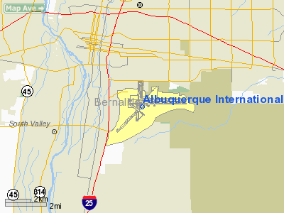
Location of the Albuquerque International Sunport
|
| Summary |
| Airport type |
Public |
| Operator |
City of Albuquerque |
| Serves |
Albuquerque, New Mexico |
| Hub for |
New Mexico Airlines |
| Elevation AMSL |
5,355 ft / 1,632 m |
| Coordinates |
35°02′25″N 106°36′33″W / 35.04028°N 106.60917°W / 35.04028; -106.60917 |
| Runways |
| Direction |
Length |
Surface |
| ft |
m |
| 3/21 |
10,000 |
3,048 |
Concrete |
| 8/26 |
13,793 |
4,204 |
Concrete |
| 12/30 |
6,000 |
1,829 |
Concrete |
| 17/35 |
10,000 |
3,048 |
Asphalt/Concrete |
| Statistics (2006) |
| Aircraft operations |
192,520 |
| Based aircraft |
322 |
| Sources: airport website and FAA |
Albuquerque International Sunport (IATA: ABQ, ICAO: KABQ, FAA LID: ABQ) is a public airport located 3 miles (5 km) southeast of the central business district of Albuquerque, a city in Bernalillo County, New Mexico, United States. It is the largest commercial airport in the state, handling 5,888,811 passengers in 2009. The airport serves Albuquerque and Santa Fe (also served by Santa Fe Municipal Airport, providing regional jet service to Dallas-Fort Worth International Airport and Los Angeles International Airport). History
Albuquerque in the 1930s was served by two private airports, West Mesa Airport and Oxnard Field. Around 1935 it was suggested that the city build a new public airport using WPA money. Having secured $520,500 USD in funding, Governor Clyde Tingley broke ground for the project on February 28, 1937. Albuquerque Municipal Airport opened in 1939 with two paved runways, a Pueblo Style terminal building designed by Ernest Blumenthal, and a massive hangar designed to accommodate the new Boeing 307.
The Sunport took on a new role in 1940 when it was designated Albuquerque Army Air Base, the precursor to today's Kirtland Air Force Base. The airport continues to share its runways with Kirtland, which also handles rescue and firefighting operations.
The present terminal was constructed in 1965 on a site just east of the original terminal. It has since been expanded twice, first in the late 1980s and most recently in 1996. The old terminal has been restored and currently houses offices of the Transportation Security Administration. It was added to the National Register of Historic Places in 1988. On Mid-2000s, Aeroméxico Connect (as Aerolitoral) initiated services from Mexico City to Albuquerque as the first international flights in and out of Albuquerque, but ceased New Mexico operations in late-2000s.
Operations
ABQ's terminal, which was expanded to its present size in the late 1980s and again in 1996, encompasses 574,000 sq ft (53,300 m²). of space.
The airport has one passenger terminal that is designed in the Spanish-Pueblo style of architecture which houses two concourses and an area for commuter airline gates.
The count of passengers at the Sunport has seen an average per year increase of 2% over the last 15 years.
The airport's freight center moved 67,000 tons of cargo in 2008.
The passenger terminal has free wireless internet access and electrical charging stations for passenger use.
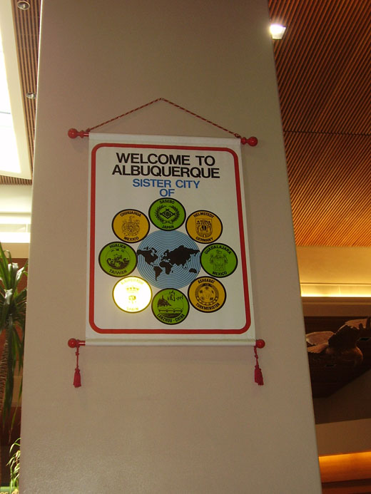 | |
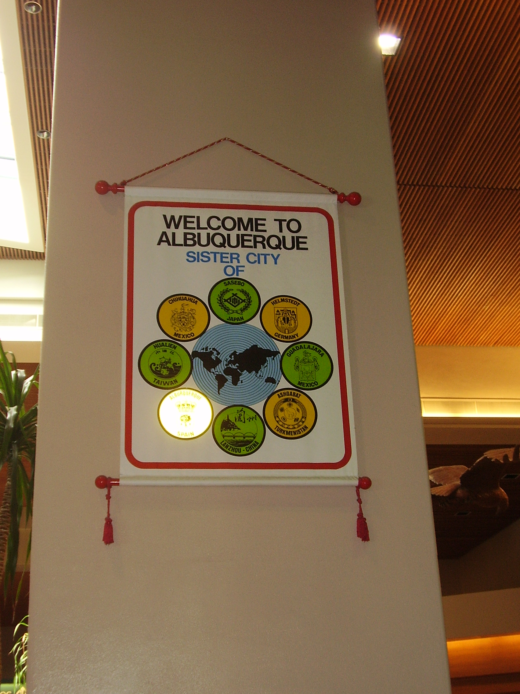
Banner inside the airport terminal listing Albuquerque's sister cities |
Facilities and aircraft
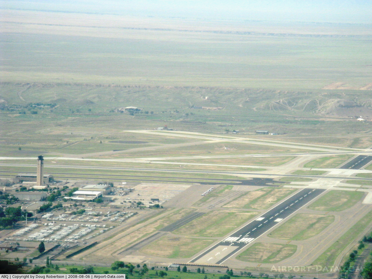
Albuquerque International Sunport Airport covers an area of 2,039 acres (825 ha) which contains four runways. For the 12-month period ending December 31, 2006, the airport had 192,520 aircraft operations, an average of 527 per day: 41% scheduled commercial, 23% air taxi, 23% general aviation and 16% military. There are 322 aircraft based at this airport: 33% multi-engine, 30% single-engine, 18% military, 13% jet and 7% helicopter. The largest passenger aircraft normally scheduled into the Albuquerque International Sunport is the Boeing 757, operated by Delta Air Lines on flights to and from Atlanta during the spring and summer months, and during the Albuquerque International Balloon Fiesta in October. The largest overall aircraft the Sunport usually sees is a UPS Airbus A300 to Louisville. In the past, however, the airport has seen regularly scheduled Lockheed L-1011 service operated by Trans World Airlines.
Future developments
The Airport Master Plan drafted in 2002 lays out intermediate- and long-term projects at the Sunport, including the removal of Runway 17/35 and the construction of a second terminal. The runway closure recommendation is based on a number of factors, including safety, noise abatement, and the cost of continued upkeep. Because 17/35 intersects all three of the other runways, it has the highest risk of runway incursions; therefore air traffic control prefers not to use the runway unless absolutely necessary. The prevailing winds are from the west, and even during strong winds, the other runways can cover departure and landing. Currently, most of the runway's use is general aviation.
In the longer term, the plan calls for a new terminal to be built to the northeast of the existing terminal. A people mover system will connect the terminal with parking facilities and the existing terminal.
A major new part of Albuquerque called Mesa del Sol is being developed 5 miles south of Albuquerque International Sunport and is planned to house 100,000 inhabitants by 2055.
Concourses
Albuquerque International Sunport has a single terminal with 25 gates in three concourses, including a concourse for commuter airline gates.
Concourse A
Concourse A has 13 Gates: A1 - A12, A14
Concourse B
Concourse B has 10 Gates: B1 - B10
Concourse E (Commuter Terminal)
Concourse E has 2 Gates: E1 & E2
Airlines and destinations
| Airlines |
Destinations |
Concourse |
| American Airlines |
Chicago-O'Hare, Dallas/Fort Worth |
B |
| Continental Express operated by ExpressJet Airlines |
Cleveland [seasonal], Houston-Intercontinental |
B |
| Delta Air Lines |
Atlanta, Minneapolis/St. Paul |
B |
| Delta Connection operated by SkyWest Airlines |
Salt Lake City |
B |
| Frontier Airlines |
Denver |
B |
| Great Lakes Airlines |
Clovis, Silver City |
E |
| New Mexico Airlines |
Alamogordo, Carlsbad, El Paso, Hobbs |
E |
| Southwest Airlines |
Baltimore, Chicago-Midway, Dallas-Love, Denver, El Paso, Houston-Hobby, Kansas City, Las Vegas, Los Angeles, Lubbock, Midland/Odessa, Oakland, Orlando, Phoenix, Portland (OR), St. Louis, Salt Lake City, San Diego, Seattle/Tacoma, Tucson |
A |
| United Airlines |
Denver, Washington-Dulles |
A |
| United Express operated by SkyWest Airlines |
Denver, Los Angeles, San Francisco |
A |
| United Express operated by Shuttle America |
Chicago-O'Hare, Denver |
A |
| US Airways |
Phoenix |
B |
| US Airways Express operated by Mesa Airlines |
Phoenix |
B |
Cargo
- FedEx Express
- UPS Airlines
Flight School
Del Sol Aviation
Ground transportation
- Bus
- ABQ RIDE offers bus service (Routes 50, 222 and 350) at the southside of the baggage claim area.
- Commuter train
- ABQ RIDE Route 222 provides connecting service to the New Mexico Rail Runner Express Bernallilo County/International Sunport Station, while ABQ RIDE Route 350 provides nonstop service to the Alvarado Transportation Center in Downtown Albuquerque. The Rail Runner provides service both north and south of the airport, including Downtown Albuquerque and Santa Fe.
- Scheduled shuttle bus service
- Regularly scheduled bus and shuttle service is provided by various carriers to locations from ABQ to the city as well as Santa Fe, New Mexico.
- Taxi
- Taxis can be hailed through the Ground Transportation employees outside the baggage claim areas.
Accidents
- On February 19, 1955, TWA Flight 260, a Martin 4-0-4 bound for Santa Fe, crashed into the Sandia Mountains shortly after takeoff. All 16 people on board the flight were killed.
- On September 11, 1958, an F-102 Delta Dagger slid off the end of Runway 35 in heavy rain and struck a car on Gibson Boulevard before coming to rest in an empty lot on the north side of the street. Both occupants of the car were killed.
- On November 3, 1973, National Airlines Flight 27, a McDonnell Douglas DC-10, suffered a catastrophic engine failure while en route from Houston to Las Vegas. Shrapnel from the engine struck the fuselage and caused an explosive decompression of the aircraft. One passenger was blown out of the cabin. The plane was able to make an emergency landing at ABQ.
- On September 14, 1977, a USAF Boeing EC-135 crashed into the Manzano Mountains just after takeoff, killing all 20 people on board.
- On July 6, 1997, Delta Air Lines Flight 1470, a Boeing 727 suffered a right landing gear failure after landing on Runway 21. While there were no fatalities, 3 people were injured and the aircraft suffered serious damage.
The above content comes from Wikipedia and is published under free licenses – click here to read more.
 |
(Click on the photo to enlarge) |
 |
(Click on the photo to enlarge) |
 |
(Click on the photo to enlarge) |
 |
(Click on the photo to enlarge) |
 |
(Click on the photo to enlarge) |
 |
(Click on the photo to enlarge) |
 |
(Click on the photo to enlarge) |
 |
(Click on the photo to enlarge) |
 |
(Click on the photo to enlarge) |
 |
(Click on the photo to enlarge) |
 |
(Click on the photo to enlarge) |
 |
(Click on the photo to enlarge) |
Location & QuickFacts
| FAA Information Effective: | 2008-09-25 |
| Airport Identifier: | ABQ |
| Airport Status: | Operational |
| Longitude/Latitude: | 106-36-33.1000W/35-02-24.8000N
-106.609194/35.040222 (Estimated) |
| Elevation: | 5355 ft / 1632.20 m (Surveyed) |
| Land: | 2039 acres |
| From nearest city: | 3 nautical miles SE of Albuquerque, NM |
| Location: | Bernalillo County, NM |
| Magnetic Variation: | 11E (1995) |
Owner & Manager
| Ownership: | Publicly owned |
| Owner: | City Of Albuquerque |
| Address: | Po Box 1293
Albuquerque, NM 87103 |
| Phone number: | 505-768-3000 |
| Manager: | Nicholas S. Bakas |
| Address: | Po Box 9948
Albuquerque, NM 87119 |
| Phone number: | 505-244-7778 |
Airport Operations and Facilities
| Airport Use: | Open to public |
| Wind indicator: | Yes |
| Segmented Circle: | No |
| Control Tower: | Yes |
| Lighting Schedule: | DUSK-DAWN |
| Beacon Color: | Clear-Green (lighted land airport) |
| Landing fee charge: | No |
| Sectional chart: | Albuquerque |
| Region: | ASW - Southwest |
| Boundary ARTCC: | ZAB - Albuquerque |
| Tie-in FSS: | ABQ - Albuquerque |
| FSS on Airport: | Yes |
| FSS Toll Free: | 1-800-WX-BRIEF |
| NOTAMs Facility: | ABQ (NOTAM-d service avaliable) |
| Certification type/date: | I C S 05/1973 |
| Federal Agreements: | NGPSY |
Airport Communications
Airport Services
| Fuel available: | 100LLA A1 A1+ |
| Airframe Repair: | MAJOR |
| Power Plant Repair: | MAJOR |
| Bottled Oxygen: | HIGH/LOW |
| Bulk Oxygen: | HIGH/LOW |
Runway Information
Runway 03/21
| Dimension: | 10000 x 150 ft / 3048.0 x 45.7 m
NE 840 FT CLSD INDEFLY.
SOUTH 5600 FT CLSD INDEFLY. |
| Surface: | CONC, Good Condition |
| Surface Treatment: | Saw-cut or plastic Grooved
RYS 08/26, 17/35, 03/21 & 12/30 GROOVED 130 FT WIDE. |
| Weight Limit: | Single wheel: 100000 lbs.
Dual wheel: 210000 lbs.
Dual tandem wheel: 360000 lbs.
Dual dual tandem wheel: 720000 lbs.
ALL UP WEIGHT 12,500 LBS. |
| Edge Lights: | High |
| |
Runway 03 |
Runway 21 |
| Longitude: | 106-37-50.1671W | 106-36-25.4643W |
| Latitude: | 35-01-20.0939N | 35-02-30.2679N |
| Elevation: | 5305.00 ft | 5316.00 ft |
| Alignment: | 45 | 127 |
| ILS Type: | ILS
| |
| Traffic Pattern: | Right | Left |
| Markings: | Precision instrument, Good Condition | Precision instrument, Good Condition |
| Arresting: | BAK14 | |
| Crossing Height: | 62.00 ft | 0.00 ft |
| VASI: | 4-light PAPI on left side | 4-light PAPI on left side |
| Visual Glide Angle: | 3.00° | 0.00° |
| RVR Equipment: | touchdown | |
| Approach lights: | MALSR | |
| Centerline Lights: | Yes | No |
| Touchdown Lights: | Yes | |
| Decleard distances: | Take off run available 10000.00 ft
Take off distance available 10000.00 ft
Actual stop distance available 10000.00 ft
Landing distance available 10000.00 ft
| Take off run available 10000.00 ft
Take off distance available 10000.00 ft
Actual stop distance available 10000.00 ft
Landing distance available 10000.00 ft
|
|
Runway 08/26
| Dimension: | 13793 x 150 ft / 4204.1 x 45.7 m
NE 840 FT CLSD INDEFLY.
SOUTH 5600 FT CLSD INDEFLY. |
| Surface: | CONC, Good Condition |
| Surface Treatment: | Saw-cut or plastic Grooved
RYS 08/26, 17/35, 03/21 & 12/30 GROOVED 130 FT WIDE. |
| Weight Limit: | Single wheel: 100000 lbs.
Dual wheel: 210000 lbs.
Dual tandem wheel: 360000 lbs.
Dual dual tandem wheel: 720000 lbs.
ALL UP WEIGHT 12,500 LBS. |
| Edge Lights: | High |
| |
Runway 08 |
Runway 26 |
| Longitude: | 106-37-17.7171W | 106-34-31.8879W |
| Latitude: | 35-02-39.6652N | 35-02-38.6272N |
| Elevation: | 5312.00 ft | 5355.00 ft |
| Alignment: | 90 | 127 |
| ILS Type: | ILS/DME
| |
| Traffic Pattern: | Right | Left |
| Markings: | Precision instrument, Good Condition | Precision instrument, Good Condition |
| Arresting: | BAK14 | |
| Crossing Height: | 54.00 ft | 47.00 ft |
| Displaced threshold: | 1000.00 ft | 0.00 ft |
| VASI: | 6-box on left side | 6-box on left side
VASI RWY 26 UPWIND TCH 77' GLIDE ANGLE 3.25 DEG; DOWNWIND TCH 47' GLIDE ANGLE 3.00 DEG. |
| Visual Glide Angle: | 2.95° | 3.00° |
| RVR Equipment: | touchdown | |
| Approach lights: | MALSR | |
| Runway End Identifier: | | Yes |
| Centerline Lights: | Yes | No |
| Touchdown Lights: | Yes | |
| Decleard distances: | Take off run available 13793.00 ft
Take off distance available 13793.00 ft
Actual stop distance available 13793.00 ft
Landing distance available 12793.00 ft
| Take off run available 13793.00 ft
Take off distance available 13793.00 ft
Actual stop distance available 13793.00 ft
Landing distance available 13793.00 ft
|
|
Runway 12/30
| Dimension: | 6000 x 150 ft / 1828.8 x 45.7 m
NE 840 FT CLSD INDEFLY.
SOUTH 5600 FT CLSD INDEFLY. |
| Surface: | CONC, Good Condition |
| Surface Treatment: | Saw-cut or plastic Grooved
RYS 08/26, 17/35, 03/21 & 12/30 GROOVED 130 FT WIDE. |
| Weight Limit: | Single wheel: 65000 lbs.
Dual wheel: 120000 lbs.
Dual tandem wheel: 155000 lbs.
ALL UP WEIGHT 12,500 LBS. |
| Edge Lights: | Medium |
| |
Runway 12 |
Runway 30 |
| Longitude: | 106-37-14.7063W | 106-36-18.5309W |
| Latitude: | 35-02-36.7202N | 35-01-59.5012N |
| Elevation: | 5312.00 ft | 5314.00 ft |
| Alignment: | 127 | 127 |
| Traffic Pattern: | Right | Left |
| Markings: | Basic, Good Condition | Basic, Good Condition |
| Crossing Height: | 0.00 ft | 40.00 ft |
| VASI: | | 4-light PAPI on left side |
| Visual Glide Angle: | 0.00° | 3.00° |
| Runway End Identifier: | | Yes |
| Decleard distances: | Take off run available 6000.00 ft
Take off distance available 6000.00 ft
Actual stop distance available 6000.00 ft
Landing distance available 6000.00 ft
| Take off run available 6000.00 ft
Take off distance available 6000.00 ft
Actual stop distance available 6000.00 ft
Landing distance available 6000.00 ft
|
|
Runway 17/35
| Dimension: | 10000 x 150 ft / 3048.0 x 45.7 m
NE 840 FT CLSD INDEFLY.
SOUTH 5600 FT CLSD INDEFLY. |
| Surface: | ASPH-CONC, Fair Condition |
| Surface Treatment: | Saw-cut or plastic Grooved
RYS 08/26, 17/35, 03/21 & 12/30 GROOVED 130 FT WIDE. |
| Edge Lights: | Medium |
| |
Runway 17 |
Runway 35 |
| Longitude: | 106-36-39.6019W | 106-36-46.6823W |
| Latitude: | 35-03-27.8296N | 35-01-49.1242N |
| Elevation: | 5319.00 ft | 5314.00 ft |
| Alignment: | 127 | 3 |
| Traffic Pattern: | Right | Left |
| Markings: | Non-precision instrument, Good Condition | Non-precision instrument, Good Condition |
| Crossing Height: | 53.00 ft | 55.00 ft |
| Displaced threshold: | 890.00 ft | 0.00 ft |
| VASI: | 4-box on left side | 4-box on left side |
| Visual Glide Angle: | 3.00° | 3.00° |
| Runway End Identifier: | Yes | Yes |
| Obstruction: | 15 ft road, 200.0 ft from runway
50:1 TO DSPLCD THR.
+9' BLAST FENCE 110' FM RY END. | , 50:1 slope to clear |
| Decleard distances: | Take off run available 10000.00 ft
Take off distance available 10000.00 ft
Actual stop distance available 10000.00 ft
Landing distance available 9110.00 ft
| Take off run available 9110.00 ft
Take off distance available 10110.00 ft
Actual stop distance available 9110.00 ft
Landing distance available 9110.00 ft
|
|
Radio Navigation Aids
| ID |
Type |
Name |
Ch |
Freq |
Var |
Dist |
| ILT | NDB | Isleta | | 247.00 | 11E | 3.2 nm |
| OTO | VOR | Otto | | 114.00 | 13E | 33.2 nm |
| ABQ | VORTAC | Albuquerque | 079X | 113.20 | 13E | 10.2 nm |
| SAF | VORTAC | Santa Fe | 043X | 110.60 | 13E | 40.2 nm |
| ONM | VORTAC | Socorro | 115X | 116.80 | 13E | 43.4 nm |
| ABQ | VOT | Albuquerque Intl | | 111.00 | | 0.1 nm |
Remarks
- NOISE ABATEMENT PROCS IN EFFECT FOR JET & TURBO-PROP TFC; DEP RY 08 EXPC LEFT TURN AT 13.5 DME. BTN THE HRS 2100-0700 WKDAYS & 2100-0900 SAT & SUN EXPC RIGHT TURN ON DEP FM RY 08. DEPS ON RY 03 OR RY 35 & ARRS ON RY 17 ARE RSTRD & RQR PRIOR COORDN WITH ATCT.
- RECESSED ARRESTING CABLES ON RY 03 1062 FT NE OF THLD & RY 08 1000 FT EAST OF THLD; TEXTILE BAK & HOOK (MB100.10C) AIRCRAFT ARRESTING SYSTEM AT RY 26 THLD.
- RAMP WEST OF RY 17/35 AND NORTH OF RY 08/26 CLSD TO HELICOPTERS & GA ACFT.
- TWY D NORTH OF TWY B CLSD INDEFLY.
- AIR CARRIER GND HANDLING NOT AVBL BTN THE HRS OF 0100-0430.
- USE EXTREME CARE TAXIING NORTH ON TWY E-1 TO RY 08, HOLDING POSITION FOR RY 08/26 COLLOCATED WITH RY 12/30 HOLDING POSITION PRIOR TO RY 12 THLD.
- BIRD HAZARD OCT-DEC & MAR-MAY.
- TWY H MILITARY USE ONLY.
- 200 FT AGL UNLGTD WATER TOWER 1.5 MILES SOUTH OF RY 35.
- RY 03 CNTRLN LGTS OTS INDEFLY.
- HVY STUDENT COPTER TFC; CTL FIRING AREA S OF ARPT.
- ARFF PROTECTION PROVIDED BY USAF EXCEEDS INDEX E CAPABILITY.
- FTR ACFT DEP S ONLY; NO MILITARY DEP ON RY 35.
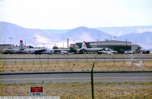
Images and information placed above are from
http://www.airport-data.com/airport/ABQ/
We thank them for the data!
| General Info
|
| Country |
United States
|
| State |
NEW MEXICO
|
| FAA ID |
ABQ
|
| Latitude |
35-02-24.800N
|
| Longitude |
106-36-33.100W
|
| Elevation |
5355 feet
|
| Near City |
ALBUQUERQUE
|
We don't guarantee the information is fresh and accurate. The data may
be wrong or outdated.
For more up-to-date information please refer to other sources.
|
|