 |
|
Location & QuickFacts
| FAA Information Effective: | 2008-09-25 |
| Airport Identifier: | 3N9 |
| Airport Status: | Closed Indefinitely |
| Longitude/Latitude: | 107-29-44.1480W/34-21-46.2140N
-107.495597/34.362837 (Estimated) |
| Elevation: | 6460 ft / 1969.01 m (Estimated) |
| Land: | 5 acres |
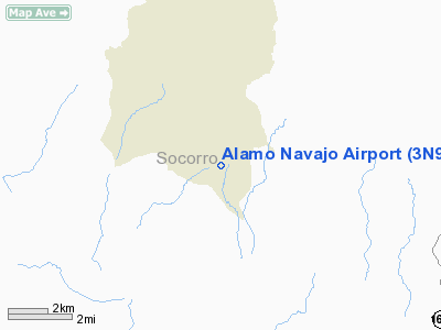
| From nearest city: | 3 nautical miles S of Alamo, NM |
| Location: | Socorro County, NM |
| Magnetic Variation: | 12E (1985) |
Owner & Manager
| Ownership: | Publicly owned |
| Owner: | Alamo Band Indian Tribe |
| Address: | Box 383
Magdalena, NM 87825 |
| Phone number: | 505-854-2543 |
| Manager: | Denise Ganadonegro |
| Address: | P O Box 827
Magdalena, NM 87825 |
| Phone number: | 505-854-2686 |
Airport Operations and Facilities
| Airport Use: | Open to public |
| Wind indicator: | Yes |
| Segmented Circle: | No |
| Control Tower: | No |
| Sectional chart: | Albuquerque |
| Region: | ASW - Southwest |
| Boundary ARTCC: | ZAB - Albuquerque |
| Tie-in FSS: | ABQ - Albuquerque |
| FSS Toll Free: | 1-800-WX-BRIEF |
| NOTAMs Facility: | ABQ (NOTAM-d service avaliable) |
Airport Communications
Runway Information
Runway 17/35
| Dimension: | 3650 x 40 ft / 1112.5 x 12.2 m |
| Surface: | DIRT, Fair Condition
MAY BE SOFT WHEN WET. |
| |
Runway 17 |
Runway 35 |
| Traffic Pattern: | Left | Left |
| Obstruction: | 12 ft tree, 50.0 ft from runway, 10 ft right of centerline, 4:1 slope to clear | 40 ft pline, 75.0 ft from runway, 1:1 slope to clear |
|
Radio Navigation Aids
| ID |
Type |
Name |
Ch |
Freq |
Var |
Dist |
| FIA | NDB | Florida | | 329.00 | 12E | 33.5 nm |
| ONM | VORTAC | Socorro | 115X | 116.80 | 13E | 33.5 nm |
Remarks
- LIVESTOCK & VEHICLES & PEDESTRIANS ON RWY.
- +4' FENCE 40' WEST OF RWY 17/35 CNTRLN OBSTRUCTS PRIMARY SFC.
- RY 17/35 RECOMMEND VISUAL INSPECTION PRIOR TO USING IRREGULARLY MAINTAINED.
- (ARPT STATUS) ARPT CLSD INDEFLY.
- PRVDD THRS ARE LCTD TO PROVIDE 20:1 CLEARANCE OVERALL OBSTRUCTIONS; PLINE SOUTH OF RWY BE REMOVED; RELOCATED; BURIED OR AT LEAST MKD.
Images and information placed above are from
http://www.airport-data.com/airport/3N9/
We thank them for the data!
| General Info
|
| Country |
United States
|
| State |
NEW MEXICO
|
| FAA ID |
3N9
|
| Latitude |
34-21-46.214N
|
| Longitude |
107-29-44.148W
|
| Elevation |
6460 feet
|
| Near City |
ALAMO
|
We don't guarantee the information is fresh and accurate. The data may
be wrong or outdated.
For more up-to-date information please refer to other sources.
|
|


