 |
|
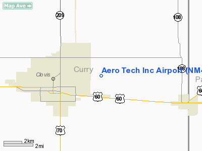
Location & QuickFacts
| FAA Information Effective: | 2008-09-25 |
| Airport Identifier: | NM42 |
| Airport Status: | Operational |
| Longitude/Latitude: | 103-08-52.0000W/34-24-57.0000N
-103.147778/34.415833 (Estimated) |
| Elevation: | 4250 ft / 1295.40 m (Estimated) |
| Land: | 17 acres |
| From nearest city: | 3 nautical miles E of Clovis, NM |
| Location: | Curry County, NM |
| Magnetic Variation: | 10E (1985) |
Owner & Manager
| Ownership: | Privately owned |
| Owner: | Ted Stallings |
| Address: | 5333 East 21st St.
Clovis, NM 88101 |
| Phone number: | 505-763-4300 |
| Manager: | Ted Stallings |
| Address: | 5333 East 21st St.
Clovis, NM 88101 |
| Phone number: | 505-763-4300 |
Airport Operations and Facilities
| Airport Use: | Private
PERSONAL USE. |
| Segmented Circle: | No |
| Control Tower: | No |
| Sectional chart: | Albuquerque |
| Region: | ASW - Southwest |
| Boundary ARTCC: | ZAB - Albuquerque |
| Tie-in FSS: | ABQ - Albuquerque |
| FSS on Airport: | No |
| FSS Toll Free: | 1-800-WX-BRIEF |
Airport Services
Runway Information
Runway 18/36
| Dimension: | 2640 x 150 ft / 804.7 x 45.7 m |
| Surface: | TURF, |
| |
Runway 18 |
Runway 36 |
| Traffic Pattern: | Right | Left |
| Displaced threshold: | 150.00 ft | 40.00 ft |
| Obstruction: | 15 ft pline, 35.0 ft from runway | 5 ft fence, 0.0 ft from runway |
|
Radio Navigation Aids
| ID |
Type |
Name |
Ch |
Freq |
Var |
Dist |
| PRZ | NDB | Portales | | 407.00 | 09E | 20.4 nm |
| LIU | NDB | Littlefield | | 212.00 | 10E | 48.2 nm |
| HRX | NDB | Hereford | | 341.00 | 09E | 48.6 nm |
| CVS | TACAN | Cannon | 053X | | 10E | 8.9 nm |
| TXO | VORTAC | Texico | 059X | 112.20 | 11E | 16.0 nm |
Images and information placed above are from
http://www.airport-data.com/airport/NM42/
We thank them for the data!
| General Info
|
| Country |
United States
|
| State |
NEW MEXICO
|
| FAA ID |
NM42
|
| Latitude |
34-24-57.000N
|
| Longitude |
103-08-52.000W
|
| Elevation |
4250 feet
|
| Near City |
CLOVIS
|
We don't guarantee the information is fresh and accurate. The data may
be wrong or outdated.
For more up-to-date information please refer to other sources.
|
|


