 |
|
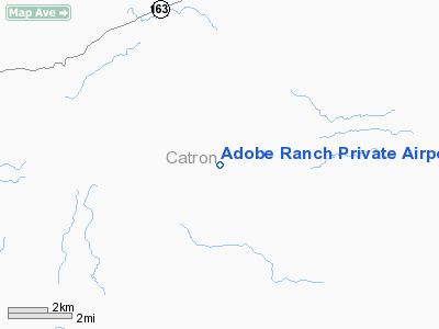
Adobe Ranch Private Airport |
Location & QuickFacts
| FAA Information Effective: | 2008-09-25 |
| Airport Identifier: | NM37 |
| Airport Status: | Operational |
| Longitude/Latitude: | 107-54-00.1630W/33-34-35.2320N
-107.900045/33.576453 (Estimated) |
| Elevation: | 7354 ft / 2241.50 m (Estimated) |
| Land: | 0 acres |
| From nearest city: | 43 nautical miles NW of Truth Or Consequences, NM |
| Location: | Catron County, NM |
| Magnetic Variation: | 12E (1985) |
Owner & Manager
| Ownership: | Privately owned |
| Owner: | Adobe Ranch |
| Address: | Box 851
Stonewall, TX 78671 |
| Phone number: | 512-644-5500 |
| Manager: | Mary O'boyle English |
| Address: | Beaverhead Route
Magdalena, NM 87450 |
| Phone number: | 505-772-5557 |
Airport Operations and Facilities
| Airport Use: | Private |
| Wind indicator: | Yes |
| Segmented Circle: | No |
| Control Tower: | No |
| Landing fee charge: | No |
| Sectional chart: | Albuquerque |
| Region: | ASW - Southwest |
| Boundary ARTCC: | ZAB - Albuquerque |
| Tie-in FSS: | ABQ - Albuquerque |
| FSS on Airport: | No |
| FSS Toll Free: | 1-800-WX-BRIEF |
Runway Information
Runway 02/20
| Dimension: | 3900 x 60 ft / 1188.7 x 18.3 m
HAS A 965 FT STOPWAY SW END. |
| Surface: | GRVL-TRTD, |
| |
Runway 02 |
Runway 20 |
| Traffic Pattern: | Left | Left |
|
Radio Navigation Aids
| ID |
Type |
Name |
Ch |
Freq |
Var |
Dist |
| TCS | VORTAC | Truth Or Consequences | 074X | 112.70 | 13E | 35.7 nm |
Remarks
- RWY 02/20 FIRST 1000' NORTH END OF RWY VERY SOFT.
Images and information placed above are from
http://www.airport-data.com/airport/NM37/
We thank them for the data!
| General Info
|
| Country |
United States
|
| State |
NEW MEXICO
|
| FAA ID |
NM37
|
| Latitude |
33-34-35.232N
|
| Longitude |
107-54-00.163W
|
| Elevation |
7354 feet
|
| Near City |
TRUTH OR CONSEQUENCES
|
We don't guarantee the information is fresh and accurate. The data may
be wrong or outdated.
For more up-to-date information please refer to other sources.
|
|


