 |
|
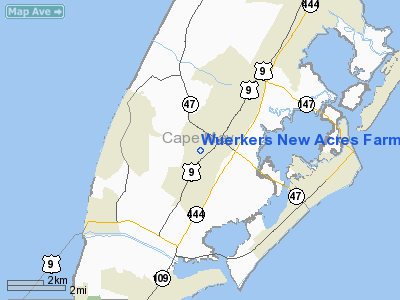
Wuerkers New Acres Farm Heliport |
Location & QuickFacts
| FAA Information Effective: | 2008-09-25 |
| Airport Identifier: | 14NJ |
| Airport Status: | Operational |
| Longitude/Latitude: | 074-53-18.6150W/39-00-32.4060N
-74.888504/39.009002 (Estimated) |
| Elevation: | 22 ft / 6.71 m (Estimated) |
| Land: | 0 acres |
| From nearest city: | 1 nautical miles SE of Rio Grande, NJ |
| Location: | Cape May County, NJ |
| Magnetic Variation: | 11W (1985) |
Owner & Manager
| Ownership: | Privately owned |
| Owner: | Edward Wuerker, President |
| Address: | 600 South Rail Road Ave.
Rio Grande, NJ 08242 |
| Phone number: | 609-886-1538 |
| Manager: | Edward Wuerker |
| Address: | 103 Lincoln Place
Rio Grande, NJ 08242 |
| Phone number: | 609-886-1538 |
Airport Operations and Facilities
| Airport Use: | Private |
| Wind indicator: | Yes |
| Segmented Circle: | No |
| Control Tower: | No |
| Landing fee charge: | No |
| Sectional chart: | Washington |
| Region: | AEA - Eastern |
| Boundary ARTCC: | ZDC - Washington |
| Tie-in FSS: | MIV - Millville |
| FSS on Airport: | No |
| FSS Toll Free: | 1-800-WX-BRIEF |
Runway Information
Helipad H1
| Dimension: | 200 x 200 ft / 61.0 x 61.0 m |
| Surface: | TURF, |
| |
Runway H1 |
Runway |
| Traffic Pattern: | Left | Left |
|
Radio Navigation Aids
| ID |
Type |
Name |
Ch |
Freq |
Var |
Dist |
| RNB | NDB | Rainbow | | 363.00 | 11W | 27.2 nm |
| OX | NDB | Landy | | 407.00 | 12W | 41.5 nm |
| DOV | TACAN | Dover | 037X | | 09W | 28.0 nm |
| ATR | VOR/DME | Waterloo | 073X | 112.60 | 09W | 19.3 nm |
| SIE | VORTAC | Sea Isle | 095X | 114.80 | 09W | 6.6 nm |
| ACY | VORTAC | Atlantic City | 023X | 108.60 | 10W | 30.5 nm |
| VCN | VORTAC | Cedar Lake | 099X | 115.20 | 10W | 32.0 nm |
| ENO | VORTAC | Smyrna | 051X | 111.40 | 09W | 32.2 nm |
| OOD | VORTAC | Woodstown | 075X | 112.80 | 10W | 42.3 nm |
| SBY | VORTAC | Salisbury | 049X | 111.20 | 12W | 49.4 nm |
Remarks
- PRVDD OPNS ARE IAW FAR 91.105(B)/91.89(B); CTC CAPE MAY CO ARPT MGR ON 609-522-6464 PRIOR TO USE; VFR DALGT USE ONLY. INGRESS/EGRESS ROUTES OF HELI ARE TO REMAIN CLEAR OF RWY 10 DEP & RWY 28 ARR AT CAPE MAY ARPT. HELI USERS MONITOR CAPE MAY UNICOM TO OBTAIN RWYS IN USE.
Images and information placed above are from
http://www.airport-data.com/airport/14NJ/
We thank them for the data!
| General Info
|
| Country |
United States
|
| State |
NEW JERSEY
|
| FAA ID |
14NJ
|
| Latitude |
39-00-32.406N
|
| Longitude |
074-53-18.615W
|
| Elevation |
22 feet
|
| Near City |
RIO GRANDE
|
We don't guarantee the information is fresh and accurate. The data may
be wrong or outdated.
For more up-to-date information please refer to other sources.
|
|


