 |
|
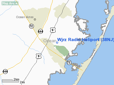
Location & QuickFacts
| FAA Information Effective: | 2008-09-25 |
| Airport Identifier: | 38NJ |
| Airport Status: | Operational |
| Longitude/Latitude: | 074-14-03.5050W/39-41-57.4290N
-74.234307/39.699286 (Estimated) |
| Elevation: | 11 ft / 3.35 m (Estimated) |
| Land: | 13 acres |
| From nearest city: | 1 nautical miles E of Manahawkin, NJ |
| Location: | Ocean County, NJ |
| Magnetic Variation: | 12W (1985) |
Owner & Manager
| Ownership: | Privately owned |
| Owner: | Jersey Shore Broadcasting |
| Address: | 1001 Beach Ave. Po Box 1000
Manahawkin, NJ 08050 |
| Phone number: | 609-597-1100 |
| Manager: | J. Knox, Jr. & L. De Bock |
| Address: | 1001 Beach Ave. Po Box 1000
Manhawkin, NJ 08050 |
| Phone number: | 609-597-1100 |
Airport Operations and Facilities
| Airport Use: | Private |
| Wind indicator: | Yes |
| Segmented Circle: | No |
| Control Tower: | No |
| Landing fee charge: | No |
| Sectional chart: | Washington |
| Region: | AEA - Eastern |
| Boundary ARTCC: | ZNY - New York |
| Tie-in FSS: | MIV - Millville |
| FSS on Airport: | No |
| FSS Toll Free: | 1-800-WX-BRIEF |
Airport Communications
Runway Information
Helipad H1
| Dimension: | 480 x 200 ft / 146.3 x 61.0 m |
| Surface: | TURF, |
| |
Runway H1 |
Runway |
| Traffic Pattern: | Left | Left |
|
Radio Navigation Aids
| ID |
Type |
Name |
Ch |
Freq |
Var |
Dist |
| NEL | NDB | Lakehurst | | 396.00 | 13W | 21.3 nm |
| RNB | NDB | Rainbow | | 363.00 | 11W | 45.0 nm |
| NEL | TACAN | Lakehurst | 055X | | 11W | 21.0 nm |
| NEL | UHF/NDB | Lakehurst | | 274.80 | 13W | 21.3 nm |
| PNE | VOR | North Philadelphia | | 112.00 | 10W | 42.5 nm |
| COL | VOR/DME | Colts Neck | 101X | 115.40 | 11W | 37.0 nm |
| ARD | VOR/DME | Yardley | 019X | 108.20 | 10W | 45.5 nm |
| CYN | VORTAC | Coyle | 081X | 113.40 | 10W | 11.6 nm |
| ACY | VORTAC | Atlantic City | 023X | 108.60 | 10W | 21.6 nm |
| GXU | VORTAC | Mc Guire | 043X | 110.60 | 11W | 25.0 nm |
| RBV | VORTAC | Robbinsville | 085X | 113.80 | 10W | 32.5 nm |
| VCN | VORTAC | Cedar Lake | 099X | 115.20 | 10W | 35.3 nm |
| SIE | VORTAC | Sea Isle | 095X | 114.80 | 09W | 44.8 nm |
| OOD | VORTAC | Woodstown | 075X | 112.80 | 10W | 49.6 nm |
| PHL | VOT | Philadelphia Intl | | 109.80 | | 47.8 nm |
Remarks
- MRKD/LGTD PLINE NORTH & WEST OF PAD.
- PROVIDED WIRES SUPPORTING ANTENNA TOWER ARE OBSTRUCTION; MARKED.
Images and information placed above are from
http://www.airport-data.com/airport/38NJ/
We thank them for the data!
| General Info
|
| Country |
United States
|
| State |
NEW JERSEY
|
| FAA ID |
38NJ
|
| Latitude |
39-41-57.429N
|
| Longitude |
074-14-03.505W
|
| Elevation |
11 feet
|
| Near City |
MANAHAWKIN
|
We don't guarantee the information is fresh and accurate. The data may
be wrong or outdated.
For more up-to-date information please refer to other sources.
|
|


