 |
|
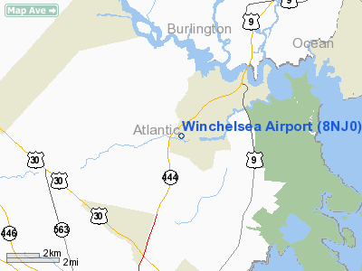
Location & QuickFacts
| FAA Information Effective: | 2008-09-25 |
| Airport Identifier: | 8NJ0 |
| Airport Status: | Operational |
| Longitude/Latitude: | 074-30-32.5480W/39-31-04.4230N
-74.509041/39.517895 (Estimated) |
| Elevation: | 30 ft / 9.14 m (Surveyed) |
| Land: | 0 acres |
| From nearest city: | 1 nautical miles W of Port Republic, NJ |
| Location: | Atlantic County, NJ |
| Magnetic Variation: | 12W (1985) |
Owner & Manager
| Ownership: | Privately owned |
| Owner: | Lawrence R. Winchell, Jr. |
| Address: | 3450 Upper Pomona Ave
Port Republic, NJ 08241 |
| Phone number: | 609-652-6855 |
| Manager: | Lawrence R. Winchell, Jr |
| Address: | 3450 Upper Pomona Ave
Port Republic, NJ 08241 |
| Phone number: | 609-652-6855 |
Airport Operations and Facilities
| Airport Use: | Private
PERSONAL USE. |
| Wind indicator: | No |
| Segmented Circle: | No |
| Control Tower: | No |
| Landing fee charge: | No |
| Sectional chart: | Washington |
| Region: | AEA - Eastern |
| Boundary ARTCC: | ZDC - Washington |
| Tie-in FSS: | MIV - Millville |
| FSS on Airport: | No |
| FSS Toll Free: | 1-800-WX-BRIEF |
Runway Information
Runway 02/20
| Dimension: | 980 x 100 ft / 298.7 x 30.5 m |
| Surface: | TURF, |
| |
Runway 02 |
Runway 20 |
| Traffic Pattern: | Left | Right |
| Obstruction: | 50 ft trees, 20.0 ft from runway | 50 ft trees, 20.0 ft from runway |
|
Radio Navigation Aids
| ID |
Type |
Name |
Ch |
Freq |
Var |
Dist |
| RNB | NDB | Rainbow | | 363.00 | 11W | 29.7 nm |
| NEL | NDB | Lakehurst | | 396.00 | 13W | 32.7 nm |
| NXX | NDB | Willow Grove | | 388.00 | 12W | 49.9 nm |
| NEL | TACAN | Lakehurst | 055X | | 11W | 32.0 nm |
| NEL | UHF/NDB | Lakehurst | | 274.80 | 13W | 32.7 nm |
| PNE | VOR | North Philadelphia | | 112.00 | 10W | 41.0 nm |
| ARD | VOR/DME | Yardley | 019X | 108.20 | 10W | 47.9 nm |
| ACY | VORTAC | Atlantic City | 023X | 108.60 | 10W | 4.9 nm |
| CYN | VORTAC | Coyle | 081X | 113.40 | 10W | 18.4 nm |
| VCN | VORTAC | Cedar Lake | 099X | 115.20 | 10W | 21.3 nm |
| SIE | VORTAC | Sea Isle | 095X | 114.80 | 09W | 28.8 nm |
| GXU | VORTAC | Mc Guire | 043X | 110.60 | 11W | 29.8 nm |
| OOD | VORTAC | Woodstown | 075X | 112.80 | 10W | 37.5 nm |
| RBV | VORTAC | Robbinsville | 085X | 113.80 | 10W | 41.1 nm |
| ENO | VORTAC | Smyrna | 051X | 111.40 | 09W | 49.8 nm |
| PHL | VOT | Philadelphia Intl | | 109.80 | | 40.1 nm |
Remarks
- OWNER DESIRES ARPT NOT BE CHARTED.
- VFR WX CONDS ONLY
Images and information placed above are from
http://www.airport-data.com/airport/8NJ0/
We thank them for the data!
| General Info
|
| Country |
United States
|
| State |
NEW JERSEY
|
| FAA ID |
8NJ0
|
| Latitude |
39-31-04.423N
|
| Longitude |
074-30-32.548W
|
| Elevation |
30 feet
|
| Near City |
PORT REPUBLIC
|
We don't guarantee the information is fresh and accurate. The data may
be wrong or outdated.
For more up-to-date information please refer to other sources.
|
|


